Wettmannstätten elevation
Wettmannstätten (Styria, Politischer Bezirk Deutschlandsberg), Austria elevation is 301 meters and Wettmannstätten elevation in feet is 988 ft above sea level [src 1]. Wettmannstätten is a seat of a third-order administrative division (feature code) with elevation that is 208 meters (682 ft) smaller than average city elevation in Austria.
Below is the Elevation map of Wettmannstätten, which displays elevation range with different colors. Scale of the first map is from 284 to 568 m (932 to 1864 ft) with average elevation of 321.5 meters (=1055 ft) [note 1]
These maps also provides idea of topography and contour of this city, they are displayed at different zoom levels. More info about maps, scale and edge coordinates you can find below images.
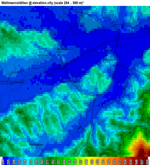
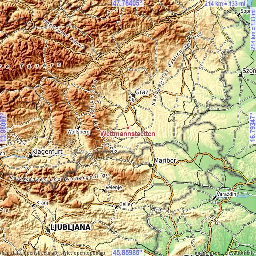
| \ | Map #1 | Topo.Map |
| Scale [m] | 284..568 m | × |
| Scale [ft] | 932..1864 ft | × |
| Average | 321.5 m = 1055 ft | × |
| Width | 6.69 km = 4.2 mi | 214 km = 133 mi |
| Height | 6.69 km = 4.2 mi | 213.9 km = 132.9 mi |
| ↑Max Latitude | 46.860617° | 47.78405° |
| Latitude at center | 46.83056° | 46.83056° |
| ↓Min Latitude | 46.800486° | 45.85985° |
| ← Min Longitude | 15.343275° | 13.98097° |
| Longitude center | 15.38722° | 15.38722° |
| →Max Longitude | 15.431165° | 16.79347° |
Nearby cities:
Cities around Wettmannstätten sort by population:
• Gleinstätten elevation 298 m
8.7 km,  188°
188°
• Groß Sankt Florian 309 m
5.3 km,  262°
262°
• Preding 329 m
3.6 km,  28°
28°
• Sankt Josef (Weststeiermark) 351 m
9.6 km,  336°
336°
• Pistorf 321 m
7.3 km, 192°
• Stallhof 327 m
9.8 km,  306°
306°
• Rassach 382 m
9.5 km,  290°
290°
• Sankt Nikolai im Sausal 325 m
5 km,  102°
102°
• Unterbergla 345 m
6.1 km,  244°
244°
• Hengsberg 346 m
5.3 km,  41°
41°
• Lang 287 m
9 km,  84°
84°
• Kitzeck im Sausal 550 m
7.5 km,  137°
137°
Multilingual:
 En español:
Wettmannstätten elevación 301 m.
 En France:
Wettmannstätten élévation 301 m.
 Auf Deutsch:
Wettmannstätten höhe über dem Meeresspiegel ist 301 m.

Sources and notes:
- [note 1] Map square and city borders are not equal. Map elevation data is calculated only from area inside that square.
- [src 1] Elevation data from geonames database provided with same terms of usage.
- [src 2] The elevation map of Wettmannstätten is generated using elevation data from NASA's 3 arcsec (90m) resolution SRTM data.
- [src 3] Base (background) map © OpenStreetMap contributors tiles are generated by Geofabrik and OpenTopoMap.
Copyright & License:
This Wettmannstätten Elevation Map is licensed under CC BY-SA. You may reuse any part from this page, if you give a proper credit by linking to this URL:
 More info on terms of use page.