Walding elevation
Walding (Upper Austria, Politischer Bezirk Urfahr-Umgebung), Austria elevation is 277 meters and Walding elevation in feet is 909 ft above sea level [src 1]. Walding is a seat of a third-order administrative division (feature code) with elevation that is 232 meters (761 ft) smaller than average city elevation in Austria.
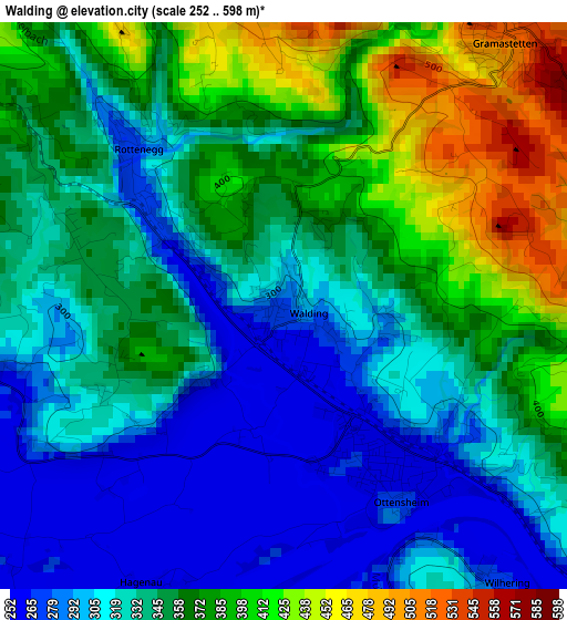
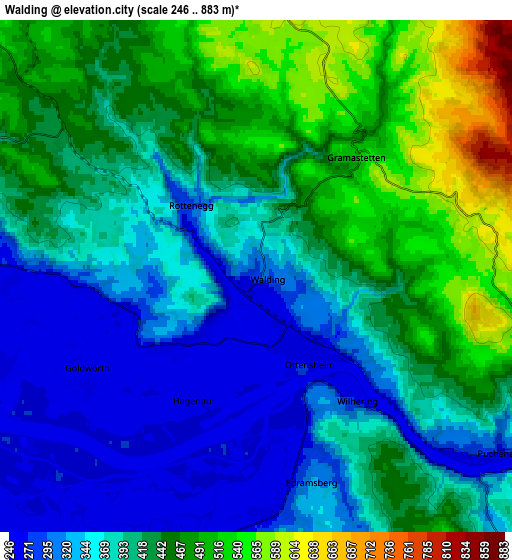
Below is the Elevation map of Walding, which displays elevation range with different colors. Scale of the first map is from 252 to 598 m (827 to 1962 ft) with average elevation of 346 meters (=1135 ft) [note 1]
These maps also provides idea of topography and contour of this city, they are displayed at different zoom levels. More info about maps, scale and edge coordinates you can find below images.
| \ | Map #1 | Map #2 | Topo.Map |
| Scale [m] | 252..598 m | 246..883 m | × |
| Scale [ft] | 827..1962 ft | 807..2897 ft | × |
| Average | 346 m = 1135 ft | 406.6 m = 1334 ft | × |
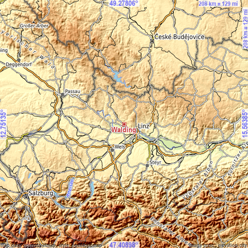
| Width | 6.49 km = 4 mi | 12.99 km = 8.1 mi | 207.8 km = 129.1 mi |
| Height | 6.49 km = 4 mi | 12.99 km = 8.1 mi | 207.8 km = 129.1 mi |
| ↑Max Latitude | 48.381286° | 48.410464° | 49.27806° |
| Latitude at center | 48.35209° | 48.35209° | 48.35209° |
| ↓Min Latitude | 48.322878° | 48.293649° | 47.40898° |
| ← Min Longitude | 14.113655° | 14.069709° | 12.75135° |
| Longitude center | 14.1576° | 14.1576° | 14.1576° |
| →Max Longitude | 14.201545° | 14.245491° | 15.56385° |
Nearby cities:
Cities around Walding sort by population:
• Ottensheim elevation 269 m
2.5 km,  150°
150°
• Puchenau 288 m
7.3 km,  127°
127°
• Strassham 268 m
7.7 km,  186°
186°
• Gramastetten 526 m
4 km,  38°
38°
• Alkoven 264 m
8.1 km,  207°
207°
• Altlichtenberg 622 m
7.5 km,  83°
83°
• Hartheim 270 m
8.6 km,  202°
202°
• Schönering 266 m
6 km,  177°
177°
• Feldkirchen an der Donau 266 m
7.9 km,  264°
264°
• Eidenberg 688 m
7.3 km,  49°
49°
• Goldwörth 259 m
5 km,  235°
235°
• Sankt Gotthard im Mühlkreis 468 m
3.7 km,  328°
328°
Multilingual:
 En español:
Walding elevación 277 m.
 En France:
Walding élévation 277 m.


Sources and notes:
- [note 1] Map square and city borders are not equal. Map elevation data is calculated only from area inside that square.
- [src 1] Elevation data from geonames database provided with same terms of usage.
- [src 2] The elevation map of Walding is generated using elevation data from NASA's 3 arcsec (90m) resolution SRTM data.
- [src 3] Base (background) map © OpenStreetMap contributors tiles are generated by Geofabrik and OpenTopoMap.
Copyright & License:
This Walding Elevation Map is licensed under CC BY-SA. You may reuse any part from this page, if you give a proper credit by linking to this URL:
 More info on terms of use page.