Weiz elevation
Weiz (Styria, Politischer Bezirk Weiz), Austria elevation is 506 meters and Weiz elevation in feet is 1660 ft above sea level [src 1]. Weiz is a seat of a third-order administrative division (feature code) with elevation that is 3 meters (10 ft) smaller than average city elevation in Austria.
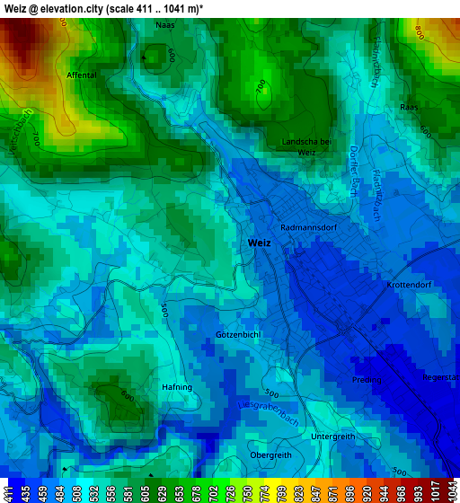
Below is the Elevation map of Weiz, which displays elevation range with different colors. Scale of the first map is from 411 to 1041 m (1348 to 3415 ft) with average elevation of 542.7 meters (=1781 ft) [note 1]
These maps also provides idea of topography and contour of this city, they are displayed at different zoom levels. More info about maps, scale and edge coordinates you can find below images.
| \ | Map #1 | Map #2 | Topo.Map |
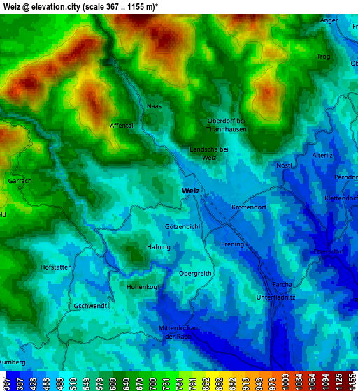
| Scale [m] | 411..1041 m | 367..1155 m | × |
| Scale [ft] | 1348..3415 ft | 1204..3789 ft | × |
| Average | 542.7 m = 1781 ft | 583.9 m = 1916 ft | × |
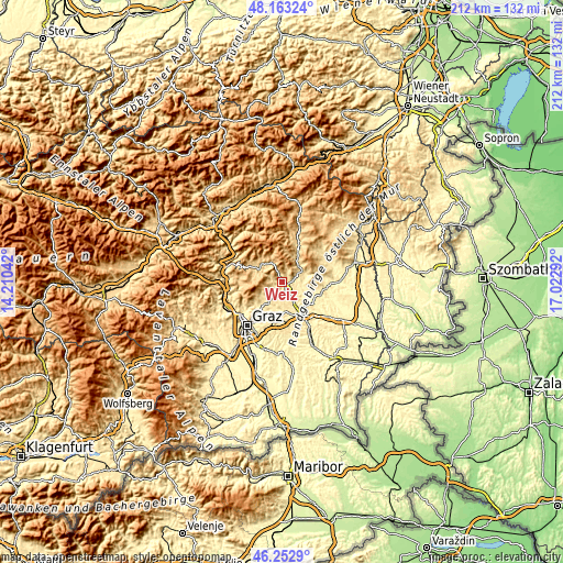
| Width | 6.64 km = 4.1 mi | 13.28 km = 8.3 mi | 212.4 km = 132 mi |
| Height | 6.64 km = 4.1 mi | 13.28 km = 8.3 mi | 212.4 km = 132 mi |
| ↑Max Latitude | 47.24651° | 47.276334° | 48.16324° |
| Latitude at center | 47.21667° | 47.21667° | 47.21667° |
| ↓Min Latitude | 47.186813° | 47.156939° | 46.2529° |
| ← Min Longitude | 15.572725° | 15.528779° | 14.21042° |
| Longitude center | 15.61667° | 15.61667° | 15.61667° |
| →Max Longitude | 15.660615° | 15.704561° | 17.02292° |
Nearby cities:
Cities around Weiz sort by population:
• Kumberg elevation 517 m
8.6 km,  227°
227°
• Sankt Ruprecht an der Raab 381 m
7.8 km,  153°
153°
• Göttelsberg 536 m
1.3 km,  270°
270°
• Krottendorf 470 m
2.2 km, 145°
• Anger 473 m
8.5 km,  41°
41°
• Puch bei Weiz 406 m
7.6 km,  90°
90°
• Arzberg 660 m
8.4 km,  296°
296°
• Unterfladnitz 408 m
5.3 km,  134°
134°
• Naas 541 m
4.2 km,  336°
336°
• Stenzengreith 750 m
7.8 km,  256°
256°
• Mortantsch 486 m
3 km,  250°
250°
• Mitterdorf an der Raab 477 m
5.7 km,  192°
192°
Multilingual:
 En español:
Weiz elevación 506 m.
 En France:
Weiz élévation 506 m.


Sources and notes:
- [note 1] Map square and city borders are not equal. Map elevation data is calculated only from area inside that square.
- [src 1] Elevation data from geonames database provided with same terms of usage.
- [src 2] The elevation map of Weiz is generated using elevation data from NASA's 3 arcsec (90m) resolution SRTM data.
- [src 3] Base (background) map © OpenStreetMap contributors tiles are generated by Geofabrik and OpenTopoMap.
Copyright & License:
This Weiz Elevation Map is licensed under CC BY-SA. You may reuse any part from this page, if you give a proper credit by linking to this URL:
 More info on terms of use page.