Wullersdorf elevation
Wullersdorf (Lower Austria, Politischer Bezirk Hollabrunn), Austria elevation is 230 meters and Wullersdorf elevation in feet is 755 ft above sea level [src 1]. Wullersdorf is a seat of a third-order administrative division (feature code) with elevation that is 279 meters (915 ft) smaller than average city elevation in Austria.
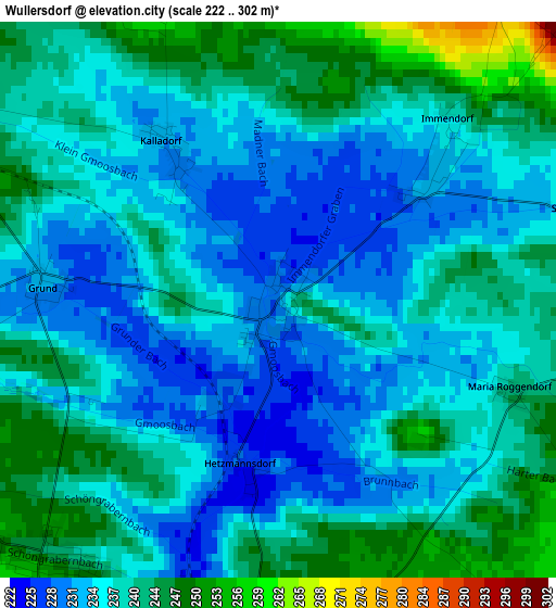
Below is the Elevation map of Wullersdorf, which displays elevation range with different colors. Scale of the first map is from 222 to 302 m (728 to 991 ft) with average elevation of 238 meters (=781 ft) [note 1]
These maps also provides idea of topography and contour of this city, they are displayed at different zoom levels. More info about maps, scale and edge coordinates you can find below images.
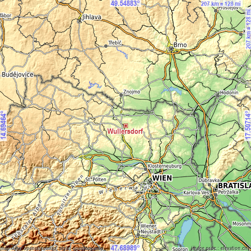
| \ | Map #1 | Topo.Map |
| Scale [m] | 222..302 m | × |
| Scale [ft] | 728..991 ft | × |
| Average | 238 m = 781 ft | × |
| Width | 6.46 km = 4 mi | 206.7 km = 128.4 mi |
| Height | 6.46 km = 4 mi | 206.7 km = 128.4 mi |
| ↑Max Latitude | 48.656957° | 49.54883° |
| Latitude at center | 48.62792° | 48.62792° |
| ↓Min Latitude | 48.598866° | 47.68989° |
| ← Min Longitude | 16.056945° | 14.69464° |
| Longitude center | 16.10089° | 16.10089° |
| →Max Longitude | 16.144835° | 17.50714° |
Nearby cities:
Cities around Wullersdorf sort by population:
• Hollabrunn elevation 257 m
8.8 km,  188°
188°
• Ziersdorf 235 m
16.8 km,  229°
229°
• Göllersdorf 200 m
15 km,  174°
174°
• Zellerndorf 224 m
13 km,  306°
306°
• Guntersdorf 248 m
4.5 km,  303°
303°
• Haugsdorf 203 m
9 km,  348°
348°
• Hadres 194 m
9.3 km,  13°
13°
• Stronsdorf 204 m
14.8 km,  79°
79°
• Sitzendorf an der Schmida 241 m
12.1 km,  254°
254°
• Mailberg 209 m
7.8 km,  49°
49°
• Großharras 195 m
11.4 km,  69°
69°
• Pernersdorf 214 m
10.1 km,  322°
322°
Multilingual:
 En español:
Wullersdorf elevación 230 m.
 En France:
Wullersdorf élévation 230 m.
 Auf Deutsch:
Wullersdorf höhe über dem Meeresspiegel ist 230 m.

Sources and notes:
- [note 1] Map square and city borders are not equal. Map elevation data is calculated only from area inside that square.
- [src 1] Elevation data from geonames database provided with same terms of usage.
- [src 2] The elevation map of Wullersdorf is generated using elevation data from NASA's 3 arcsec (90m) resolution SRTM data.
- [src 3] Base (background) map © OpenStreetMap contributors tiles are generated by Geofabrik and OpenTopoMap.
Copyright & License:
This Wullersdorf Elevation Map is licensed under CC BY-SA. You may reuse any part from this page, if you give a proper credit by linking to this URL:
 More info on terms of use page.