Beltrán elevation
Beltrán (Santiago del Estero, Departamento de Robles), Argentina elevation is 172 meters and Beltrán elevation in feet is 564 ft above sea level [src 1]. Beltrán is a populated place (feature code) with elevation that is 178 meters (584 ft) smaller than average city elevation in Argentina.
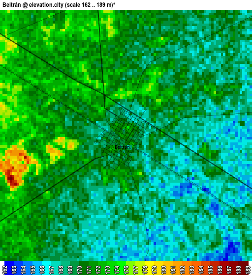
Below is the Elevation map of Beltrán, which displays elevation range with different colors. Scale of the first map is from 162 to 189 m (531 to 620 ft) with average elevation of 170.6 meters (=560 ft) [note 1]
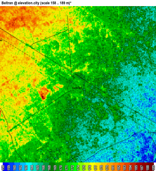
These maps also provides idea of topography and contour of this city, they are displayed at different zoom levels. More info about maps, scale and edge coordinates you can find below images.
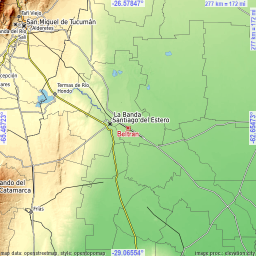
| \ | Map #1 | Map #2 | Topo.Map |
| Scale [m] | 162..189 m | 158..189 m | × |
| Scale [ft] | 531..620 ft | 518..620 ft | × |
| Average | 170.6 m = 560 ft | 170.6 m = 560 ft | × |
| Width | 8.64 km = 5.4 mi | 17.28 km = 10.7 mi | 276.5 km = 171.8 mi |
| Height | 8.64 km = 5.4 mi | 17.28 km = 10.7 mi | 276.5 km = 171.8 mi |
| ↑Max Latitude | -27.79026° | -27.751377° | -26.57847° |
| Latitude at center | -27.82913° | -27.82913° | -27.82913° |
| ↓Min Latitude | -27.867986° | -27.906828° | -29.06554° |
| ← Min Longitude | -64.104925° | -64.148871° | -65.46723° |
| Longitude center | -64.06098° | -64.06098° | -64.06098° |
| →Max Longitude | -64.017035° | -63.973089° | -62.65473° |
Nearby cities:
Cities around Beltrán sort by population:
• Santiago del Estero elevation 188 m
20.1 km,  280°
280°
• Clodomira 180 m
29.2 km,  346°
346°
• Suncho Corral 135 m
63.2 km,  100°
100°
• Villa Atamisqui 124 m
77.9 km,  162°
162°
• Pozo Hondo 266 m
85 km,  330°
330°
• El Simbolar 507 m
83.5 km,  259°
259°
• Garza 130 m
62.6 km,  125°
125°
• Brea Pozo 143 m
47.4 km,  166°
166°
• La Cañada 156 m
31.3 km,  64°
64°
• Arraga 169 m
29.2 km,  212°
212°
• La Banda 193 m
20.8 km,  300°
300°
• Fernández 155 m
19.3 km,  121°
121°
Multilingual:
 En español:
Beltrán elevación 172 m.
 En France:
Beltrán élévation 172 m.


Sources and notes:
- [note 1] Map square and city borders are not equal. Map elevation data is calculated only from area inside that square.
- [src 1] Elevation data from geonames database provided with same terms of usage.
- [src 2] The elevation map of Beltrán is generated using elevation data from NASA's 3 arcsec (90m) resolution SRTM data.
- [src 3] Base (background) map © OpenStreetMap contributors tiles are generated by Geofabrik and OpenTopoMap.
Copyright & License:
This Beltrán Elevation Map is licensed under CC BY-SA. You may reuse any part from this page, if you give a proper credit by linking to this URL:
 More info on terms of use page.