Brinkmann elevation
Brinkmann (Cordoba, Departamento de San Justo), Argentina elevation is 105 meters and Brinkmann elevation in feet is 344 ft above sea level [src 1]. Brinkmann is a populated place (feature code) with elevation that is 245 meters (804 ft) smaller than average city elevation in Argentina.
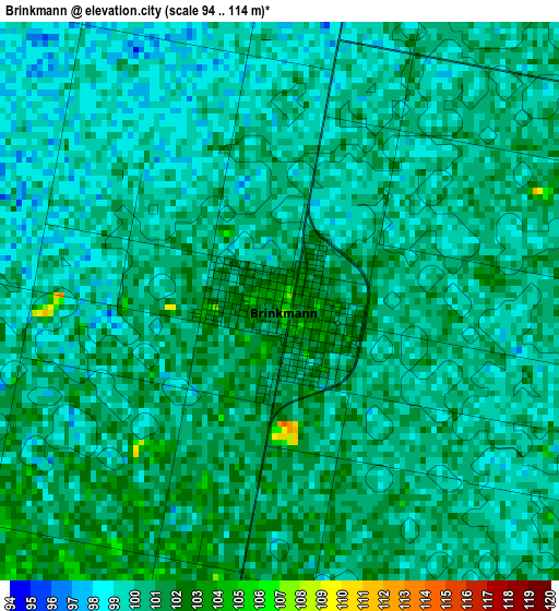
Below is the Elevation map of Brinkmann, which displays elevation range with different colors. Scale of the first map is from 94 to 114 m (308 to 374 ft) with average elevation of 99.9 meters (=328 ft) [note 1]
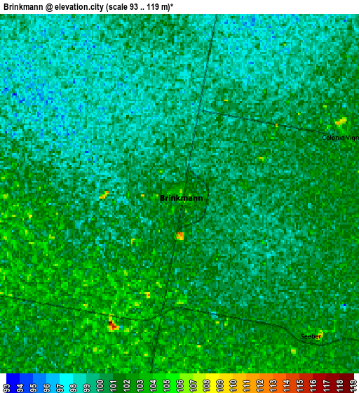
These maps also provides idea of topography and contour of this city, they are displayed at different zoom levels. More info about maps, scale and edge coordinates you can find below images.
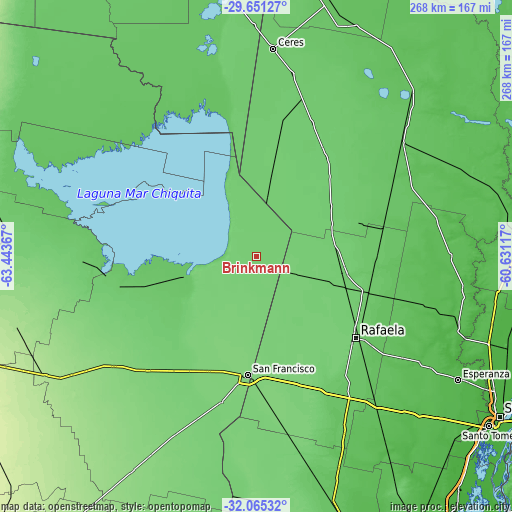
| \ | Map #1 | Map #2 | Topo.Map |
| Scale [m] | 94..114 m | 93..119 m | × |
| Scale [ft] | 308..374 ft | 305..390 ft | × |
| Average | 99.9 m = 328 ft | 100.1 m = 328 ft | × |
| Width | 8.39 km = 5.2 mi | 16.78 km = 10.4 mi | 268.4 km = 166.8 mi |
| Height | 8.39 km = 5.2 mi | 16.78 km = 10.4 mi | 268.4 km = 166.8 mi |
| ↑Max Latitude | -30.828161° | -30.790418° | -29.65127° |
| Latitude at center | -30.86589° | -30.86589° | -30.86589° |
| ↓Min Latitude | -30.903604° | -30.941303° | -32.06532° |
| ← Min Longitude | -62.081365° | -62.125311° | -63.44367° |
| Longitude center | -62.03742° | -62.03742° | -62.03742° |
| →Max Longitude | -61.993475° | -61.949529° | -60.63117° |
Nearby cities:
Cities around Brinkmann sort by population:
• Rafaela elevation 103 m
67.7 km,  129°
129°
• San Francisco 118 m
62.6 km,  183°
183°
• Sunchales 98 m
46.2 km,  100°
100°
• Morteros 99 m
17.5 km,  12°
12°
• Devoto 112 m
65.1 km,  203°
203°
• Balnearia 86 m
62.1 km,  255°
255°
• Porteña 105 m
16.7 km,  189°
189°
• Villa Trinidad 95 m
74.2 km, 12°
• Arrufó 94 m
76.4 km,  22°
22°
• Miramar 78 m
61.4 km, 264°
• Altos de Chipión 109 m
30.3 km,  250°
250°
• Bella Italia 77 m
75.5 km, 127°
Multilingual:
 En español:
Brinkmann elevación 105 m.
 En France:
Brinkmann élévation 105 m.
 Auf Deutsch:
Brinkmann höhe über dem Meeresspiegel ist 105 m.

Sources and notes:
- [note 1] Map square and city borders are not equal. Map elevation data is calculated only from area inside that square.
- [src 1] Elevation data from geonames database provided with same terms of usage.
- [src 2] The elevation map of Brinkmann is generated using elevation data from NASA's 3 arcsec (90m) resolution SRTM data.
- [src 3] Base (background) map © OpenStreetMap contributors tiles are generated by Geofabrik and OpenTopoMap.
Copyright & License:
This Brinkmann Elevation Map is licensed under CC BY-SA. You may reuse any part from this page, if you give a proper credit by linking to this URL:
 More info on terms of use page.