Balnearia elevation
Balnearia (Cordoba, Departamento de San Justo), Argentina elevation is 86 meters and Balnearia elevation in feet is 282 ft above sea level [src 1]. Balnearia is a populated place (feature code) with elevation that is 264 meters (866 ft) smaller than average city elevation in Argentina.
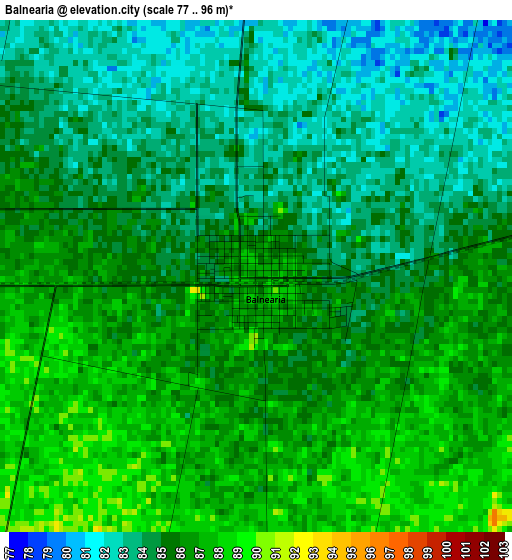
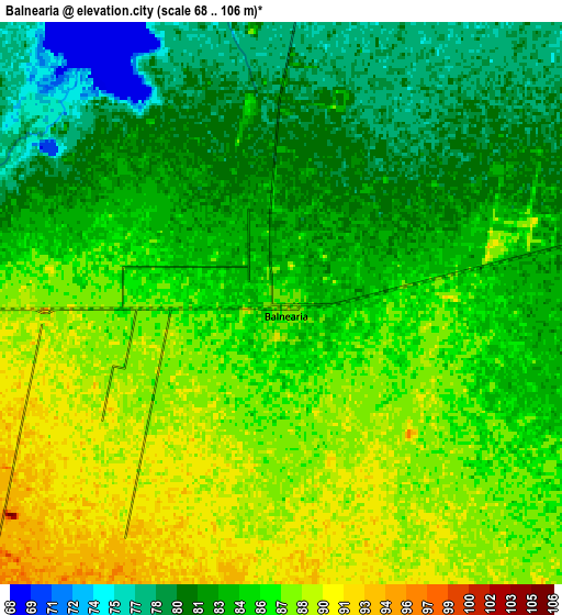
Below is the Elevation map of Balnearia, which displays elevation range with different colors. Scale of the first map is from 77 to 96 m (253 to 315 ft) with average elevation of 85 meters (=279 ft) [note 1]
These maps also provides idea of topography and contour of this city, they are displayed at different zoom levels. More info about maps, scale and edge coordinates you can find below images.
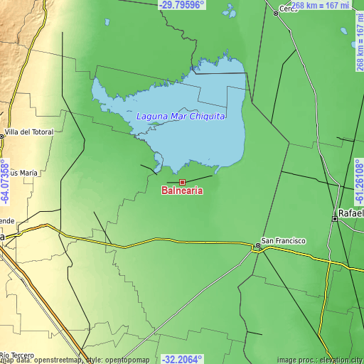
| \ | Map #1 | Map #2 | Topo.Map |
| Scale [m] | 77..96 m | 68..106 m | × |
| Scale [ft] | 253..315 ft | 223..348 ft | × |
| Average | 85 m = 279 ft | 84.6 m = 278 ft | × |
| Width | 8.38 km = 5.2 mi | 16.75 km = 10.4 mi | 268 km = 166.5 mi |
| Height | 8.38 km = 5.2 mi | 16.75 km = 10.4 mi | 268 km = 166.5 mi |
| ↑Max Latitude | -30.971128° | -30.93344° | -29.79596° |
| Latitude at center | -31.0088° | -31.0088° | -31.0088° |
| ↓Min Latitude | -31.046458° | -31.0841° | -32.2064° |
| ← Min Longitude | -62.711275° | -62.755221° | -64.07358° |
| Longitude center | -62.66733° | -62.66733° | -62.66733° |
| →Max Longitude | -62.623385° | -62.579439° | -61.26108° |
Nearby cities:
Cities around Balnearia sort by population:
• Arroyito elevation 154 m
58.5 km,  218°
218°
• Devoto 112 m
55.8 km,  142°
142°
• Porteña 105 m
57.3 km,  90°
90°
• La Francia 112 m
44.4 km,  175°
175°
• La Para 93 m
34.3 km,  291°
291°
• Miramar 78 m
10.1 km,  354°
354°
• Marull 93 m
15.2 km,  275°
275°
• Villa Concepción del Tío 125 m
37.6 km,  201°
201°
• Altos de Chipión 109 m
32 km,  79°
79°
• El Tío 126 m
44.4 km, 200°
• Colonia La Tordilla 141 m
45.3 km,  235°
235°
• Colonia San Bartolomé 125 m
58 km,  185°
185°
Multilingual:
 En español:
Balnearia elevación 86 m.
 En France:
Balnearia élévation 86 m.
 Auf Deutsch:
Balnearia höhe über dem Meeresspiegel ist 86 m.

Sources and notes:
- [note 1] Map square and city borders are not equal. Map elevation data is calculated only from area inside that square.
- [src 1] Elevation data from geonames database provided with same terms of usage.
- [src 2] The elevation map of Balnearia is generated using elevation data from NASA's 3 arcsec (90m) resolution SRTM data.
- [src 3] Base (background) map © OpenStreetMap contributors tiles are generated by Geofabrik and OpenTopoMap.
Copyright & License:
This Balnearia Elevation Map is licensed under CC BY-SA. You may reuse any part from this page, if you give a proper credit by linking to this URL:
 More info on terms of use page.