Canals elevation
Canals (Cordoba, Departamento de Unión), Argentina elevation is 127 meters and Canals elevation in feet is 417 ft above sea level [src 1]. Canals is a populated place (feature code) with elevation that is 223 meters (732 ft) smaller than average city elevation in Argentina.
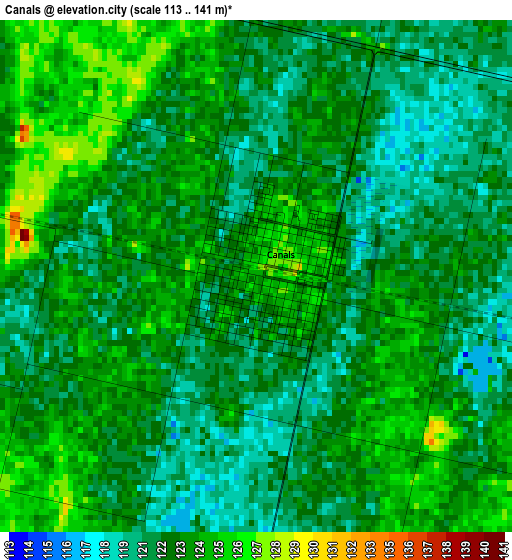
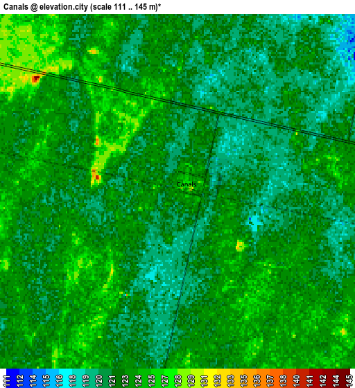
Below is the Elevation map of Canals, which displays elevation range with different colors. Scale of the first map is from 113 to 141 m (371 to 463 ft) with average elevation of 122.3 meters (=401 ft) [note 1]
These maps also provides idea of topography and contour of this city, they are displayed at different zoom levels. More info about maps, scale and edge coordinates you can find below images.
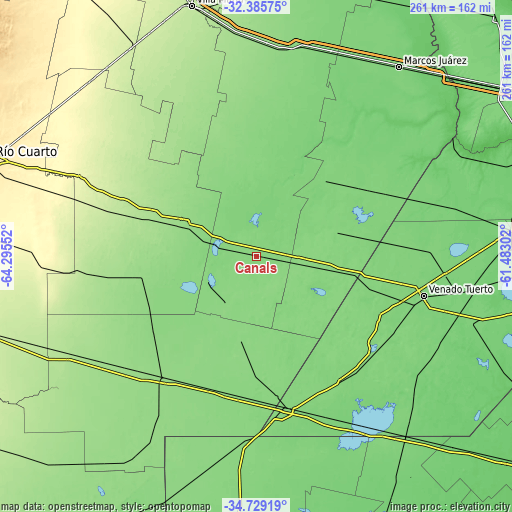
| \ | Map #1 | Map #2 | Topo.Map |
| Scale [m] | 113..141 m | 111..145 m | × |
| Scale [ft] | 371..463 ft | 364..476 ft | × |
| Average | 122.3 m = 401 ft | 122.6 m = 402 ft | × |
| Width | 8.14 km = 5.1 mi | 16.29 km = 10.1 mi | 260.6 km = 161.9 mi |
| Height | 8.14 km = 5.1 mi | 16.29 km = 10.1 mi | 260.6 km = 161.9 mi |
| ↑Max Latitude | -33.528795° | -33.492154° | -32.38575° |
| Latitude at center | -33.56542° | -33.56542° | -33.56542° |
| ↓Min Latitude | -33.60203° | -33.638624° | -34.72919° |
| ← Min Longitude | -62.933215° | -62.977161° | -64.29552° |
| Longitude center | -62.88927° | -62.88927° | -62.88927° |
| →Max Longitude | -62.845325° | -62.801379° | -61.48302° |
Nearby cities:
Cities around Canals sort by population:
• La Carlota elevation 147 m
41.2 km,  293°
293°
• Arias 127 m
45.9 km,  100°
100°
• Monte Maíz 119 m
48.2 km,  33°
33°
• Laborde 127 m
45.9 km,  3°
3°
• Alejo Ledesma 132 m
25.1 km, 100°
• Pascanas 140 m
50.9 km,  343°
343°
• Guatimozín 127 m
43.4 km,  74°
74°
• Santa Eufemia 155 m
56.6 km,  319°
319°
• Viamonte 131 m
27.9 km,  223°
223°
• Wenceslao Escalante 119 m
45 km,  14°
14°
• Cavanagh 123 m
52 km,  78°
78°
• La Cesira 133 m
43.6 km,  190°
190°
Multilingual:
 En español:
Canals elevación 127 m.
 En France:
Canals élévation 127 m.


Sources and notes:
- [note 1] Map square and city borders are not equal. Map elevation data is calculated only from area inside that square.
- [src 1] Elevation data from geonames database provided with same terms of usage.
- [src 2] The elevation map of Canals is generated using elevation data from NASA's 3 arcsec (90m) resolution SRTM data.
- [src 3] Base (background) map © OpenStreetMap contributors tiles are generated by Geofabrik and OpenTopoMap.
Copyright & License:
This Canals Elevation Map is licensed under CC BY-SA. You may reuse any part from this page, if you give a proper credit by linking to this URL:
 More info on terms of use page.