Cintra elevation
Cintra (Cordoba, Departamento de Unión), Argentina elevation is 130 meters and Cintra elevation in feet is 427 ft above sea level [src 1]. Cintra is a populated place (feature code) with elevation that is 220 meters (722 ft) smaller than average city elevation in Argentina.
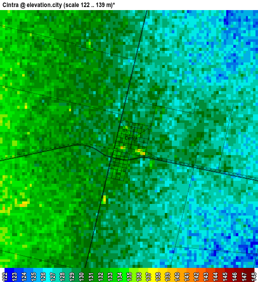
Below is the Elevation map of Cintra, which displays elevation range with different colors. Scale of the first map is from 122 to 139 m (400 to 456 ft) with average elevation of 129.2 meters (=424 ft) [note 1]
These maps also provides idea of topography and contour of this city, they are displayed at different zoom levels. More info about maps, scale and edge coordinates you can find below images.
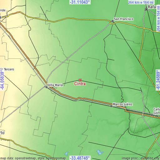
| \ | Map #1 | Topo.Map |
| Scale [m] | 122..139 m | × |
| Scale [ft] | 400..456 ft | × |
| Average | 129.2 m = 424 ft | × |
| Width | 8.26 km = 5.1 mi | 264.3 km = 164.2 mi |
| Height | 8.26 km = 5.1 mi | 264.3 km = 164.2 mi |
| ↑Max Latitude | -32.26958° | -31.11043° |
| Latitude at center | -32.30673° | -32.30673° |
| ↓Min Latitude | -32.343865° | -33.48745° |
| ← Min Longitude | -62.696085° | -64.05839° |
| Longitude center | -62.65214° | -62.65214° |
| →Max Longitude | -62.608195° | -61.24589° |
Nearby cities:
Cities around Cintra sort by population:
• Villa María elevation 202 m
56.4 km,  258°
258°
• Bell Ville 132 m
35.7 km,  185°
185°
• Villa Nueva 204 m
57.7 km, 255°
• Las Varillas 138 m
48.7 km,  352°
352°
• Leones 120 m
51.7 km,  139°
139°
• Pozo del Molle 160 m
40.8 km,  321°
321°
• Noetinger 113 m
32.7 km,  101°
101°
• Morrison 148 m
36.3 km,  208°
208°
• La Playosa 175 m
42.4 km,  302°
302°
• Ordóñez 138 m
62.6 km,  198°
198°
• San Antonio de Litín 130 m
10.5 km,  10°
10°
• Las Varas 128 m
56.2 km,  3°
3°
Multilingual:
 En español:
Cintra elevación 130 m.
 En France:
Cintra élévation 130 m.


Sources and notes:
- [note 1] Map square and city borders are not equal. Map elevation data is calculated only from area inside that square.
- [src 1] Elevation data from geonames database provided with same terms of usage.
- [src 2] The elevation map of Cintra is generated using elevation data from NASA's 3 arcsec (90m) resolution SRTM data.
- [src 3] Base (background) map © OpenStreetMap contributors tiles are generated by Geofabrik and OpenTopoMap.
Copyright & License:
This Cintra Elevation Map is licensed under CC BY-SA. You may reuse any part from this page, if you give a proper credit by linking to this URL:
 More info on terms of use page.