Gálvez elevation
Gálvez (Santa Fe, San Jerónimo Department), Argentina elevation is 57 meters and Gálvez elevation in feet is 187 ft above sea level [src 1]. Gálvez is a populated place (feature code) with elevation that is 293 meters (961 ft) smaller than average city elevation in Argentina.
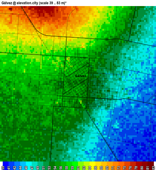
Below is the Elevation map of Gálvez, which displays elevation range with different colors. Scale of the first map is from 39 to 83 m (128 to 272 ft) with average elevation of 54.5 meters (=179 ft) [note 1]
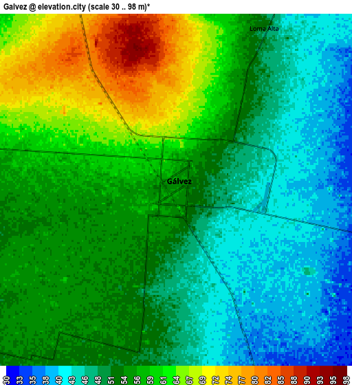
These maps also provides idea of topography and contour of this city, they are displayed at different zoom levels. More info about maps, scale and edge coordinates you can find below images.
| \ | Map #1 | Map #2 | Topo.Map |
| Scale [m] | 39..83 m | 30..98 m | × |
| Scale [ft] | 128..272 ft | 98..322 ft | × |
| Average | 54.5 m = 179 ft | 53.8 m = 177 ft | × |
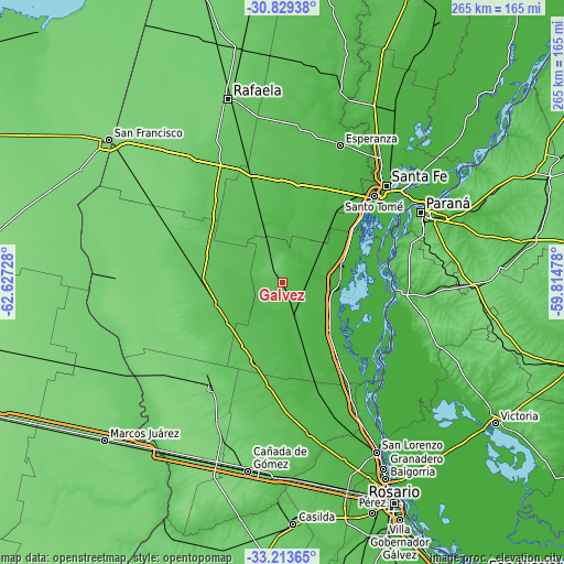
| Width | 8.28 km = 5.1 mi | 16.57 km = 10.3 mi | 265.1 km = 164.7 mi |
| Height | 8.28 km = 5.1 mi | 16.57 km = 10.3 mi | 265.1 km = 164.7 mi |
| ↑Max Latitude | -31.992007° | -31.954728° | -30.82938° |
| Latitude at center | -32.02927° | -32.02927° | -32.02927° |
| ↓Min Latitude | -32.066518° | -32.103751° | -33.21365° |
| ← Min Longitude | -61.264975° | -61.308921° | -62.62728° |
| Longitude center | -61.22103° | -61.22103° | -61.22103° |
| →Max Longitude | -61.177085° | -61.133139° | -59.81478° |
Nearby cities:
Cities around Gálvez sort by population:
• Santa Fe elevation 20 m
64.3 km,  48°
48°
• Santo Tomé 19 m
59.3 km, 46°
• Esperanza 40 m
70.1 km,  22°
22°
• Diamante 71 m
55.1 km,  94°
94°
• Coronda 19 m
29.1 km,  77°
77°
• San Jorge 109 m
62.1 km,  283°
283°
• Las Rosas 107 m
60.1 km,  214°
214°
• El Trébol 96 m
49.1 km,  247°
247°
• San Carlos Centro 44 m
35.6 km, 20°
• Totoras 56 m
61.9 km,  175°
175°
• Sastre 109 m
64.3 km,  296°
296°
• Oro Verde 86 m
70.2 km,  71°
71°
Multilingual:
 En español:
Gálvez elevación 57 m.
 En France:
Gálvez élévation 57 m.


Sources and notes:
- [note 1] Map square and city borders are not equal. Map elevation data is calculated only from area inside that square.
- [src 1] Elevation data from geonames database provided with same terms of usage.
- [src 2] The elevation map of Gálvez is generated using elevation data from NASA's 3 arcsec (90m) resolution SRTM data.
- [src 3] Base (background) map © OpenStreetMap contributors tiles are generated by Geofabrik and OpenTopoMap.
Copyright & License:
This Gálvez Elevation Map is licensed under CC BY-SA. You may reuse any part from this page, if you give a proper credit by linking to this URL:
 More info on terms of use page.