San Carlos Centro elevation
San Carlos Centro (Santa Fe, Las Colonias Department), Argentina elevation is 44 meters and San Carlos Centro elevation in feet is 144 ft above sea level [src 1]. San Carlos Centro is a populated place (feature code) with elevation that is 306 meters (1004 ft) smaller than average city elevation in Argentina.
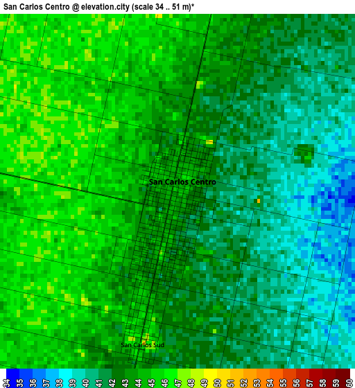
Below is the Elevation map of San Carlos Centro, which displays elevation range with different colors. Scale of the first map is from 34 to 51 m (112 to 167 ft) with average elevation of 42.7 meters (=140 ft) [note 1]
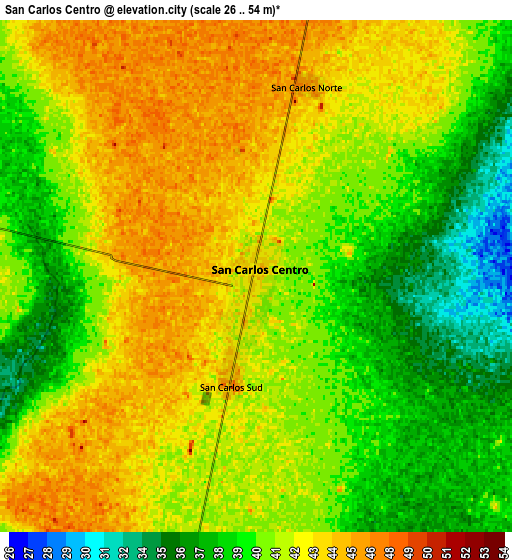
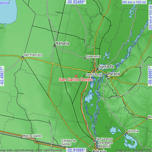
These maps also provides idea of topography and contour of this city, they are displayed at different zoom levels. More info about maps, scale and edge coordinates you can find below images.
| \ | Map #1 | Map #2 | Topo.Map |
| Scale [m] | 34..51 m | 26..54 m | × |
| Scale [ft] | 112..167 ft | 85..177 ft | × |
| Average | 42.7 m = 140 ft | 41.2 m = 135 ft | × |
| Width | 8.31 km = 5.2 mi | 16.62 km = 10.3 mi | 266 km = 165.3 mi |
| Height | 8.31 km = 5.2 mi | 16.62 km = 10.3 mi | 266 km = 165.3 mi |
| ↑Max Latitude | -31.691255° | -31.653855° | -30.52489° |
| Latitude at center | -31.72864° | -31.72864° | -31.72864° |
| ↓Min Latitude | -31.76601° | -31.803365° | -32.91695° |
| ← Min Longitude | -61.135865° | -61.179811° | -62.49817° |
| Longitude center | -61.09192° | -61.09192° | -61.09192° |
| →Max Longitude | -61.047975° | -61.004029° | -59.68567° |
Nearby cities:
Cities around San Carlos Centro sort by population:
• Santa Fe elevation 20 m
37.3 km,  76°
76°
• Paraná 68 m
53.2 km,  90°
90°
• Santo Tomé 19 m
31.8 km, 76°
• Esperanza 40 m
34.6 km,  25°
25°
• Diamante 71 m
57 km,  131°
131°
• Gálvez 57 m
35.6 km,  200°
200°
• Coronda 19 m
31.6 km,  149°
149°
• Recreo 23 m
43.1 km,  52°
52°
• Laguna Paiva 24 m
62.6 km,  40°
40°
• San Benito 61 m
61.8 km,  95°
95°
• Oro Verde 86 m
55.3 km, 101°
• Bella Italia 77 m
58.2 km,  328°
328°
Multilingual:
 En español:
San Carlos Centro elevación 44 m.
 En France:
San Carlos Centro élévation 44 m.
 Auf Deutsch:
San Carlos Centro höhe über dem Meeresspiegel ist 44 m.

Sources and notes:
- [note 1] Map square and city borders are not equal. Map elevation data is calculated only from area inside that square.
- [src 1] Elevation data from geonames database provided with same terms of usage.
- [src 2] The elevation map of San Carlos Centro is generated using elevation data from NASA's 3 arcsec (90m) resolution SRTM data.
- [src 3] Base (background) map © OpenStreetMap contributors tiles are generated by Geofabrik and OpenTopoMap.
Copyright & License:
This San Carlos Centro Elevation Map is licensed under CC BY-SA. You may reuse any part from this page, if you give a proper credit by linking to this URL:
 More info on terms of use page.