Las Acequias elevation
Las Acequias (Cordoba, Departamento de Río Cuarto), Argentina elevation is 295 meters and Las Acequias elevation in feet is 968 ft above sea level [src 1]. Las Acequias is a populated place (feature code) with elevation that is 55 meters (180 ft) smaller than average city elevation in Argentina.
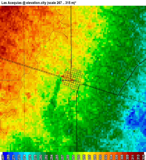
Below is the Elevation map of Las Acequias, which displays elevation range with different colors. Scale of the first map is from 267 to 315 m (876 to 1033 ft) with average elevation of 290.9 meters (=954 ft) [note 1]
These maps also provides idea of topography and contour of this city, they are displayed at different zoom levels. More info about maps, scale and edge coordinates you can find below images.
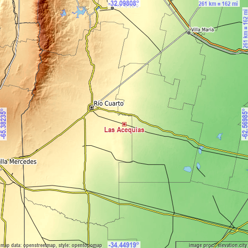
| \ | Map #1 | Topo.Map |
| Scale [m] | 267..315 m | × |
| Scale [ft] | 876..1033 ft | × |
| Average | 290.9 m = 954 ft | × |
| Width | 8.17 km = 5.1 mi | 261.4 km = 162.4 mi |
| Height | 8.17 km = 5.1 mi | 261.4 km = 162.4 mi |
| ↑Max Latitude | -33.244805° | -32.09808° |
| Latitude at center | -33.28155° | -33.28155° |
| ↓Min Latitude | -33.31828° | -34.44919° |
| ← Min Longitude | -64.020045° | -65.38235° |
| Longitude center | -63.9761° | -63.9761° |
| →Max Longitude | -63.932155° | -62.56985° |
Nearby cities:
Cities around Las Acequias sort by population:
• Río Cuarto elevation 441 m
38.6 km,  295°
295°
• General Cabrera 298 m
53 km,  10°
10°
• Adelia María 266 m
39.1 km,  186°
186°
• Las Higueras 432 m
35.9 km,  305°
305°
• Ucacha 197 m
51.8 km,  57°
57°
• Alejandro Roca 216 m
25.2 km,  108°
108°
• San Basilio 303 m
39.6 km,  232°
232°
• Carnerillo 322 m
41.1 km,  354°
354°
• Villa Reducción 265 m
13.9 km,  49°
49°
• Coronel Baigorria 532 m
60.1 km,  323°
323°
• Huanchillas 161 m
53.1 km,  143°
143°
• Charras 350 m
29.4 km, 346°
Multilingual:
 En español:
Las Acequias elevación 295 m.
 En France:
Las Acequias élévation 295 m.
 Auf Deutsch:
Las Acequias höhe über dem Meeresspiegel ist 295 m.

Sources and notes:
- [note 1] Map square and city borders are not equal. Map elevation data is calculated only from area inside that square.
- [src 1] Elevation data from geonames database provided with same terms of usage.
- [src 2] The elevation map of Las Acequias is generated using elevation data from NASA's 3 arcsec (90m) resolution SRTM data.
- [src 3] Base (background) map © OpenStreetMap contributors tiles are generated by Geofabrik and OpenTopoMap.
Copyright & License:
This Las Acequias Elevation Map is licensed under CC BY-SA. You may reuse any part from this page, if you give a proper credit by linking to this URL:
 More info on terms of use page.