Olavarría elevation
Olavarría (Buenos Aires, Partido de Olavarría), Argentina elevation is 170 meters and Olavarría elevation in feet is 558 ft above sea level [src 1]. Olavarría is a seat of a second-order administrative division (feature code) with elevation that is 180 meters (591 ft) smaller than average city elevation in Argentina.
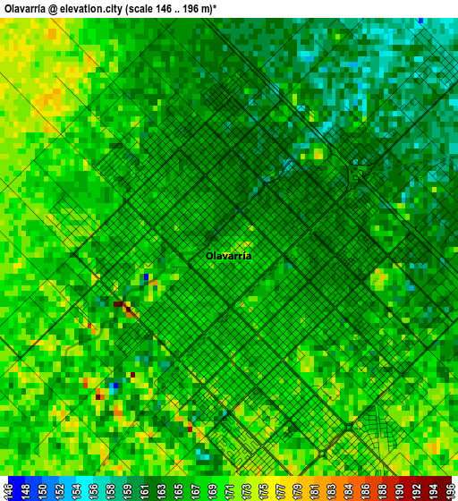
Below is the Elevation map of Olavarría, which displays elevation range with different colors. Scale of the first map is from 146 to 196 m (479 to 643 ft) with average elevation of 166.8 meters (=547 ft) [note 1]
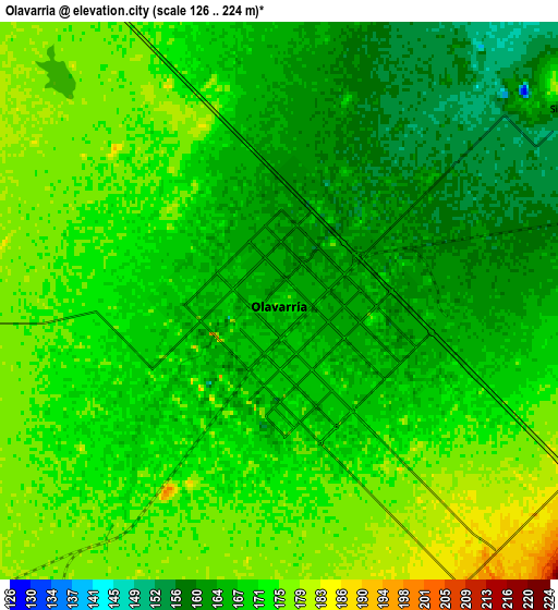
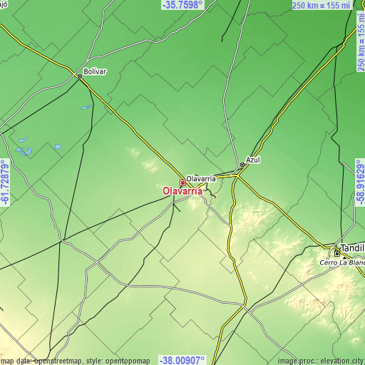
These maps also provides idea of topography and contour of this city, they are displayed at different zoom levels. More info about maps, scale and edge coordinates you can find below images.
| \ | Map #1 | Map #2 | Topo.Map |
| Scale [m] | 146..196 m | 126..224 m | × |
| Scale [ft] | 479..643 ft | 413..735 ft | × |
| Average | 166.8 m = 547 ft | 169.7 m = 557 ft | × |
| Width | 7.82 km = 4.9 mi | 15.63 km = 9.7 mi | 250.1 km = 155.4 mi |
| Height | 7.82 km = 4.9 mi | 15.63 km = 9.7 mi | 250.1 km = 155.4 mi |
| ↑Max Latitude | -36.857566° | -36.822396° | -35.7598° |
| Latitude at center | -36.89272° | -36.89272° | -36.89272° |
| ↓Min Latitude | -36.927858° | -36.962979° | -38.00907° |
| ← Min Longitude | -60.366485° | -60.410431° | -61.72879° |
| Longitude center | -60.32254° | -60.32254° | -60.32254° |
| →Max Longitude | -60.278595° | -60.234649° | -58.91629° |
Nearby cities:
Cities around Olavarría sort by population:
• Tandil elevation 192 m
115.7 km,  114°
114°
• Azul 141 m
43.3 km,  72°
72°
• Las Flores 39 m
146.6 km,  48°
48°
• Henderson 110 m
140.8 km,  297°
297°
• Daireaux 118 m
131.3 km,  284°
284°
• Rauch 95 m
110.5 km,  83°
83°
• San Carlos de Bolívar 99 m
102.2 km,  316°
316°
• General Alvear 57 m
100.8 km,  15°
15°
• Benito Juárez 219 m
97.9 km,  152°
152°
• General La Madrid 172 m
92.3 km,  244°
244°
• Laprida 213 m
83.9 km,  210°
210°
• Tapalqué 90 m
65.4 km, 23°
Multilingual:
 En español:
Olavarría elevación 170 m.
 En France:
Olavarría élévation 170 m.
 Auf Deutsch:
Olavarría höhe über dem Meeresspiegel ist 170 m.

Sources and notes:
- [note 1] Map square and city borders are not equal. Map elevation data is calculated only from area inside that square.
- [src 1] Elevation data from geonames database provided with same terms of usage.
- [src 2] The elevation map of Olavarría is generated using elevation data from NASA's 3 arcsec (90m) resolution SRTM data.
- [src 3] Base (background) map © OpenStreetMap contributors tiles are generated by Geofabrik and OpenTopoMap.
Copyright & License:
This Olavarría Elevation Map is licensed under CC BY-SA. You may reuse any part from this page, if you give a proper credit by linking to this URL:
 More info on terms of use page.