Río Gallegos elevation
Río Gallegos (Santa Cruz, Departamento de Güer Aike), Argentina elevation is 15 meters and Río Gallegos elevation in feet is 49 ft above sea level [src 1]. Río Gallegos is a seat of a first-order administrative division (feature code) with elevation that is 335 meters (1099 ft) smaller than average city elevation in Argentina.
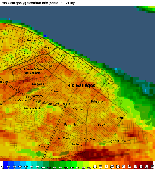
Below is the Elevation map of Río Gallegos, which displays elevation range with different colors. Scale of the first map is from -7 to 21 m (-23 to 69 ft) with average elevation of 11.5 meters (=38 ft) [note 1]
These maps also provides idea of topography and contour of this city, they are displayed at different zoom levels. More info about maps, scale and edge coordinates you can find below images.
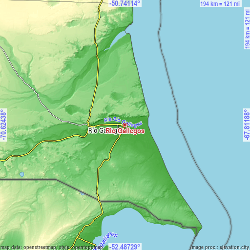
| \ | Map #1 | Map #2 | Topo.Map |
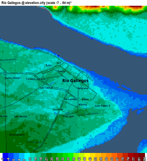
| Scale [m] | -7..21 m | -7..84 m | × |
| Scale [ft] | -23..69 ft | -23..276 ft | × |
| Average | 11.5 m = 38 ft | 13.7 m = 45 ft | × |
| Width | 6.07 km = 3.8 mi | 12.13 km = 7.5 mi | 194.2 km = 120.7 mi |
| Height | 6.07 km = 3.8 mi | 12.13 km = 7.5 mi | 194.1 km = 120.6 mi |
| ↑Max Latitude | -51.595319° | -51.568011° | -50.74114° |
| Latitude at center | -51.62261° | -51.62261° | -51.62261° |
| ↓Min Latitude | -51.649885° | -51.677143° | -52.48729° |
| ← Min Longitude | -69.262075° | -69.306021° | -70.62438° |
| Longitude center | -69.21813° | -69.21813° | -69.21813° |
| →Max Longitude | -69.174185° | -69.130239° | -67.81188° |
Nearby cities:
Cities around Río Gallegos sort by population:
• Ushuaia elevation 52 m
359.5 km,  170°
170°
• Río Grande 9 m
261.3 km,  157°
157°
• El Calafate 205 m
257.2 km,  303°
303°
• Yacimiento Río Turbio 573 m
216.4 km,  271°
271°
• Río Turbio 324 m
215.7 km, 272°
• San Julián 20 m
278.4 km,  22°
22°
• 28 de Noviembre 227 m
206.9 km, 271°
• Comandante Luis Piedra Buena 12 m
183.3 km,  6°
6°
• Puerto Santa Cruz 17 m
184.9 km, 15°
• Tolhuin 121 m
348.4 km, 157°
• Gobernador Gregores 289 m
327.6 km,  347°
347°
Multilingual:
 En español:
Río Gallegos elevación 15 m.
 En France:
Río Gallegos élévation 15 m.
 Auf Deutsch:
Río Gallegos höhe über dem Meeresspiegel ist 15 m.

Sources and notes:
- [note 1] Map square and city borders are not equal. Map elevation data is calculated only from area inside that square.
- [src 1] Elevation data from geonames database provided with same terms of usage.
- [src 2] The elevation map of Río Gallegos is generated using elevation data from NASA's 3 arcsec (90m) resolution SRTM data.
- [src 3] Base (background) map © OpenStreetMap contributors tiles are generated by Geofabrik and OpenTopoMap.
Copyright & License:
This Río Gallegos Elevation Map is licensed under CC BY-SA. You may reuse any part from this page, if you give a proper credit by linking to this URL:
 More info on terms of use page.