Ushuaia elevation
Ushuaia (Tierra del Fuego, Departamento de Ushuaia), Argentina elevation is 52 meters and Ushuaia elevation in feet is 171 ft above sea level [src 1]. Ushuaia is a seat of a first-order administrative division (feature code) with elevation that is 298 meters (978 ft) smaller than average city elevation in Argentina.
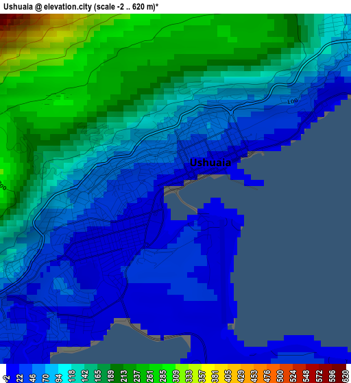
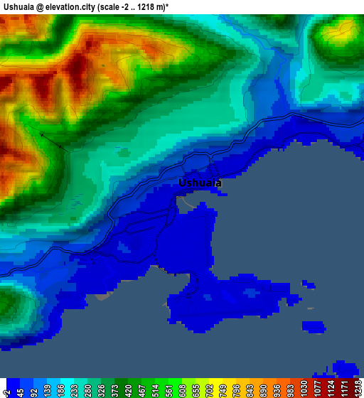
Below is the Elevation map of Ushuaia, which displays elevation range with different colors. Scale of the first map is from -2 to 620 m (-7 to 2034 ft) with average elevation of 114.2 meters (=375 ft) [note 1]
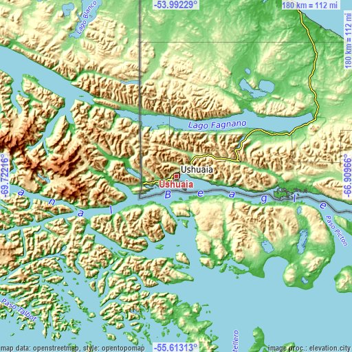
These maps also provides idea of topography and contour of this city, they are displayed at different zoom levels. More info about maps, scale and edge coordinates you can find below images.
| \ | Map #1 | Map #2 | Topo.Map |
| Scale [m] | -2..620 m | -2..1218 m | × |
| Scale [ft] | -7..2034 ft | -7..3996 ft | × |
| Average | 114.2 m = 375 ft | 313.1 m = 1027 ft | × |
| Width | 5.63 km = 3.5 mi | 11.26 km = 7 mi | 180.2 km = 112 mi |
| Height | 5.63 km = 3.5 mi | 11.26 km = 7 mi | 180.2 km = 112 mi |
| ↑Max Latitude | -54.785507° | -54.760159° | -53.99229° |
| Latitude at center | -54.81084° | -54.81084° | -54.81084° |
| ↓Min Latitude | -54.836157° | -54.861458° | -55.61313° |
| ← Min Longitude | -68.359855° | -68.403801° | -69.72216° |
| Longitude center | -68.31591° | -68.31591° | -68.31591° |
| →Max Longitude | -68.271965° | -68.228019° | -66.90966° |
Nearby cities:
Cities around Ushuaia sort by population:
• Río Gallegos elevation 15 m
359.5 km,  350°
350°
• Río Grande 9 m
120.4 km,  19°
19°
• Tolhuin 121 m
79.4 km,  65°
65°
Multilingual:
 En español:
Ushuaia elevación 52 m.
 En France:
Ushuaïa élévation 52 m.


Sources and notes:
- [note 1] Map square and city borders are not equal. Map elevation data is calculated only from area inside that square.
- [src 1] Elevation data from geonames database provided with same terms of usage.
- [src 2] The elevation map of Ushuaia is generated using elevation data from NASA's 3 arcsec (90m) resolution SRTM data.
- [src 3] Base (background) map © OpenStreetMap contributors tiles are generated by Geofabrik and OpenTopoMap.
Copyright & License:
This Ushuaia Elevation Map is licensed under CC BY-SA. You may reuse any part from this page, if you give a proper credit by linking to this URL:
 More info on terms of use page.