San Antonio Oeste elevation
San Antonio Oeste (Rio Negro, Departamento de San Antonio), Argentina elevation is 12 meters and San Antonio Oeste elevation in feet is 39 ft above sea level [src 1]. San Antonio Oeste is a seat of a second-order administrative division (feature code) with elevation that is 338 meters (1109 ft) smaller than average city elevation in Argentina.
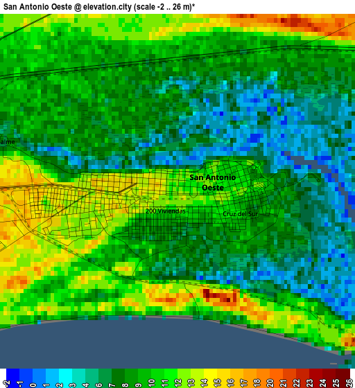
Below is the Elevation map of San Antonio Oeste, which displays elevation range with different colors. Scale of the first map is from -2 to 26 m (-7 to 85 ft) with average elevation of 9 meters (=30 ft) [note 1]
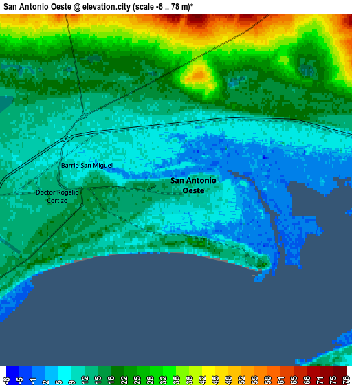
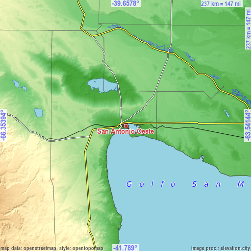
These maps also provides idea of topography and contour of this city, they are displayed at different zoom levels. More info about maps, scale and edge coordinates you can find below images.
| \ | Map #1 | Map #2 | Topo.Map |
| Scale [m] | -2..26 m | -8..78 m | × |
| Scale [ft] | -7..85 ft | -26..256 ft | × |
| Average | 9 m = 30 ft | 17.4 m = 57 ft | × |
| Width | 7.41 km = 4.6 mi | 14.81 km = 9.2 mi | 237 km = 147.3 mi |
| Height | 7.41 km = 4.6 mi | 14.81 km = 9.2 mi | 237 km = 147.3 mi |
| ↑Max Latitude | -40.698621° | -40.665296° | -39.6578° |
| Latitude at center | -40.73193° | -40.73193° | -40.73193° |
| ↓Min Latitude | -40.765222° | -40.798498° | -41.789° |
| ← Min Longitude | -64.991635° | -65.035581° | -66.35394° |
| Longitude center | -64.94769° | -64.94769° | -64.94769° |
| →Max Longitude | -64.903745° | -64.859799° | -63.54144° |
Nearby cities:
Cities around San Antonio Oeste sort by population:
• Viedma elevation 8 m
164.5 km,  93°
93°
• Choele Choel 131 m
171.5 km,  339°
339°
• Lamarque 128 m
159.1 km, 336°
• Sierra Grande 245 m
103 km,  199°
199°
• Fray Luis Beltrán 135 m
172.2 km, 336°
• General Conesa 58 m
81.3 km,  30°
30°
• Chimpay 158 m
201.8 km,  329°
329°
• Valcheta 185 m
102.6 km,  273°
273°
• Coronel Belisle 156 m
192 km, 333°
• Darwin 137 m
182.9 km, 338°
• Río Colorado 81 m
206.6 km,  20°
20°
• Carmen de Patagones 31 m
165.8 km, 92°
Multilingual:
 En español:
San Antonio Oeste elevación 12 m.
 En France:
San Antonio Oeste élévation 12 m.
 Auf Deutsch:
San Antonio Oeste höhe über dem Meeresspiegel ist 12 m.

Sources and notes:
- [note 1] Map square and city borders are not equal. Map elevation data is calculated only from area inside that square.
- [src 1] Elevation data from geonames database provided with same terms of usage.
- [src 2] The elevation map of San Antonio Oeste is generated using elevation data from NASA's 3 arcsec (90m) resolution SRTM data.
- [src 3] Base (background) map © OpenStreetMap contributors tiles are generated by Geofabrik and OpenTopoMap.
Copyright & License:
This San Antonio Oeste Elevation Map is licensed under CC BY-SA. You may reuse any part from this page, if you give a proper credit by linking to this URL:
 More info on terms of use page.