Villa del Totoral elevation
Villa del Totoral (Cordoba, Departamento de Totoral), Argentina elevation is 233 meters and Villa del Totoral elevation in feet is 764 ft above sea level [src 1]. Villa del Totoral is a seat of a second-order administrative division (feature code) with elevation that is 117 meters (384 ft) smaller than average city elevation in Argentina.
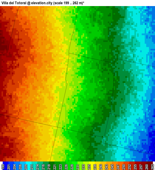
Below is the Elevation map of Villa del Totoral, which displays elevation range with different colors. Scale of the first map is from 199 to 262 m (653 to 860 ft) with average elevation of 230 meters (=755 ft) [note 1]
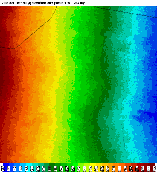
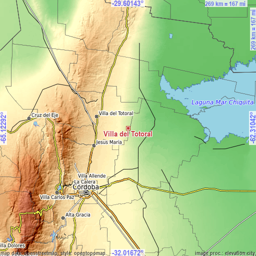
These maps also provides idea of topography and contour of this city, they are displayed at different zoom levels. More info about maps, scale and edge coordinates you can find below images.
| \ | Map #1 | Map #2 | Topo.Map |
| Scale [m] | 199..262 m | 175..293 m | × |
| Scale [ft] | 653..860 ft | 574..961 ft | × |
| Average | 230 m = 755 ft | 230.3 m = 756 ft | × |
| Width | 8.39 km = 5.2 mi | 16.79 km = 10.4 mi | 268.6 km = 166.9 mi |
| Height | 8.39 km = 5.2 mi | 16.79 km = 10.4 mi | 268.6 km = 166.9 mi |
| ↑Max Latitude | -30.778922° | -30.741159° | -29.60143° |
| Latitude at center | -30.81667° | -30.81667° | -30.81667° |
| ↓Min Latitude | -30.854403° | -30.892122° | -32.01672° |
| ← Min Longitude | -63.760615° | -63.804561° | -65.12292° |
| Longitude center | -63.71667° | -63.71667° | -63.71667° |
| →Max Longitude | -63.672725° | -63.628779° | -62.31042° |
Nearby cities:
Cities around Villa del Totoral sort by population:
• Jesús María elevation 533 m
40.4 km,  243°
243°
• Monte Cristo 350 m
62.4 km,  200°
200°
• Santa Rosa de Río Primero 171 m
47.9 km,  141°
141°
• Salsipuedes 739 m
65.7 km, 237°
• San José de la Dormida 468 m
56 km,  336°
336°
• La Para 93 m
68.8 km,  97°
97°
• La Granja 695 m
56.8 km,  247°
247°
• Obispo Trejo 103 m
29.2 km,  82°
82°
• Agua de Oro 791 m
62.2 km, 243°
• Piquillín 285 m
54.1 km,  184°
184°
• Villa Tulumba 702 m
60.8 km,  320°
320°
• Cañada de Luque 239 m
9.3 km,  355°
355°
Multilingual:
 En español:
Villa del Totoral elevación 233 m.
 En France:
Villa del Totoral élévation 233 m.
 Auf Deutsch:
Villa del Totoral höhe über dem Meeresspiegel ist 233 m.

Sources and notes:
- [note 1] Map square and city borders are not equal. Map elevation data is calculated only from area inside that square.
- [src 1] Elevation data from geonames database provided with same terms of usage.
- [src 2] The elevation map of Villa del Totoral is generated using elevation data from NASA's 3 arcsec (90m) resolution SRTM data.
- [src 3] Base (background) map © OpenStreetMap contributors tiles are generated by Geofabrik and OpenTopoMap.
Copyright & License:
This Villa del Totoral Elevation Map is licensed under CC BY-SA. You may reuse any part from this page, if you give a proper credit by linking to this URL:
 More info on terms of use page.