Formosa elevation
Formosa, Argentina elevation is 62 meters and Formosa elevation in feet is 203 ft above sea level [src 1]. Formosa is a seat of a first-order administrative division (feature code) with elevation that is 288 meters (945 ft) smaller than average city elevation in Argentina.
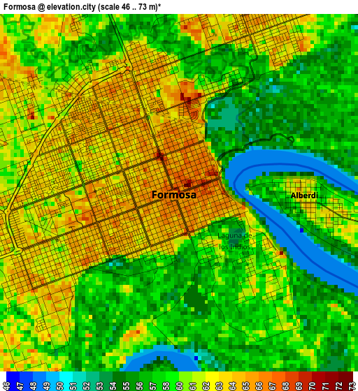
Below is the Elevation map of Formosa, which displays elevation range with different colors. Scale of the first map is from 46 to 73 m (151 to 240 ft) with average elevation of 59.6 meters (=196 ft) [note 1]
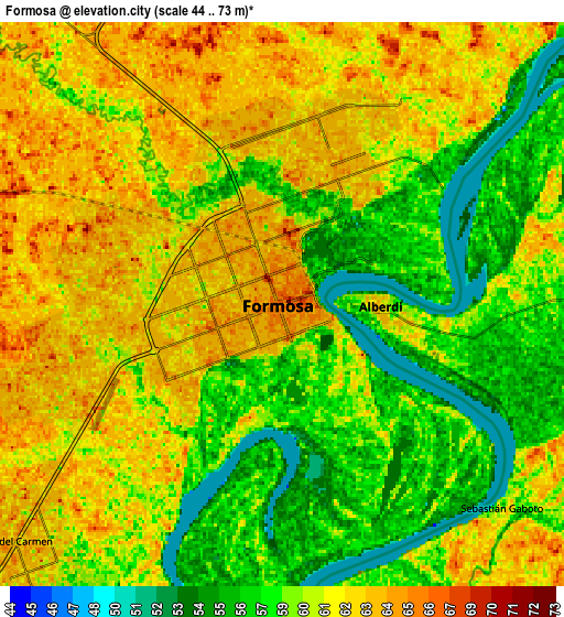
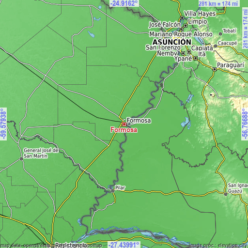
These maps also provides idea of topography and contour of this city, they are displayed at different zoom levels. More info about maps, scale and edge coordinates you can find below images.
| \ | Map #1 | Map #2 | Topo.Map |
| Scale [m] | 46..73 m | 44..73 m | × |
| Scale [ft] | 151..240 ft | 144..240 ft | × |
| Average | 59.6 m = 196 ft | 60 m = 197 ft | × |
| Width | 8.77 km = 5.4 mi | 17.54 km = 10.9 mi | 280.6 km = 174.4 mi |
| Height | 8.77 km = 5.4 mi | 17.54 km = 10.9 mi | 280.6 km = 174.4 mi |
| ↑Max Latitude | -26.145448° | -26.105992° | -24.9162° |
| Latitude at center | -26.18489° | -26.18489° | -26.18489° |
| ↓Min Latitude | -26.224319° | -26.263734° | -27.43991° |
| ← Min Longitude | -58.217075° | -58.261021° | -59.57938° |
| Longitude center | -58.17313° | -58.17313° | -58.17313° |
| →Max Longitude | -58.129185° | -58.085239° | -56.76688° |
Nearby cities:
Cities around Formosa sort by population:
• Pirané elevation 86 m
106.2 km,  298°
298°
• Clorinda 66 m
110 km,  24°
24°
• La Leonesa 60 m
108.5 km,  209°
209°
• San Francisco de Laishí 73 m
46.1 km,  261°
261°
• La Eduvigis 70 m
114.3 km,  230°
230°
• Riacho Eh-Eh 78 m
92.1 km,  353°
353°
• General Vedia 58 m
96.3 km, 210°
• Herradura 64 m
36.3 km,  202°
202°
• Laguna Naick-Neck 78 m
104.5 km,  4°
4°
• Puerto Bermejo 54 m
89.1 km, 202°
• Pampa Almirón 68 m
110.6 km,  238°
238°
• Villa Escolar 69 m
69.5 km, 225°
Multilingual:
 En español:
Ciudad de Formosa elevación 62 m.
 En France:
Formosa élévation 62 m.


Sources and notes:
- [note 1] Map square and city borders are not equal. Map elevation data is calculated only from area inside that square.
- [src 1] Elevation data from geonames database provided with same terms of usage.
- [src 2] The elevation map of Formosa is generated using elevation data from NASA's 3 arcsec (90m) resolution SRTM data.
- [src 3] Base (background) map © OpenStreetMap contributors tiles are generated by Geofabrik and OpenTopoMap.
Copyright & License:
This Formosa Elevation Map is licensed under CC BY-SA. You may reuse any part from this page, if you give a proper credit by linking to this URL:
 More info on terms of use page.