Puerto Ibicuy elevation
Puerto Ibicuy (Entre Rios, Departamento de Islas del Ibicuy), Argentina elevation is 4 meters and Puerto Ibicuy elevation in feet is 13 ft above sea level [src 1]. Puerto Ibicuy is a populated place (feature code) with elevation that is 346 meters (1135 ft) smaller than average city elevation in Argentina.
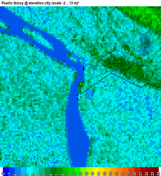
Below is the Elevation map of Puerto Ibicuy, which displays elevation range with different colors. Scale of the first map is from -2 to 13 m (-7 to 43 ft) with average elevation of 2.7 meters (=9 ft) [note 1]
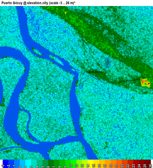
These maps also provides idea of topography and contour of this city, they are displayed at different zoom levels. More info about maps, scale and edge coordinates you can find below images.
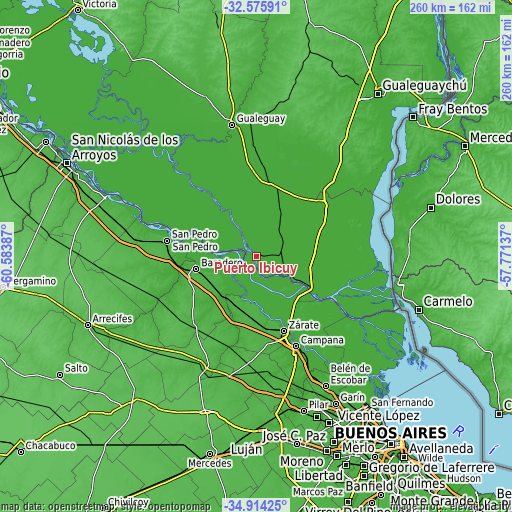
| \ | Map #1 | Map #2 | Topo.Map |
| Scale [m] | -2..13 m | -3..26 m | × |
| Scale [ft] | -7..43 ft | -10..85 ft | × |
| Average | 2.7 m = 9 ft | 2.8 m = 9 ft | × |
| Width | 8.13 km = 5.1 mi | 16.25 km = 10.1 mi | 260 km = 161.6 mi |
| Height | 8.13 km = 5.1 mi | 16.25 km = 10.1 mi | 260 km = 161.6 mi |
| ↑Max Latitude | -33.716504° | -33.679943° | -32.57591° |
| Latitude at center | -33.75305° | -33.75305° | -33.75305° |
| ↓Min Latitude | -33.78958° | -33.826095° | -34.91425° |
| ← Min Longitude | -59.221565° | -59.265511° | -60.58387° |
| Longitude center | -59.17762° | -59.17762° | -59.17762° |
| →Max Longitude | -59.133675° | -59.089729° | -57.77137° |
Nearby cities:
Cities around Puerto Ibicuy sort by population:
• Zárate elevation 28 m
40.8 km,  160°
160°
• Campana 16 m
49.9 km, 156°
• San Pedro 30 m
45.9 km,  280°
280°
• Gualeguay 14 m
69.1 km,  349°
349°
• Villa Paranacito 7 m
48.2 km,  84°
84°
• Ceibas 7 m
53.2 km,  48°
48°
• San Andrés de Giles 51 m
81 km,  197°
197°
• Belén de Escobar 26 m
75.1 km,  151°
151°
• Capitán Sarmiento 51 m
73.3 km,  230°
230°
• San Antonio de Areco 32 m
61.6 km,  206°
206°
• Capilla del Señor 24 m
60.3 km,  173°
173°
• Baradero 29 m
31.2 km,  258°
258°
Multilingual:
 En español:
Puerto Ibicuy elevación 4 m.
 En France:
Puerto Ibicuy élévation 4 m.
 Auf Deutsch:
Puerto Ibicuy höhe über dem Meeresspiegel ist 4 m.

Sources and notes:
- [note 1] Map square and city borders are not equal. Map elevation data is calculated only from area inside that square.
- [src 1] Elevation data from geonames database provided with same terms of usage.
- [src 2] The elevation map of Puerto Ibicuy is generated using elevation data from NASA's 3 arcsec (90m) resolution SRTM data.
- [src 3] Base (background) map © OpenStreetMap contributors tiles are generated by Geofabrik and OpenTopoMap.
Copyright & License:
This Puerto Ibicuy Elevation Map is licensed under CC BY-SA. You may reuse any part from this page, if you give a proper credit by linking to this URL:
 More info on terms of use page.