Ostreni i Math elevation
Ostreni i Math (Dibër, Rrethi i Bulqizës), Albania elevation is 927 meters and Ostreni i Math elevation in feet is 3041 ft above sea level [src 1]. Ostreni i Math is a seat of a third-order administrative division (feature code) with elevation that is 553 meters (1814 ft) bigger than average city elevation in Albania.
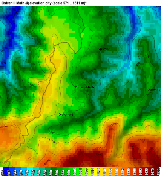
Below is the Elevation map of Ostreni i Math, which displays elevation range with different colors. Scale of the first map is from 571 to 1511 m (1873 to 4957 ft) with average elevation of 994.6 meters (=3263 ft) [note 1]
These maps also provides idea of topography and contour of this city, they are displayed at different zoom levels. More info about maps, scale and edge coordinates you can find below images.
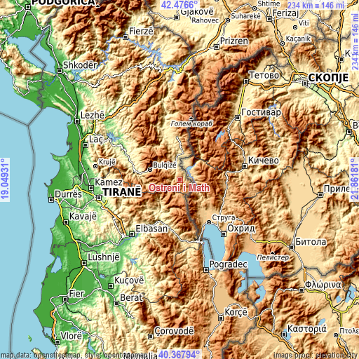
| \ | Map #1 | Topo.Map |
| Scale [m] | 571..1511 m | × |
| Scale [ft] | 1873..4957 ft | × |
| Average | 994.6 m = 3263 ft | × |
| Width | 7.33 km = 4.6 mi | 234.5 km = 145.7 mi |
| Height | 7.33 km = 4.6 mi | 234.5 km = 145.7 mi |
| ↑Max Latitude | 41.46377° | 42.4766° |
| Latitude at center | 41.43083° | 41.43083° |
| ↓Min Latitude | 41.397873° | 40.36794° |
| ← Min Longitude | 20.411615° | 19.04931° |
| Longitude center | 20.45556° | 20.45556° |
| →Max Longitude | 20.499505° | 21.86181° |
Nearby cities:
Cities around Ostreni i Math sort by population:
• Bulqizë elevation 775 m
20.6 km,  289°
289°
• Orenjë 802 m
26 km,  231°
231°
• Melan 812 m
24.8 km,  1°
1°
• Martanesh 905 m
21.6 km,  260°
260°
• Lunik 668 m
19.2 km,  214°
214°
• Maqellarë 617 m
17.7 km,  7°
7°
• Fushë-Bulqizë 678 m
17.6 km,  305°
305°
• Gjorica e Sipërme 462 m
11.5 km,  357°
357°
• Shupenzë 499 m
11.3 km,  346°
346°
• Zerqan 725 m
11.2 km,  315°
315°
• Steblevë 1148 m
10.5 km,  173°
173°
• Trebisht-Muçinë 790 m
7 km,  108°
108°
Multilingual:
 En español:
Ostreni i Math elevación 927 m.
 En France:
Ostreni i Math élévation 927 m.
 Auf Deutsch:
Ostreni i Math höhe über dem Meeresspiegel ist 927 m.

Sources and notes:
- [note 1] Map square and city borders are not equal. Map elevation data is calculated only from area inside that square.
- [src 1] Elevation data from geonames database provided with same terms of usage.
- [src 2] The elevation map of Ostreni i Math is generated using elevation data from NASA's 3 arcsec (90m) resolution SRTM data.
- [src 3] Base (background) map © OpenStreetMap contributors tiles are generated by Geofabrik and OpenTopoMap.
Copyright & License:
This Ostreni i Math Elevation Map is licensed under CC BY-SA. You may reuse any part from this page, if you give a proper credit by linking to this URL:
 More info on terms of use page.