Rrëshen elevation
Rrëshen (Lezhë, Rrethi i Mirditës), Albania elevation is 94 meters and Rrëshen elevation in feet is 308 ft above sea level [src 1]. Rrëshen is a seat of a second-order administrative division (feature code) with elevation that is 280 meters (919 ft) smaller than average city elevation in Albania.
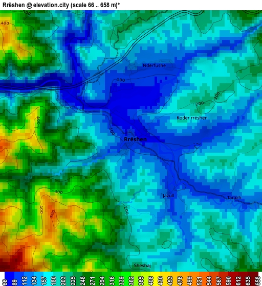
Below is the Elevation map of Rrëshen, which displays elevation range with different colors. Scale of the first map is from 66 to 658 m (217 to 2159 ft) with average elevation of 207 meters (=679 ft) [note 1]
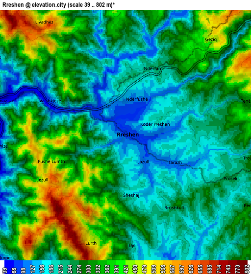
These maps also provides idea of topography and contour of this city, they are displayed at different zoom levels. More info about maps, scale and edge coordinates you can find below images.
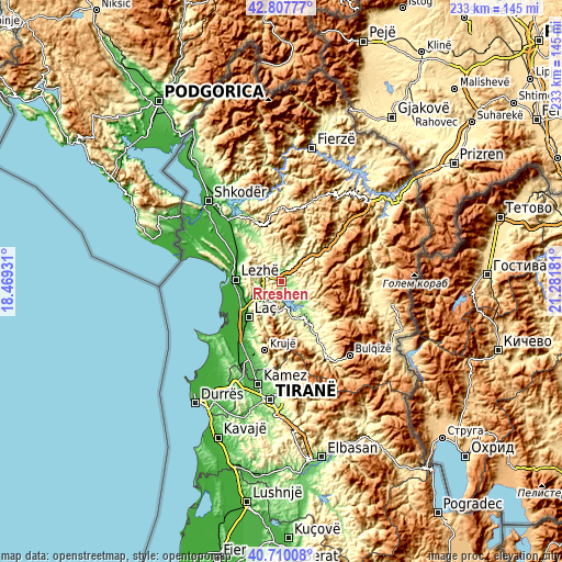
| \ | Map #1 | Map #2 | Topo.Map |
| Scale [m] | 66..658 m | 39..802 m | × |
| Scale [ft] | 217..2159 ft | 128..2631 ft | × |
| Average | 207 m = 679 ft | 284.5 m = 933 ft | × |
| Width | 7.29 km = 4.5 mi | 14.58 km = 9.1 mi | 233.2 km = 144.9 mi |
| Height | 7.29 km = 4.5 mi | 14.58 km = 9.1 mi | 233.2 km = 144.9 mi |
| ↑Max Latitude | 41.800268° | 41.83302° | 42.80777° |
| Latitude at center | 41.7675° | 41.7675° | 41.7675° |
| ↓Min Latitude | 41.734715° | 41.701913° | 40.71008° |
| ← Min Longitude | 19.831615° | 19.787669° | 18.46931° |
| Longitude center | 19.87556° | 19.87556° | 19.87556° |
| →Max Longitude | 19.919505° | 19.963451° | 21.28181° |
Nearby cities:
Cities around Rrëshen sort by population:
• Rubik elevation 79 m
7.5 km,  275°
275°
• Milot 23 m
16.2 km,  235°
235°
• Kurbnesh 745 m
17.3 km,  85°
85°
• Ulëz 162 m
9.5 km,  171°
171°
• Zejmen 8 m
16.8 km,  246°
246°
• Kolç 35 m
16.7 km, 277°
• Kthella e Epërme 600 m
16 km,  71°
71°
• Baz 319 m
15.7 km,  163°
163°
• Rukaj 332 m
15.1 km,  128°
128°
• Blinisht 342 m
14.7 km,  44°
44°
• Kaçinar 430 m
14.1 km,  7°
7°
• Ungrej 253 m
13.7 km,  330°
330°
Multilingual:
 En español:
Rrëshen elevación 94 m.
 En France:
Rrëshen élévation 94 m.


Sources and notes:
- [note 1] Map square and city borders are not equal. Map elevation data is calculated only from area inside that square.
- [src 1] Elevation data from geonames database provided with same terms of usage.
- [src 2] The elevation map of Rrëshen is generated using elevation data from NASA's 3 arcsec (90m) resolution SRTM data.
- [src 3] Base (background) map © OpenStreetMap contributors tiles are generated by Geofabrik and OpenTopoMap.
Copyright & License:
This Rrëshen Elevation Map is licensed under CC BY-SA. You may reuse any part from this page, if you give a proper credit by linking to this URL:
 More info on terms of use page.