Jalālābād elevation
Jalālābād (Nangarhar), Afghanistan elevation is 575 meters and Jalālābād elevation in feet is 1886 ft above sea level [src 1]. Jalālābād is a seat of a first-order administrative division (feature code) with elevation that is 844 meters (2769 ft) smaller than average city elevation in Afghanistan.
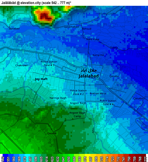
Below is the Elevation map of Jalālābād, which displays elevation range with different colors. Scale of the first map is from 542 to 777 m (1778 to 2549 ft) with average elevation of 583.8 meters (=1915 ft) [note 1]
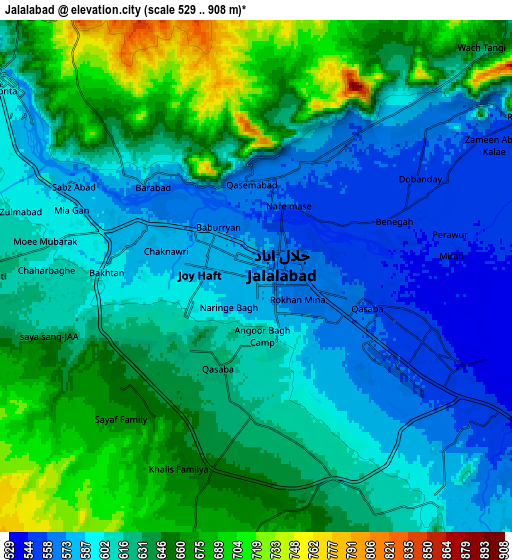
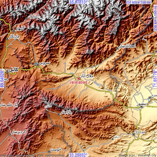
These maps also provides idea of topography and contour of this city, they are displayed at different zoom levels. More info about maps, scale and edge coordinates you can find below images.
| \ | Map #1 | Map #2 | Topo.Map |
| Scale [m] | 542..777 m | 529..908 m | × |
| Scale [ft] | 1778..2549 ft | 1736..2979 ft | × |
| Average | 583.8 m = 1915 ft | 621.7 m = 2040 ft | × |
| Width | 8.06 km = 5 mi | 16.12 km = 10 mi | 257.9 km = 160.3 mi |
| Height | 8.06 km = 5 mi | 16.12 km = 10 mi | 257.9 km = 160.3 mi |
| ↑Max Latitude | 34.462711° | 34.498935° | 35.57833° |
| Latitude at center | 34.42647° | 34.42647° | 34.42647° |
| ↓Min Latitude | 34.390214° | 34.353942° | 33.25852° |
| ← Min Longitude | 70.407585° | 70.363639° | 69.04528° |
| Longitude center | 70.45153° | 70.45153° | 70.45153° |
| →Max Longitude | 70.495475° | 70.539421° | 71.85778° |
Nearby cities:
Cities around Jalālābād sort by population:
• Mehtar Lām elevation 795 m
35.1 km,  320°
320°
• Kōṯowāl 1464 m
36 km,  178°
178°
• Nūrgal 679 m
35.4 km,  54°
54°
• Kaz̲h̲ah 1276 m
32.2 km,  230°
230°
• Pachīr wa Āgām 1241 m
29.8 km,  212°
212°
• Gōshtah 483 m
29.5 km,  104°
104°
• Qal‘ah-ye Shāhī 894 m
27.9 km,  27°
27°
• Qarghah’ī 659 m
23.8 km,  306°
306°
• Sheywah 602 m
20.5 km,  37°
37°
• Sangar Sarāy 517 m
17.4 km, 97°
• Khafizan 909 m
17.2 km, 205°
• Sulţānpūr-e ‘Ulyā 696 m
14.3 km,  263°
263°
Multilingual:
 En español:
Jalalabad elevación 575 m.
 En France:
Jalalabad élévation 575 m.
 Auf Deutsch:
Dschalalabad höhe über dem Meeresspiegel ist 575 m.

Sources and notes:
- [note 1] Map square and city borders are not equal. Map elevation data is calculated only from area inside that square.
- [src 1] Elevation data from geonames database provided with same terms of usage.
- [src 2] The elevation map of Jalālābād is generated using elevation data from NASA's 3 arcsec (90m) resolution SRTM data.
- [src 3] Base (background) map © OpenStreetMap contributors tiles are generated by Geofabrik and OpenTopoMap.
Copyright & License:
This Jalālābād Elevation Map is licensed under CC BY-SA. You may reuse any part from this page, if you give a proper credit by linking to this URL:
 More info on terms of use page.