Mamuša elevation
Mamuša (Prizren, Komuna e Mamushës), Kosovo elevation is 333 meters and Mamuša elevation in feet is 1093 ft above sea level [src 1]. Mamuša is a seat of a second-order administrative division (feature code) with elevation that is 213 meters (699 ft) smaller than average city elevation in Kosovo.
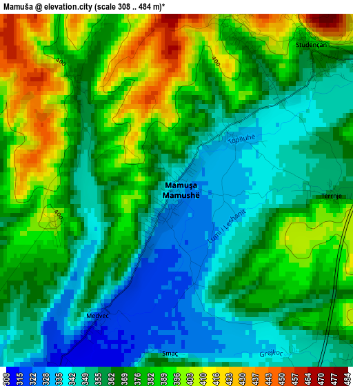
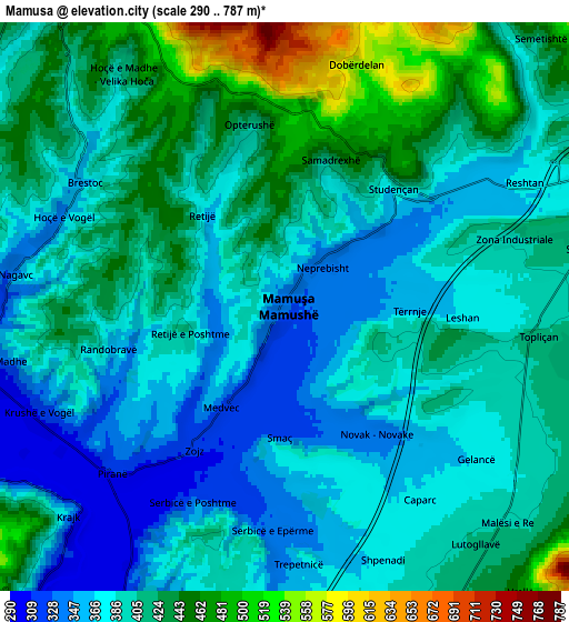
Below is the Elevation map of Mamuša, which displays elevation range with different colors. Scale of the first map is from 308 to 484 m (1010 to 1588 ft) with average elevation of 369.7 meters (=1213 ft) [note 1]
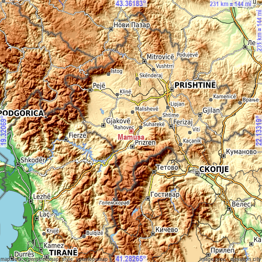
These maps also provides idea of topography and contour of this city, they are displayed at different zoom levels. More info about maps, scale and edge coordinates you can find below images.
| \ | Map #1 | Map #2 | Topo.Map |
| Scale [m] | 308..484 m | 290..787 m | × |
| Scale [ft] | 1010..1588 ft | 951..2582 ft | × |
| Average | 369.7 m = 1213 ft | 401.1 m = 1316 ft | × |
| Width | 7.22 km = 4.5 mi | 14.45 km = 9 mi | 231.2 km = 143.7 mi |
| Height | 7.22 km = 4.5 mi | 14.45 km = 9 mi | 231.2 km = 143.7 mi |
| ↑Max Latitude | 42.363309° | 42.395771° | 43.36183° |
| Latitude at center | 42.33083° | 42.33083° | 42.33083° |
| ↓Min Latitude | 42.298334° | 42.265822° | 41.28265° |
| ← Min Longitude | 20.682995° | 20.639049° | 19.32069° |
| Longitude center | 20.72694° | 20.72694° | 20.72694° |
| →Max Longitude | 20.770885° | 20.814831° | 22.13319° |
Nearby cities:
Cities around Mamuša sort by population:
• Prizren elevation 413 m
13 km,  175°
175°
• Gjakovë 362 m
24.9 km,  282°
282°
• Suva Reka 387 m
8.6 km,  69°
69°
• Orahovac 393 m
9.7 km,  322°
322°
• Llazicë 635 m
25.1 km,  6°
6°
• Mališevo 529 m
16.9 km, 5°
• Peqan 432 m
9.8 km,  53°
53°
• Budakovo 846 m
16.5 km,  80°
80°
• Leshan 370 m
4.5 km,  94°
94°
• Gjinoc 425 m
7.7 km,  100°
100°
• Pagaruša 539 m
10 km, 7°
• Nishor 624 m
12 km,  30°
30°
Multilingual:
 En español:
Mamuša elevación 333 m.
 En France:
Mamuša élévation 333 m.


Sources and notes:
- [note 1] Map square and city borders are not equal. Map elevation data is calculated only from area inside that square.
- [src 1] Elevation data from geonames database provided with same terms of usage.
- [src 2] The elevation map of Mamuša is generated using elevation data from NASA's 3 arcsec (90m) resolution SRTM data.
- [src 3] Base (background) map © OpenStreetMap contributors tiles are generated by Geofabrik and OpenTopoMap.
Copyright & License:
This Mamuša Elevation Map is licensed under CC BY-SA. You may reuse any part from this page, if you give a proper credit by linking to this URL:
 More info on terms of use page.