Lạng Sơn elevation
Lạng Sơn, Vietnam elevation is 265 meters and Lạng Sơn elevation in feet is 869 ft above sea level [src 1]. Lạng Sơn is a seat of a first-order administrative division (feature code) with elevation that is 137 meters (449 ft) bigger than average city elevation in Vietnam.
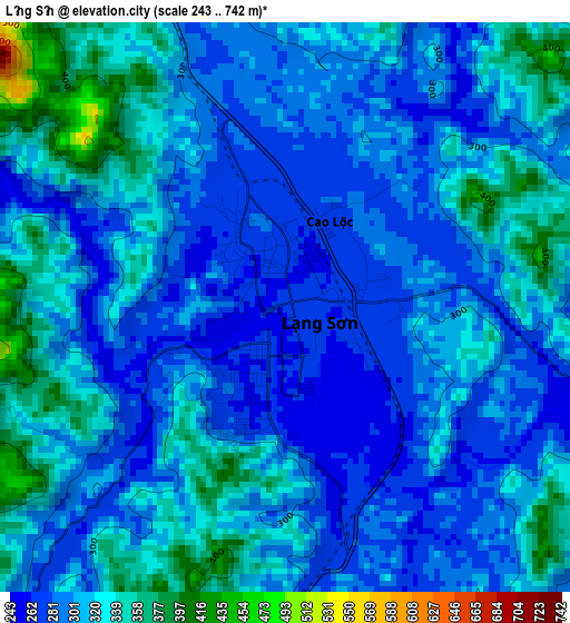
Below is the Elevation map of Lạng Sơn, which displays elevation range with different colors. Scale of the first map is from 243 to 742 m (797 to 2434 ft) with average elevation of 308.3 meters (=1011 ft) [note 1]
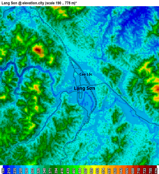
These maps also provides idea of topography and contour of this city, they are displayed at different zoom levels. More info about maps, scale and edge coordinates you can find below images.
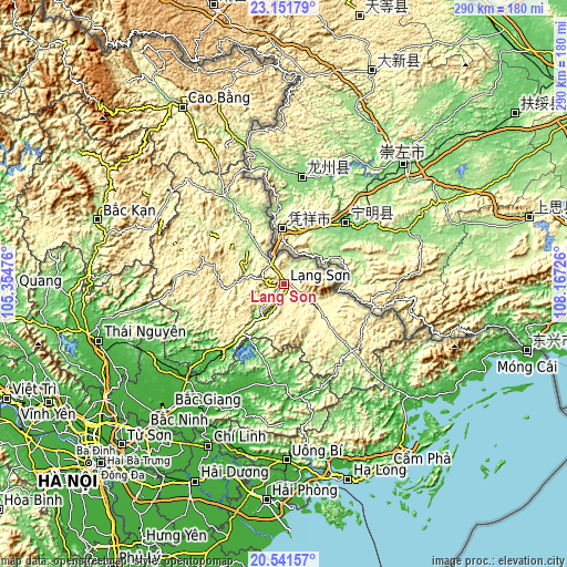
| \ | Map #1 | Map #2 | Topo.Map |
| Scale [m] | 243..742 m | 190..778 m | × |
| Scale [ft] | 797..2434 ft | 623..2552 ft | × |
| Average | 308.3 m = 1011 ft | 325 m = 1066 ft | × |
| Width | 9.07 km = 5.6 mi | 18.14 km = 11.3 mi | 290.2 km = 180.3 mi |
| Height | 9.07 km = 5.6 mi | 18.14 km = 11.3 mi | 290.2 km = 180.3 mi |
| ↑Max Latitude | 21.893422° | 21.934192° | 23.15179° |
| Latitude at center | 21.85264° | 21.85264° | 21.85264° |
| ↓Min Latitude | 21.811847° | 21.771042° | 20.54157° |
| ← Min Longitude | 106.717065° | 106.673119° | 105.35476° |
| Longitude center | 106.76101° | 106.76101° | 106.76101° |
| →Max Longitude | 106.804955° | 106.848901° | 108.16726° |
Nearby cities:
Cities around Lạng Sơn sort by population:
• An Châu elevation 56 m
58.3 km,  170°
170°
• Hữu Lũng 31 m
57.8 km,  228°
228°
• Chũ 18 m
56.9 km,  200°
200°
• Thị Trấn Thất Khê 159 m
53.7 km,  326°
326°
• Đình Lập 189 m
48.7 km,  134°
134°
• Bắc Sơn 396 m
45.7 km,  276°
276°
• Bình Gia 413 m
42.6 km,  286°
286°
• Đồng Mỏ 65 m
28.8 km,  220°
220°
• Thị Trấn Na Sầm 179 m
27.2 km, 326°
• Văn Quan 239 m
22.9 km,  273°
273°
• Lộc Bình 279 m
19.7 km,  121°
121°
• Thị Trấn Cao Lộc 280 m
1.7 km,  26°
26°
Multilingual:
 En español:
Lạng Sơn elevación 265 m.
 En France:
Lạng Sơn élévation 265 m.
 Auf Deutsch:
Lạng Sơn höhe über dem Meeresspiegel ist 265 m.

Sources and notes:
- [note 1] Map square and city borders are not equal. Map elevation data is calculated only from area inside that square.
- [src 1] Elevation data from geonames database provided with same terms of usage.
- [src 2] The elevation map of Lạng Sơn is generated using elevation data from NASA's 3 arcsec (90m) resolution SRTM data.
- [src 3] Base (background) map © OpenStreetMap contributors tiles are generated by Geofabrik and OpenTopoMap.
Copyright & License:
This Lạng Sơn Elevation Map is licensed under CC BY-SA. You may reuse any part from this page, if you give a proper credit by linking to this URL:
 More info on terms of use page.