Lào Cai elevation
Lào Cai, Vietnam elevation is 86 meters and Lào Cai elevation in feet is 282 ft above sea level [src 1]. Lào Cai is a seat of a first-order administrative division (feature code) with elevation that is 42 meters (138 ft) smaller than average city elevation in Vietnam.
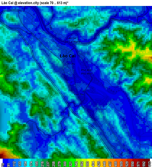
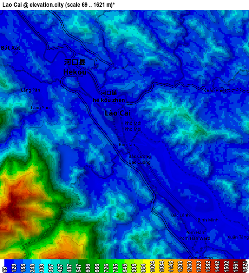
Below is the Elevation map of Lào Cai, which displays elevation range with different colors. Scale of the first map is from 70 to 613 m (230 to 2011 ft) with average elevation of 154.2 meters (=506 ft) [note 1]
These maps also provides idea of topography and contour of this city, they are displayed at different zoom levels. More info about maps, scale and edge coordinates you can find below images.
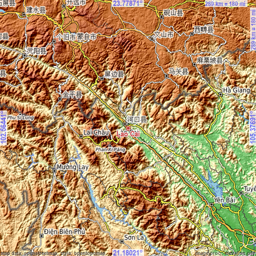
| \ | Map #1 | Map #2 | Topo.Map |
| Scale [m] | 70..613 m | 69..1621 m | × |
| Scale [ft] | 230..2011 ft | 226..5318 ft | × |
| Average | 154.2 m = 506 ft | 272.6 m = 894 ft | × |
| Width | 9.03 km = 5.6 mi | 18.06 km = 11.2 mi | 288.9 km = 179.5 mi |
| Height | 9.03 km = 5.6 mi | 18.06 km = 11.2 mi | 288.9 km = 179.5 mi |
| ↑Max Latitude | 22.526158° | 22.566745° | 23.77871° |
| Latitude at center | 22.48556° | 22.48556° | 22.48556° |
| ↓Min Latitude | 22.44495° | 22.404327° | 21.18021° |
| ← Min Longitude | 103.926715° | 103.882769° | 102.56441° |
| Longitude center | 103.97066° | 103.97066° | 103.97066° |
| →Max Longitude | 104.014605° | 104.058551° | 105.37691° |
Nearby cities:
Cities around Lào Cai sort by population:
• Sa Pa elevation 1522 m
20.7 km,  218°
218°
• Lao Chải 1168 m
21.8 km,  208°
208°
• Than Uyên 587 m
59.3 km,  189°
189°
• Thị Trấn Phố Ràng 87 m
59 km,  118°
118°
• Lai Châu 919 m
53.6 km,  259°
259°
• Thị Trấn Khánh Yên 202 m
52.7 km,  146°
146°
• Tam Đường 643 m
40 km,  242°
242°
• Si Ma Cai 1065 m
39.3 km,  53°
53°
• Thị Trấn Mường Khương 771 m
34.4 km,  26°
26°
• Bắc Hà 908 m
33.6 km,  79°
79°
• Thị Trấn Phố Lu 77 m
28.9 km,  129°
129°
• Bát Xát 109 m
10.5 km,  307°
307°
Multilingual:
 En español:
Laos elevación 86 m.
 En France:
Lào Cai élévation 86 m.


Sources and notes:
- [note 1] Map square and city borders are not equal. Map elevation data is calculated only from area inside that square.
- [src 1] Elevation data from geonames database provided with same terms of usage.
- [src 2] The elevation map of Lào Cai is generated using elevation data from NASA's 3 arcsec (90m) resolution SRTM data.
- [src 3] Base (background) map © OpenStreetMap contributors tiles are generated by Geofabrik and OpenTopoMap.
Copyright & License:
This Lào Cai Elevation Map is licensed under CC BY-SA. You may reuse any part from this page, if you give a proper credit by linking to this URL:
 More info on terms of use page.