Calabozo elevation
Calabozo (Guárico, Municipio Francisco de Miranda), Venezuela elevation is 103 meters and Calabozo elevation in feet is 338 ft above sea level [src 1]. Calabozo is a seat of a second-order administrative division (feature code) with elevation that is 278 meters (912 ft) smaller than average city elevation in Venezuela.
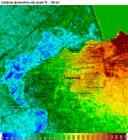
Below is the Elevation map of Calabozo, which displays elevation range with different colors. Scale of the first map is from 76 to 128 m (249 to 420 ft) with average elevation of 96.5 meters (=317 ft) [note 1]
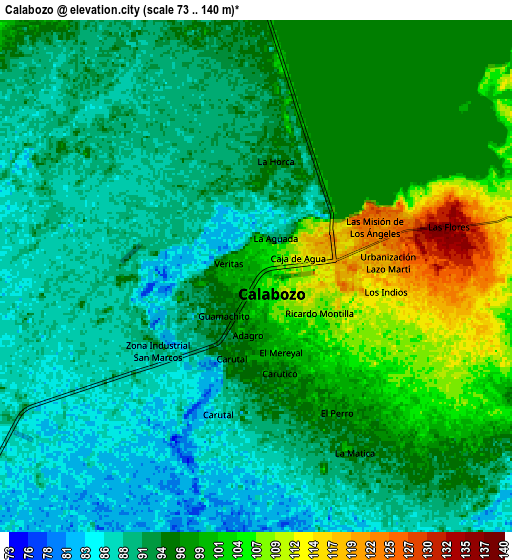
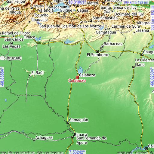
These maps also provides idea of topography and contour of this city, they are displayed at different zoom levels. More info about maps, scale and edge coordinates you can find below images.
| \ | Map #1 | Map #2 | Topo.Map |
| Scale [m] | 76..128 m | 73..140 m | × |
| Scale [ft] | 249..420 ft | 240..459 ft | × |
| Average | 96.5 m = 317 ft | 95.1 m = 312 ft | × |
| Width | 9.65 km = 6 mi | 19.31 km = 12 mi | 308.9 km = 191.9 mi |
| Height | 9.65 km = 6 mi | 19.31 km = 12 mi | 308.9 km = 191.9 mi |
| ↑Max Latitude | 8.967571° | 9.010976° | 10.31061° |
| Latitude at center | 8.92416° | 8.92416° | 8.92416° |
| ↓Min Latitude | 8.880744° | 8.837323° | 7.53242° |
| ← Min Longitude | -67.473235° | -67.517181° | -68.83554° |
| Longitude center | -67.42929° | -67.42929° | -67.42929° |
| →Max Longitude | -67.385345° | -67.341399° | -66.02304° |
Nearby cities:
Cities around Calabozo sort by population:
• San Juan de los Morros elevation 433 m
110.1 km,  4°
4°
• Camatagua 250 m
111.9 km,  30°
30°
• El Pao 136 m
110.5 km,  315°
315°
• Guayabal 56 m
102.7 km,  178°
178°
• El Baúl 68 m
95.2 km,  272°
272°
• Camaguán 60 m
92.9 km,  192°
192°
• La Unión 59 m
87.1 km,  205°
205°
• Palmasola 142 m
85.5 km,  66°
66°
• Guadarrama 63 m
80.7 km,  237°
237°
• Barbacoas 171 m
79.3 km,  38°
38°
• Ortiz 188 m
79 km,  11°
11°
• El Sombrero 163 m
65.6 km, 38°
Multilingual:
 En español:
Calabozo elevación 103 m.
 En France:
Calabozo élévation 103 m.
 Auf Deutsch:
Calabozo höhe über dem Meeresspiegel ist 103 m.

Sources and notes:
- [note 1] Map square and city borders are not equal. Map elevation data is calculated only from area inside that square.
- [src 1] Elevation data from geonames database provided with same terms of usage.
- [src 2] The elevation map of Calabozo is generated using elevation data from NASA's 3 arcsec (90m) resolution SRTM data.
- [src 3] Base (background) map © OpenStreetMap contributors tiles are generated by Geofabrik and OpenTopoMap.
Copyright & License:
This Calabozo Elevation Map is licensed under CC BY-SA. You may reuse any part from this page, if you give a proper credit by linking to this URL:
 More info on terms of use page.