Porlamar elevation
Porlamar (Nueva Esparta, Municipio Mariño), Venezuela elevation is 22 meters and Porlamar elevation in feet is 72 ft above sea level [src 1]. Porlamar is a seat of a second-order administrative division (feature code) with elevation that is 359 meters (1178 ft) smaller than average city elevation in Venezuela.
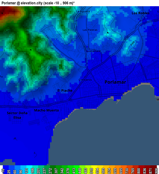
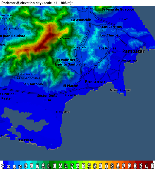
Below is the Elevation map of Porlamar, which displays elevation range with different colors. Scale of the first map is from -10 to 906 m (-33 to 2972 ft) with average elevation of 86.5 meters (=284 ft) [note 1]
These maps also provides idea of topography and contour of this city, they are displayed at different zoom levels. More info about maps, scale and edge coordinates you can find below images.
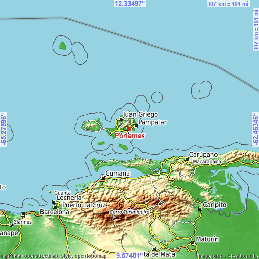
| \ | Map #1 | Map #2 | Topo.Map |
| Scale [m] | -10..906 m | -11..906 m | × |
| Scale [ft] | -33..2972 ft | -36..2972 ft | × |
| Average | 86.5 m = 284 ft | 122.7 m = 403 ft | × |
| Width | 9.59 km = 6 mi | 19.19 km = 11.9 mi | 307 km = 190.8 mi |
| Height | 9.59 km = 6 mi | 19.19 km = 11.9 mi | 307 km = 190.8 mi |
| ↑Max Latitude | 11.000851° | 11.043986° | 12.33497° |
| Latitude at center | 10.95771° | 10.95771° | 10.95771° |
| ↓Min Latitude | 10.914563° | 10.871409° | 9.57401° |
| ← Min Longitude | -63.913655° | -63.957601° | -65.27596° |
| Longitude center | -63.86971° | -63.86971° | -63.86971° |
| →Max Longitude | -63.825765° | -63.781819° | -62.46346° |
Nearby cities:
Cities around Porlamar sort by population:
• La Asunción elevation 42 m
8.4 km,  5°
5°
• Juan Griego 5 m
17.3 km,  322°
322°
• San Antonio del Golfo 39 m
58 km,  171°
171°
• Marigüitar 14 m
56.8 km,  183°
183°
• Boca de Río 3 m
33.9 km,  271°
271°
• Punta de Piedras 1 m
25.6 km,  255°
255°
• San Pedro de Coche 2 m
24 km,  215°
215°
• La Plaza Paraguachi 22 m
16.8 km, 5°
• Santa Ana 135 m
13.6 km,  334°
334°
• San Juan Bautista 181 m
10.2 km,  307°
307°
• Pampatar 3 m
9.7 km,  59°
59°
• El Valle del Espíritu Santo 61 m
3.2 km, 333°
Multilingual:
 En español:
Porlamar elevación 22 m.
 En France:
Porlamar élévation 22 m.


Sources and notes:
- [note 1] Map square and city borders are not equal. Map elevation data is calculated only from area inside that square.
- [src 1] Elevation data from geonames database provided with same terms of usage.
- [src 2] The elevation map of Porlamar is generated using elevation data from NASA's 3 arcsec (90m) resolution SRTM data.
- [src 3] Base (background) map © OpenStreetMap contributors tiles are generated by Geofabrik and OpenTopoMap.
Copyright & License:
This Porlamar Elevation Map is licensed under CC BY-SA. You may reuse any part from this page, if you give a proper credit by linking to this URL:
 More info on terms of use page.