Guliston elevation
Guliston (Sirdaryo), Uzbekistan elevation is 273 meters and Guliston elevation in feet is 896 ft above sea level [src 1]. Guliston is a seat of a first-order administrative division (feature code) with elevation that is 156 meters (512 ft) smaller than average city elevation in Uzbekistan.
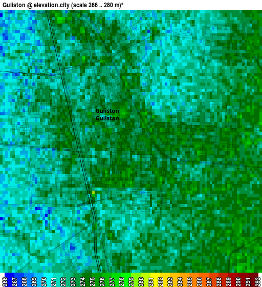
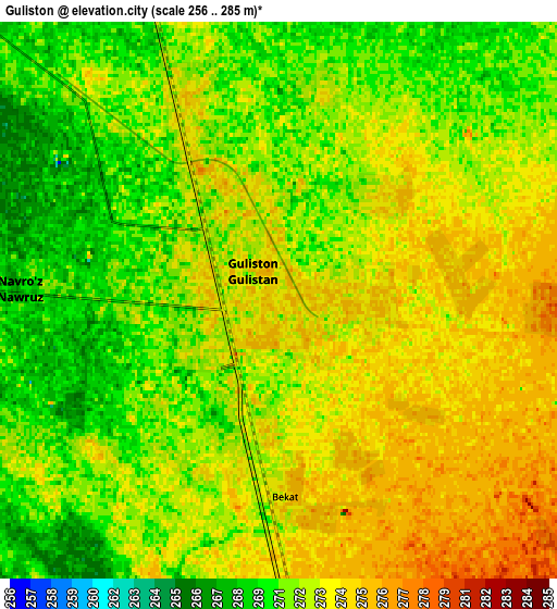
Below is the Elevation map of Guliston, which displays elevation range with different colors. Scale of the first map is from 266 to 280 m (873 to 919 ft) with average elevation of 272.3 meters (=893 ft) [note 1]
These maps also provides idea of topography and contour of this city, they are displayed at different zoom levels. More info about maps, scale and edge coordinates you can find below images.
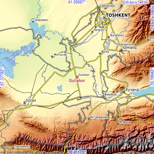
| \ | Map #1 | Map #2 | Topo.Map |
| Scale [m] | 266..280 m | 256..285 m | × |
| Scale [ft] | 873..919 ft | 840..935 ft | × |
| Average | 272.3 m = 893 ft | 272 m = 892 ft | × |
| Width | 7.43 km = 4.6 mi | 14.86 km = 9.2 mi | 237.8 km = 147.8 mi |
| Height | 7.43 km = 4.6 mi | 14.86 km = 9.2 mi | 237.8 km = 147.8 mi |
| ↑Max Latitude | 40.523133° | 40.55653° | 41.55067° |
| Latitude at center | 40.48972° | 40.48972° | 40.48972° |
| ↓Min Latitude | 40.45629° | 40.422844° | 39.41173° |
| ← Min Longitude | 68.740225° | 68.696279° | 67.37792° |
| Longitude center | 68.78417° | 68.78417° | 68.78417° |
| →Max Longitude | 68.828115° | 68.872061° | 70.19042° |
Nearby cities:
Cities around Guliston sort by population:
• Bekobod elevation 303 m
50.9 km,  126°
126°
• Yangiyer 314 m
24.1 km,  172°
172°
• Piskent 416 m
65.8 km,  46°
46°
• Zomin 645 m
67.4 km,  209°
209°
• Sirdaryo 263 m
40.7 km,  345°
345°
• Gagarin 267 m
55.1 km,  290°
290°
• Zafar 307 m
55.7 km,  10°
10°
• Chinoz 275 m
49.7 km,  357°
357°
• Dashtobod 400 m
47.2 km, 211°
• Bo‘ka 341 m
49.7 km,  44°
44°
• Dŭstlik 273 m
63.4 km,  273°
273°
• Amir Timur 319 m
60.4 km, 12°
Multilingual:
 En español:
Guliston elevación 273 m.
 En France:
Goulistan élévation 273 m.
 Auf Deutsch:
Guliston höhe über dem Meeresspiegel ist 273 m.

Sources and notes:
- [note 1] Map square and city borders are not equal. Map elevation data is calculated only from area inside that square.
- [src 1] Elevation data from geonames database provided with same terms of usage.
- [src 2] The elevation map of Guliston is generated using elevation data from NASA's 3 arcsec (90m) resolution SRTM data.
- [src 3] Base (background) map © OpenStreetMap contributors tiles are generated by Geofabrik and OpenTopoMap.
Copyright & License:
This Guliston Elevation Map is licensed under CC BY-SA. You may reuse any part from this page, if you give a proper credit by linking to this URL:
 More info on terms of use page.