Pop elevation
Pop (Namangan), Uzbekistan elevation is 440 meters and Pop elevation in feet is 1444 ft above sea level [src 1]. Pop is a populated place (feature code) with elevation that is 11 meters (36 ft) bigger than average city elevation in Uzbekistan.
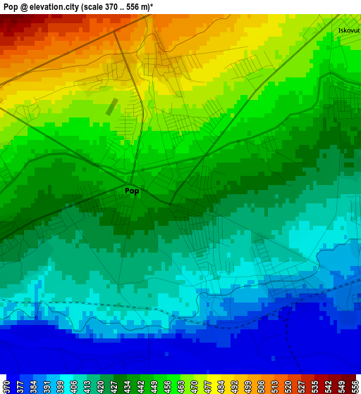
Below is the Elevation map of Pop, which displays elevation range with different colors. Scale of the first map is from 370 to 556 m (1214 to 1824 ft) with average elevation of 433.6 meters (=1423 ft) [note 1]
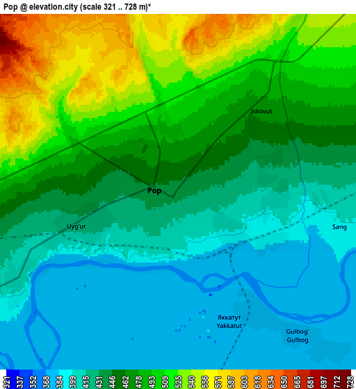
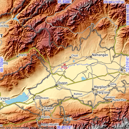
These maps also provides idea of topography and contour of this city, they are displayed at different zoom levels. More info about maps, scale and edge coordinates you can find below images.
| \ | Map #1 | Map #2 | Topo.Map |
| Scale [m] | 370..556 m | 321..728 m | × |
| Scale [ft] | 1214..1824 ft | 1053..2388 ft | × |
| Average | 433.6 m = 1423 ft | 452 m = 1483 ft | × |
| Width | 7.39 km = 4.6 mi | 14.78 km = 9.2 mi | 236.5 km = 147 mi |
| Height | 7.39 km = 4.6 mi | 14.78 km = 9.2 mi | 236.5 km = 147 mi |
| ↑Max Latitude | 40.906831° | 40.940036° | 41.9284° |
| Latitude at center | 40.87361° | 40.87361° | 40.87361° |
| ↓Min Latitude | 40.840372° | 40.807118° | 39.80174° |
| ← Min Longitude | 71.064945° | 71.020999° | 69.70264° |
| Longitude center | 71.10889° | 71.10889° | 71.10889° |
| →Max Longitude | 71.152835° | 71.196781° | 72.51514° |
Nearby cities:
Cities around Pop sort by population:
• Namangan elevation 442 m
49.3 km,  73°
73°
• Qo‘qon 416 m
40.8 km,  200°
200°
• Chust 662 m
18 km,  36°
36°
• Toshbuloq 405 m
39.7 km,  83°
83°
• To‘rqao‘rg‘on 556 m
36.6 km, 67°
• Oqoltin 405 m
51.7 km,  105°
105°
• Bag‘dod 419 m
46.5 km,  169°
169°
• Uchko‘prik 414 m
37.1 km,  186°
186°
• Tŭragŭrghon Shahri 566 m
36.7 km, 66°
• Dang‘ara 393 m
36.1 km,  206°
206°
• Yangiqo‘rg‘on 405 m
35.7 km, 174°
• Pop Shahri 450 m
0.6 km,  299°
299°
Multilingual:
 En español:
Pop elevación 440 m.
 En France:
Pop élévation 440 m.


Sources and notes:
- [note 1] Map square and city borders are not equal. Map elevation data is calculated only from area inside that square.
- [src 1] Elevation data from geonames database provided with same terms of usage.
- [src 2] The elevation map of Pop is generated using elevation data from NASA's 3 arcsec (90m) resolution SRTM data.
- [src 3] Base (background) map © OpenStreetMap contributors tiles are generated by Geofabrik and OpenTopoMap.
Copyright & License:
This Pop Elevation Map is licensed under CC BY-SA. You may reuse any part from this page, if you give a proper credit by linking to this URL:
 More info on terms of use page.