Shohimardon elevation
Shohimardon (Fergana), Uzbekistan elevation is 1464 meters and Shohimardon elevation in feet is 4803 ft above sea level [src 1]. Shohimardon is a populated place (feature code) with elevation that is 1035 meters (3396 ft) bigger than average city elevation in Uzbekistan.
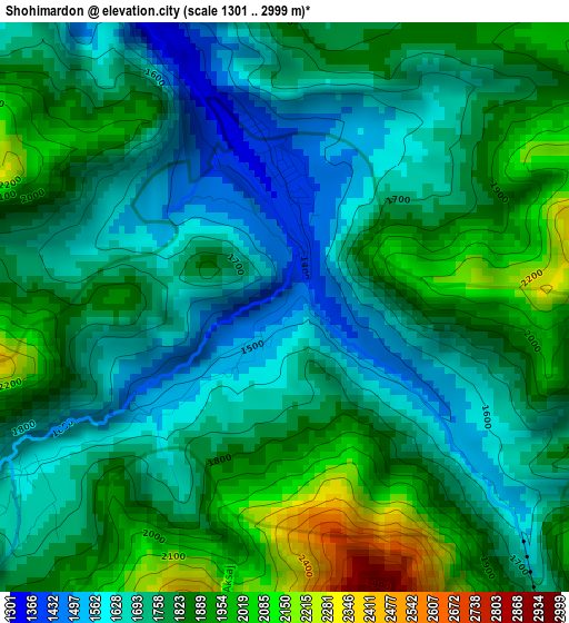
Below is the Elevation map of Shohimardon, which displays elevation range with different colors. Scale of the first map is from 1301 to 2999 m (4268 to 9839 ft) with average elevation of 1783.1 meters (=5850 ft) [note 1]
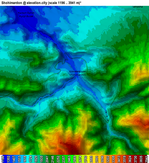
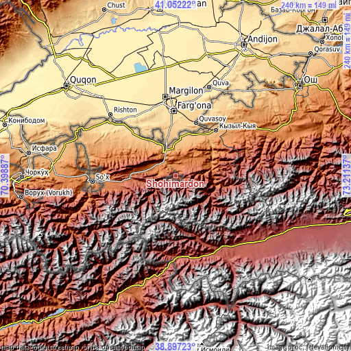
These maps also provides idea of topography and contour of this city, they are displayed at different zoom levels. More info about maps, scale and edge coordinates you can find below images.
| \ | Map #1 | Map #2 | Topo.Map |
| Scale [m] | 1301..2999 m | 1196..3941 m | × |
| Scale [ft] | 4268..9839 ft | 3924..12930 ft | × |
| Average | 1783.1 m = 5850 ft | 2042.6 m = 6701 ft | × |
| Width | 7.49 km = 4.7 mi | 14.98 km = 9.3 mi | 239.6 km = 148.9 mi |
| Height | 7.49 km = 4.7 mi | 14.98 km = 9.3 mi | 239.6 km = 148.9 mi |
| ↑Max Latitude | 40.016884° | 40.050531° | 41.05222° |
| Latitude at center | 39.98322° | 39.98322° | 39.98322° |
| ↓Min Latitude | 39.949539° | 39.915842° | 38.89723° |
| ← Min Longitude | 71.761175° | 71.717229° | 70.39887° |
| Longitude center | 71.80512° | 71.80512° | 71.80512° |
| →Max Longitude | 71.849065° | 71.893011° | 73.21137° |
Nearby cities:
Cities around Shohimardon sort by population:
• Fergana elevation 580 m
44.6 km,  357°
357°
• Marg‘ilon 494 m
54.8 km,  352°
352°
• Quvasoy 815 m
38 km,  23°
23°
• Toshloq 491 m
55 km, 356°
• Oltiariq 463 m
53.4 km,  328°
328°
• Kirguli 547 m
50.4 km, 356°
• Yangi Marg‘ilon 534 m
49.9 km, 351°
• Hamza 443 m
55.6 km, 332°
• Langar 453 m
61 km, 348°
• Rishton 479 m
60.7 km,  313°
313°
• Ravon 1151 m
57.1 km,  269°
269°
• Vodil 927 m
22.2 km,  343°
343°
Multilingual:
 En español:
Shohimardon elevación 1464 m.
 En France:
Shohimardon élévation 1464 m.
 Auf Deutsch:
Shohimardon höhe über dem Meeresspiegel ist 1464 m.

Sources and notes:
- [note 1] Map square and city borders are not equal. Map elevation data is calculated only from area inside that square.
- [src 1] Elevation data from geonames database provided with same terms of usage.
- [src 2] The elevation map of Shohimardon is generated using elevation data from NASA's 3 arcsec (90m) resolution SRTM data.
- [src 3] Base (background) map © OpenStreetMap contributors tiles are generated by Geofabrik and OpenTopoMap.
Copyright & License:
This Shohimardon Elevation Map is licensed under CC BY-SA. You may reuse any part from this page, if you give a proper credit by linking to this URL:
 More info on terms of use page.