Paysandú elevation
Paysandú, Uruguay elevation is 50 meters and Paysandú elevation in feet is 164 ft above sea level [src 1]. Paysandú is a seat of a first-order administrative division (feature code) with elevation that is 21 meters (69 ft) smaller than average city elevation in Uruguay.
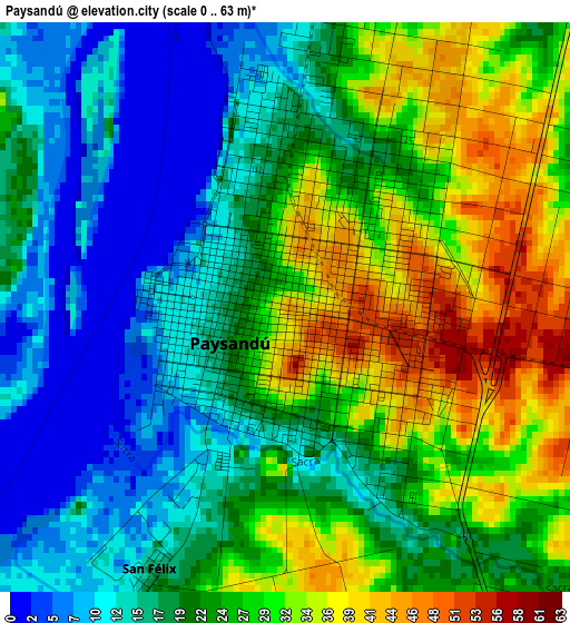
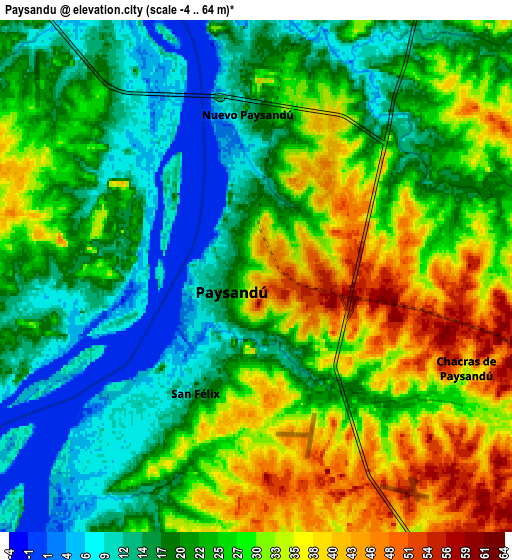
Below is the Elevation map of Paysandú, which displays elevation range with different colors. Scale of the first map is from 0 to 63 m (0 to 207 ft) with average elevation of 22.5 meters (=74 ft) [note 1]
These maps also provides idea of topography and contour of this city, they are displayed at different zoom levels. More info about maps, scale and edge coordinates you can find below images.
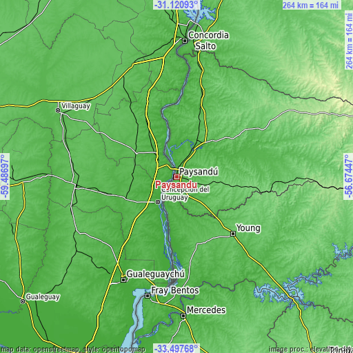
| \ | Map #1 | Map #2 | Topo.Map |
| Scale [m] | 0..63 m | -4..64 m | × |
| Scale [ft] | 0..207 ft | -13..210 ft | × |
| Average | 22.5 m = 74 ft | 24.4 m = 80 ft | × |
| Width | 8.26 km = 5.1 mi | 16.52 km = 10.3 mi | 264.3 km = 164.2 mi |
| Height | 8.26 km = 5.1 mi | 16.52 km = 10.3 mi | 264.3 km = 164.2 mi |
| ↑Max Latitude | -32.279954° | -32.242793° | -31.12093° |
| Latitude at center | -32.3171° | -32.3171° | -32.3171° |
| ↓Min Latitude | -32.354231° | -32.391346° | -33.49768° |
| ← Min Longitude | -58.124665° | -58.168611° | -59.48697° |
| Longitude center | -58.08072° | -58.08072° | -58.08072° |
| →Max Longitude | -58.036775° | -57.992829° | -56.67447° |
Nearby cities:
Cities around Paysandú sort by population:
• Salto elevation 18 m
104.4 km,  5°
5°
• Mercedes 29 m
104.1 km,  177°
177°
• Fray Bentos 17 m
91.5 km,  193°
193°
• Young 86 m
60.1 km,  134°
134°
• Guichón 94 m
83.1 km,  93°
93°
• Quebracho 66 m
45.7 km,  21°
21°
• Nuevo Berlín 11 m
73.7 km, 178°
• San Javier 13 m
39 km, 187°
• Villa Soriano 5 m
122.3 km, 190°
• San Félix 7 m
3.8 km,  210°
210°
• Piedras Coloradas 91 m
44.7 km,  97°
97°
• Estación Porvenir 63 m
22.1 km,  105°
105°
Multilingual:
 En español:
Paysandú elevación 50 m.
 En France:
Paysandú élévation 50 m.


Sources and notes:
- [note 1] Map square and city borders are not equal. Map elevation data is calculated only from area inside that square.
- [src 1] Elevation data from geonames database provided with same terms of usage.
- [src 2] The elevation map of Paysandú is generated using elevation data from NASA's 3 arcsec (90m) resolution SRTM data.
- [src 3] Base (background) map © OpenStreetMap contributors tiles are generated by Geofabrik and OpenTopoMap.
Copyright & License:
This Paysandú Elevation Map is licensed under CC BY-SA. You may reuse any part from this page, if you give a proper credit by linking to this URL:
 More info on terms of use page.