Crocker elevation
Crocker (Washington, Pierce County), United States elevation is 278 meters and Crocker elevation in feet is 912 ft above sea level [src 1]. Crocker is a populated place (feature code) with elevation that is 1 meters (3 ft) smaller than average city elevation in United States.
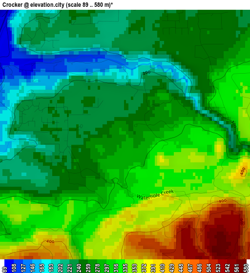
Below is the Elevation map of Crocker, which displays elevation range with different colors. Scale of the first map is from 89 to 580 m (292 to 1903 ft) with average elevation of 286.6 meters (=940 ft) [note 1]
These maps also provides idea of topography and contour of this city, they are displayed at different zoom levels. More info about maps, scale and edge coordinates you can find below images.
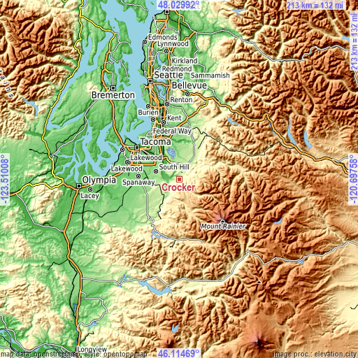
| \ | Map #1 | Topo.Map |
| Scale [m] | 89..580 m | × |
| Scale [ft] | 292..1903 ft | × |
| Average | 286.6 m = 940 ft | × |
| Width | 6.65 km = 4.1 mi | 213 km = 132.4 mi |
| Height | 6.65 km = 4.1 mi | 212.9 km = 132.3 mi |
| ↑Max Latitude | 47.110827° | 48.02992° |
| Latitude at center | 47.08091° | 47.08091° |
| ↓Min Latitude | 47.050976° | 46.11469° |
| ← Min Longitude | -122.147775° | -123.51008° |
| Longitude center | -122.10383° | -122.10383° |
| →Max Longitude | -122.059885° | -120.69758° |
Nearby cities:
Cities around Crocker sort by population:
• South Hill elevation 165 m
14.3 km,  298°
298°
• Puyallup 11 m
18.4 km,  309°
309°
• Graham 188 m
14.8 km,  257°
257°
• Bonney Lake 180 m
12.4 km,  329°
329°
• Enumclaw 230 m
16.1 km,  31°
31°
• Prairie Ridge 198 m
7.2 km, 331°
• Sumner 20 m
17.1 km,  322°
322°
• Orting 59 m
7.8 km,  283°
283°
• Buckley 216 m
10.8 km, 32°
• Prairie Heights 202 m
7.6 km,  359°
359°
• Alderton 25 m
13.7 km, 316°
• McMillin 36 m
12 km, 303°
Multilingual:
 En español:
Crocker elevación 278 m.
 En France:
Crocker élévation 278 m.


Sources and notes:
- [note 1] Map square and city borders are not equal. Map elevation data is calculated only from area inside that square.
- [src 1] Elevation data from geonames database provided with same terms of usage.
- [src 2] The elevation map of Crocker is generated using elevation data from NASA's 3 arcsec (90m) resolution SRTM data.
- [src 3] Base (background) map © OpenStreetMap contributors tiles are generated by Geofabrik and OpenTopoMap.
Copyright & License:
This Crocker Elevation Map is licensed under CC BY-SA. You may reuse any part from this page, if you give a proper credit by linking to this URL:
 More info on terms of use page.