Oatfield elevation
Oatfield (Oregon, Clackamas County), United States elevation is 45 meters and Oatfield elevation in feet is 148 ft above sea level [src 1]. Oatfield is a populated place (feature code) with elevation that is 234 meters (768 ft) smaller than average city elevation in United States.
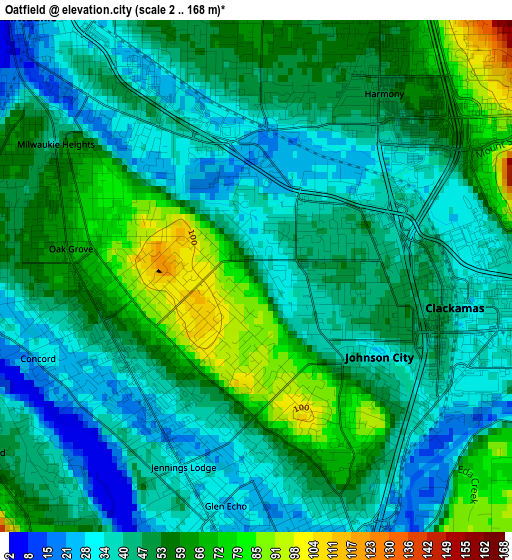
Below is the Elevation map of Oatfield, which displays elevation range with different colors. Scale of the first map is from 2 to 168 m (7 to 551 ft) with average elevation of 48.5 meters (=159 ft) [note 1]
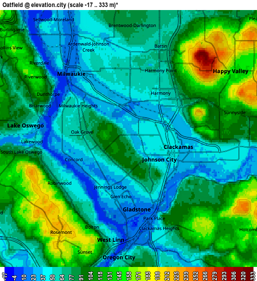
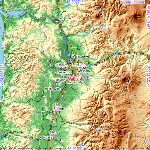
These maps also provides idea of topography and contour of this city, they are displayed at different zoom levels. More info about maps, scale and edge coordinates you can find below images.
| \ | Map #1 | Map #2 | Topo.Map |
| Scale [m] | 2..168 m | -17..333 m | × |
| Scale [ft] | 7..551 ft | -56..1093 ft | × |
| Average | 48.5 m = 159 ft | 84.4 m = 277 ft | × |
| Width | 6.86 km = 4.3 mi | 13.72 km = 8.5 mi | 219.5 km = 136.4 mi |
| Height | 6.86 km = 4.3 mi | 13.72 km = 8.5 mi | 219.5 km = 136.4 mi |
| ↑Max Latitude | 45.44502° | 45.475843° | 46.39271° |
| Latitude at center | 45.41418° | 45.41418° | 45.41418° |
| ↓Min Latitude | 45.383323° | 45.352449° | 44.4184° |
| ← Min Longitude | -122.644015° | -122.687961° | -124.00632° |
| Longitude center | -122.60007° | -122.60007° | -122.60007° |
| →Max Longitude | -122.556125° | -122.512179° | -121.19382° |
Nearby cities:
Cities around Oatfield sort by population:
• Lake Oswego elevation 61 m
5.6 km,  277°
277°
• Oregon City 37 m
6.3 km,  184°
184°
• West Linn 44 m
5.5 km,  190°
190°
• Milwaukie 15 m
4.7 km,  319°
319°
• Lents 67 m
7.7 km,  19°
19°
• Happy Valley 151 m
6.5 km,  56°
56°
• Oak Grove 58 m
3.1 km, 275°
• Gladstone 18 m
3.7 km,  173°
173°
• Damascus 162 m
11 km,  88°
88°
• Jennings Lodge 30 m
2.7 km,  200°
200°
• Clackamas 50 m
2.4 km,  107°
107°
• Stafford 122 m
11.5 km,  236°
236°
Multilingual:
 En español:
Oatfield elevación 45 m.
 En France:
Oatfield élévation 45 m.


Sources and notes:
- [note 1] Map square and city borders are not equal. Map elevation data is calculated only from area inside that square.
- [src 1] Elevation data from geonames database provided with same terms of usage.
- [src 2] The elevation map of Oatfield is generated using elevation data from NASA's 3 arcsec (90m) resolution SRTM data.
- [src 3] Base (background) map © OpenStreetMap contributors tiles are generated by Geofabrik and OpenTopoMap.
Copyright & License:
This Oatfield Elevation Map is licensed under CC BY-SA. You may reuse any part from this page, if you give a proper credit by linking to this URL:
 More info on terms of use page.