Greater Upper Marlboro elevation
Greater Upper Marlboro (Maryland, Prince George's County), United States elevation is 29 meters and Greater Upper Marlboro elevation in feet is 95 ft above sea level [src 1]. Greater Upper Marlboro is a populated place (feature code) with elevation that is 250 meters (820 ft) smaller than average city elevation in United States.
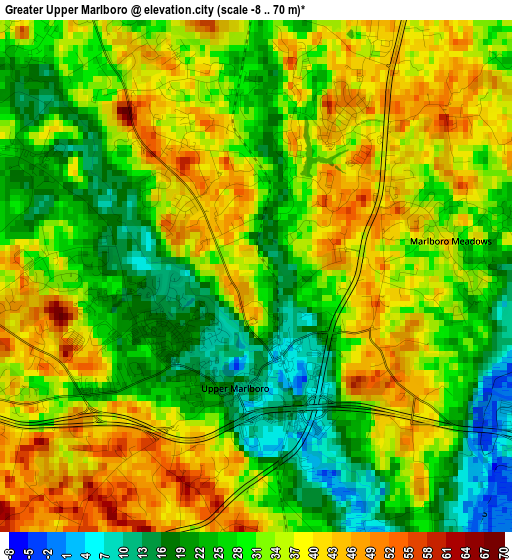
Below is the Elevation map of Greater Upper Marlboro, which displays elevation range with different colors. Scale of the first map is from -8 to 70 m (-26 to 230 ft) with average elevation of 31.4 meters (=103 ft) [note 1]
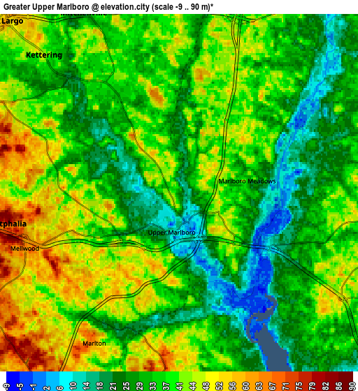
These maps also provides idea of topography and contour of this city, they are displayed at different zoom levels. More info about maps, scale and edge coordinates you can find below images.
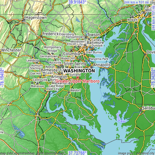
| \ | Map #1 | Map #2 | Topo.Map |
| Scale [m] | -8..70 m | -9..90 m | × |
| Scale [ft] | -26..230 ft | -30..295 ft | × |
| Average | 31.4 m = 103 ft | 36 m = 118 ft | × |
| Width | 7.61 km = 4.7 mi | 15.23 km = 9.5 mi | 243.6 km = 151.4 mi |
| Height | 7.61 km = 4.7 mi | 15.23 km = 9.5 mi | 243.6 km = 151.4 mi |
| ↑Max Latitude | 38.865645° | 38.899853° | 39.91843° |
| Latitude at center | 38.83142° | 38.83142° | 38.83142° |
| ↓Min Latitude | 38.797179° | 38.762921° | 37.72755° |
| ← Min Longitude | -76.792215° | -76.836161° | -78.15452° |
| Longitude center | -76.74827° | -76.74827° | -76.74827° |
| →Max Longitude | -76.704325° | -76.660379° | -75.34202° |
Nearby cities:
Cities around Greater Upper Marlboro sort by population:
• Kettering elevation 47 m
8.2 km,  315°
315°
• Rosaryville 67 m
9.9 km,  212°
212°
• Brock Hall 37 m
2.4 km,  331°
331°
• Marlboro Village 19 m
1.9 km,  266°
266°
• Marlton 60 m
7.4 km, 209°
• Westphalia 57 m
5.7 km,  285°
285°
• Marlboro Meadows 34 m
2.9 km,  79°
79°
• Mellwood 64 m
7 km,  250°
250°
• Croom 80 m
8.9 km,  188°
188°
• Queenland 54 m
4.7 km,  231°
231°
• Queen Anne 18 m
9.6 km,  38°
38°
• Upper Marlboro 17 m
1.7 km,  184°
184°
Multilingual:
 En español:
Greater Upper Marlboro elevación 29 m.
 En France:
Greater Upper Marlboro élévation 29 m.
 Auf Deutsch:
Greater Upper Marlboro höhe über dem Meeresspiegel ist 29 m.
 На русском:
Greater Upper Marlboro высота над уровнем моря 29 м
Sources and notes:
- [note 1] Map square and city borders are not equal. Map elevation data is calculated only from area inside that square.
- [src 1] Elevation data from geonames database provided with same terms of usage.
- [src 2] The elevation map of Greater Upper Marlboro is generated using elevation data from NASA's 3 arcsec (90m) resolution SRTM data.
- [src 3] Base (background) map © OpenStreetMap contributors tiles are generated by Geofabrik and OpenTopoMap.
Copyright & License:
This Greater Upper Marlboro Elevation Map is licensed under CC BY-SA. You may reuse any part from this page, if you give a proper credit by linking to this URL:
 More info on terms of use page.