Moorestown-Lenola elevation
Moorestown-Lenola (New Jersey, Burlington County), United States elevation is 25 meters and Moorestown-Lenola elevation in feet is 82 ft above sea level [src 1]. Moorestown-Lenola is a populated place (feature code) with elevation that is 254 meters (833 ft) smaller than average city elevation in United States.
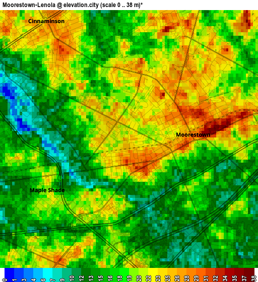
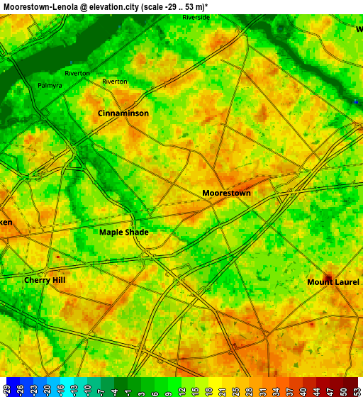
Below is the Elevation map of Moorestown-Lenola, which displays elevation range with different colors. Scale of the first map is from 0 to 38 m (0 to 125 ft) with average elevation of 18.5 meters (=61 ft) [note 1]
These maps also provides idea of topography and contour of this city, they are displayed at different zoom levels. More info about maps, scale and edge coordinates you can find below images.
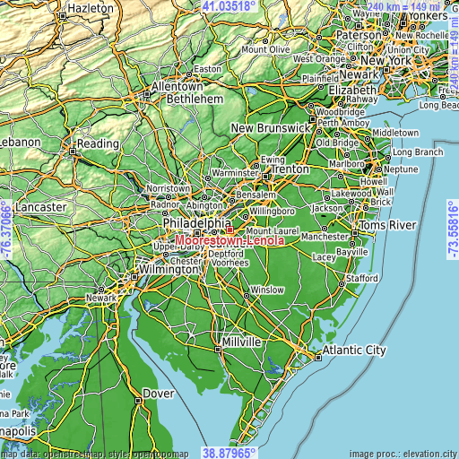
| \ | Map #1 | Map #2 | Topo.Map |
| Scale [m] | 0..38 m | -29..53 m | × |
| Scale [ft] | 0..125 ft | -95..174 ft | × |
| Average | 18.5 m = 61 ft | 17.1 m = 56 ft | × |
| Width | 7.49 km = 4.7 mi | 14.98 km = 9.3 mi | 239.7 km = 148.9 mi |
| Height | 7.49 km = 4.7 mi | 14.98 km = 9.3 mi | 239.7 km = 148.9 mi |
| ↑Max Latitude | 39.999583° | 40.033239° | 41.03518° |
| Latitude at center | 39.96591° | 39.96591° | 39.96591° |
| ↓Min Latitude | 39.932221° | 39.898515° | 38.87965° |
| ← Min Longitude | -75.008355° | -75.052301° | -76.37066° |
| Longitude center | -74.96441° | -74.96441° | -74.96441° |
| →Max Longitude | -74.920465° | -74.876519° | -73.55816° |
Nearby cities:
Cities around Moorestown-Lenola sort by population:
• Cherry Hill elevation 19 m
6.6 km,  238°
238°
• Mount Laurel 25 m
7.2 km,  119°
119°
• Maple Shade 20 m
2.8 km, 238°
• Cinnaminson 26 m
4.2 km,  324°
324°
• Springdale 29 m
7 km,  181°
181°
• Cherry Hill Mall 21 m
5.1 km,  228°
228°
• Palmyra 7 m
7.1 km,  310°
310°
• Ramblewood 11 m
4.5 km,  156°
156°
• Kingston Estates 15 m
5.1 km,  203°
203°
• Ellisburg 17 m
7 km,  214°
214°
• Riverton 19 m
5.5 km,  329°
329°
• Riverton 8 m
6.6 km, 319°
Multilingual:
 En español:
Moorestown-Lenola elevación 25 m.
 En France:
Moorestown-Lenola élévation 25 m.
 Auf Deutsch:
Moorestown-Lenola höhe über dem Meeresspiegel ist 25 m.

Sources and notes:
- [note 1] Map square and city borders are not equal. Map elevation data is calculated only from area inside that square.
- [src 1] Elevation data from geonames database provided with same terms of usage.
- [src 2] The elevation map of Moorestown-Lenola is generated using elevation data from NASA's 3 arcsec (90m) resolution SRTM data.
- [src 3] Base (background) map © OpenStreetMap contributors tiles are generated by Geofabrik and OpenTopoMap.
Copyright & License:
This Moorestown-Lenola Elevation Map is licensed under CC BY-SA. You may reuse any part from this page, if you give a proper credit by linking to this URL:
 More info on terms of use page.