High Point elevation
High Point (Florida, Hernando County), United States elevation is 25 meters and High Point elevation in feet is 82 ft above sea level [src 1]. High Point is a populated place (feature code) with elevation that is 254 meters (833 ft) smaller than average city elevation in United States.
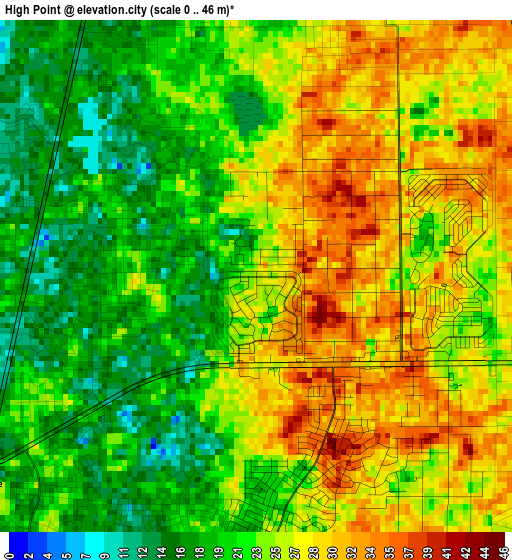
Below is the Elevation map of High Point, which displays elevation range with different colors. Scale of the first map is from 0 to 46 m (0 to 151 ft) with average elevation of 23.8 meters (=78 ft) [note 1]
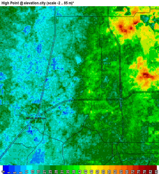
These maps also provides idea of topography and contour of this city, they are displayed at different zoom levels. More info about maps, scale and edge coordinates you can find below images.
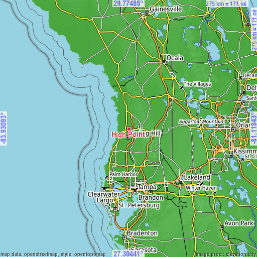
| \ | Map #1 | Map #2 | Topo.Map |
| Scale [m] | 0..46 m | -2..85 m | × |
| Scale [ft] | 0..151 ft | -7..279 ft | × |
| Average | 23.8 m = 78 ft | 25.3 m = 83 ft | × |
| Width | 8.58 km = 5.3 mi | 17.17 km = 10.7 mi | 274.7 km = 170.7 mi |
| Height | 8.58 km = 5.3 mi | 17.17 km = 10.7 mi | 274.7 km = 170.7 mi |
| ↑Max Latitude | 28.585466° | 28.624047° | 29.77485° |
| Latitude at center | 28.54687° | 28.54687° | 28.54687° |
| ↓Min Latitude | 28.50826° | 28.469636° | 27.30441° |
| ← Min Longitude | -82.568625° | -82.612571° | -83.93093° |
| Longitude center | -82.52468° | -82.52468° | -82.52468° |
| →Max Longitude | -82.480735° | -82.436789° | -81.11843° |
Nearby cities:
Cities around High Point sort by population:
• Spring Hill elevation 20 m
7.8 km,  180°
180°
• Shady Hills 25 m
15.3 km,  186°
186°
• North Weeki Wachee 15 m
3.4 km,  276°
276°
• Brooksville 62 m
13.2 km,  85°
85°
• Timber Pines 8 m
11.5 km,  222°
222°
• Brookridge 31 m
3.2 km,  81°
81°
• South Brooksville 52 m
13.8 km,  95°
95°
• North Brooksville 60 m
11.7 km, 75°
• Hernando Beach 4 m
15.7 km,  236°
236°
• Heritage Pines 11 m
16.5 km,  214°
214°
• Weeki Wachee Gardens 10 m
10.3 km,  261°
261°
• Masaryktown 30 m
13.4 km,  150°
150°
Multilingual:
 En español:
High Point elevación 25 m.
 En France:
High Point élévation 25 m.
 Auf Deutsch:
High Point höhe über dem Meeresspiegel ist 25 m.

Sources and notes:
- [note 1] Map square and city borders are not equal. Map elevation data is calculated only from area inside that square.
- [src 1] Elevation data from geonames database provided with same terms of usage.
- [src 2] The elevation map of High Point is generated using elevation data from NASA's 3 arcsec (90m) resolution SRTM data.
- [src 3] Base (background) map © OpenStreetMap contributors tiles are generated by Geofabrik and OpenTopoMap.
Copyright & License:
This High Point Elevation Map is licensed under CC BY-SA. You may reuse any part from this page, if you give a proper credit by linking to this URL:
 More info on terms of use page.