Palmer elevation
Palmer (Alaska, Matanuska-Susitna Borough), United States elevation is 62 meters and Palmer elevation in feet is 203 ft above sea level [src 1]. Palmer is a seat of a second-order administrative division (feature code) with elevation that is 217 meters (712 ft) smaller than average city elevation in United States.
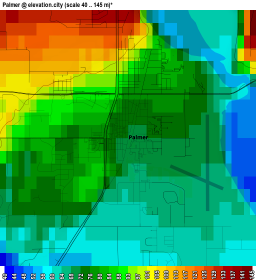
Below is the Elevation map of Palmer, which displays elevation range with different colors. Scale of the first map is from 40 to 145 m (131 to 476 ft) with average elevation of 78.5 meters (=258 ft) [note 1]
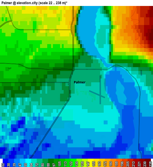
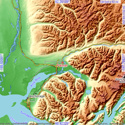
These maps also provides idea of topography and contour of this city, they are displayed at different zoom levels. More info about maps, scale and edge coordinates you can find below images.
| \ | Map #1 | Map #2 | Topo.Map |
| Scale [m] | 40..145 m | 22..238 m | × |
| Scale [ft] | 131..476 ft | 72..781 ft | × |
| Average | 78.5 m = 258 ft | 87.1 m = 286 ft | × |
| Width | 4.65 km = 2.9 mi | 9.3 km = 5.8 mi | 148.7 km = 92.4 mi |
| Height | 4.65 km = 2.9 mi | 9.3 km = 5.8 mi | 148.7 km = 92.4 mi |
| ↑Max Latitude | 61.620305° | 61.641186° | 62.26109° |
| Latitude at center | 61.59941° | 61.59941° | 61.59941° |
| ↓Min Latitude | 61.578501° | 61.557578° | 60.92329° |
| ← Min Longitude | -149.158505° | -149.202451° | -150.52081° |
| Longitude center | -149.11456° | -149.11456° | -149.11456° |
| →Max Longitude | -149.070615° | -149.026669° | -147.70831° |
Nearby cities:
Cities around Palmer sort by population:
• Knik-Fairview elevation 51 m
27.5 km,  249°
249°
• Wasilla 121 m
17.4 km,  263°
263°
• Lakes 99 m
10.3 km,  274°
274°
• Tanaina 145 m
16.9 km,  280°
280°
• Meadow Lakes 111 m
25.9 km, 276°
• Gateway 60 m
7.3 km, 246°
• Fishhook 434 m
17.3 km,  338°
338°
• Butte 30 m
7.7 km,  145°
145°
• Houston 75 m
37.3 km, 275°
• Lazy Mountain 817 m
9.4 km,  71°
71°
• Sutton-Alpine 861 m
27.1 km,  42°
42°
• Farm Loop 151 m
4.6 km, 341°
Multilingual:
 En español:
Palmer elevación 62 m.
 En France:
Palmer élévation 62 m.


Sources and notes:
- [note 1] Map square and city borders are not equal. Map elevation data is calculated only from area inside that square.
- [src 1] Elevation data from geonames database provided with same terms of usage.
- [src 2] The elevation map of Palmer is generated using GMTED2010 database with 7.5 arcsec (225m) resolution.
- [src 3] Base (background) map © OpenStreetMap contributors tiles are generated by Geofabrik and OpenTopoMap.
Copyright & License:
This Palmer Elevation Map is licensed under CC BY-SA. You may reuse any part from this page, if you give a proper credit by linking to this URL:
 More info on terms of use page.