Fern Acres elevation
Fern Acres (Hawaii, Hawaii County), United States elevation is 473 meters and Fern Acres elevation in feet is 1552 ft above sea level [src 1]. Fern Acres is a populated place (feature code) with elevation that is 194 meters (636 ft) bigger than average city elevation in United States.
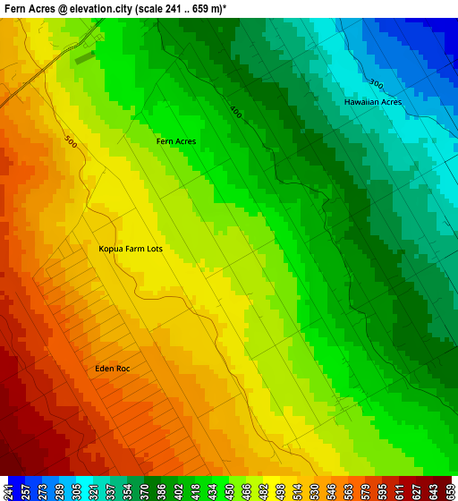
Below is the Elevation map of Fern Acres, which displays elevation range with different colors. Scale of the first map is from 241 to 659 m (791 to 2162 ft) with average elevation of 454.9 meters (=1492 ft) [note 1]
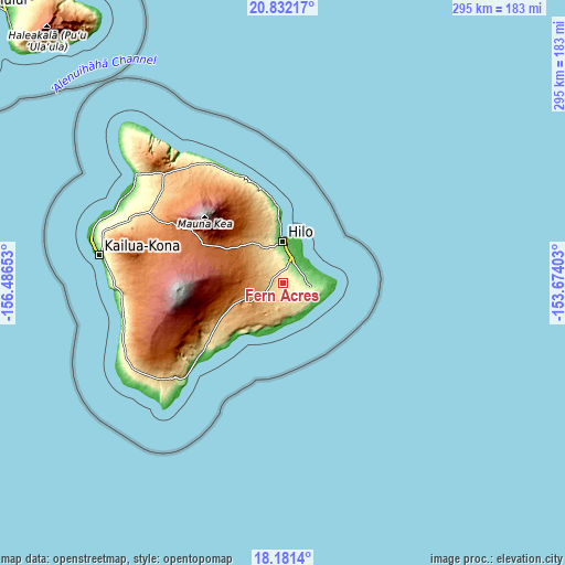
These maps also provides idea of topography and contour of this city, they are displayed at different zoom levels. More info about maps, scale and edge coordinates you can find below images.
| \ | Map #1 | Topo.Map |
| Scale [m] | 241..659 m | × |
| Scale [ft] | 791..2162 ft | × |
| Average | 454.9 m = 1492 ft | × |
| Width | 9.21 km = 5.7 mi | 294.7 km = 183.1 mi |
| Height | 9.21 km = 5.7 mi | 294.8 km = 183.2 mi |
| ↑Max Latitude | 19.553636° | 20.83217° |
| Latitude at center | 19.51222° | 19.51222° |
| ↓Min Latitude | 19.470793° | 18.1814° |
| ← Min Longitude | -155.124225° | -156.48653° |
| Longitude center | -155.08028° | -155.08028° |
| →Max Longitude | -155.036335° | -153.67403° |
Nearby cities:
Cities around Fern Acres sort by population:
• Hilo elevation 30 m
24.2 km,  357°
357°
• Hawaiian Paradise Park 50 m
14.4 km,  51°
51°
• Hawaiian Beaches 80 m
17.6 km,  78°
78°
• Mountain View 440 m
5.7 km,  329°
329°
• Ainaloa 219 m
9.3 km, 79°
• Orchidlands Estates 170 m
8.7 km, 51°
• Hawaiian Acres 316 m
4.1 km, 45°
• Volcano 1141 m
17.9 km,  244°
244°
• Kea‘au 101 m
13.1 km,  20°
20°
• Leilani Estates 238 m
17.7 km,  105°
105°
• Nanawale Estates 134 m
17.7 km,  92°
92°
• Kurtistown 202 m
10.4 km,  13°
13°
Multilingual:
 En español:
Fern Acres elevación 473 m.
 En France:
Fern Acres élévation 473 m.
 Auf Deutsch:
Fern Acres höhe über dem Meeresspiegel ist 473 m.

Sources and notes:
- [note 1] Map square and city borders are not equal. Map elevation data is calculated only from area inside that square.
- [src 1] Elevation data from geonames database provided with same terms of usage.
- [src 2] The elevation map of Fern Acres is generated using elevation data from NASA's 3 arcsec (90m) resolution SRTM data.
- [src 3] Base (background) map © OpenStreetMap contributors tiles are generated by Geofabrik and OpenTopoMap.
Copyright & License:
This Fern Acres Elevation Map is licensed under CC BY-SA. You may reuse any part from this page, if you give a proper credit by linking to this URL:
 More info on terms of use page.