Whitmore Village elevation
Whitmore Village (Hawaii, Honolulu County), United States elevation is 308 meters and Whitmore Village elevation in feet is 1010 ft above sea level [src 1]. Whitmore Village is a populated place (feature code) with elevation that is 29 meters (95 ft) bigger than average city elevation in United States.
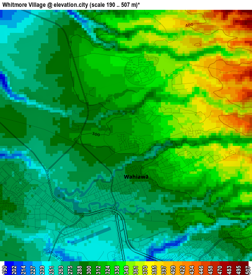
Below is the Elevation map of Whitmore Village, which displays elevation range with different colors. Scale of the first map is from 190 to 507 m (623 to 1663 ft) with average elevation of 307.6 meters (=1009 ft) [note 1]
These maps also provides idea of topography and contour of this city, they are displayed at different zoom levels. More info about maps, scale and edge coordinates you can find below images.
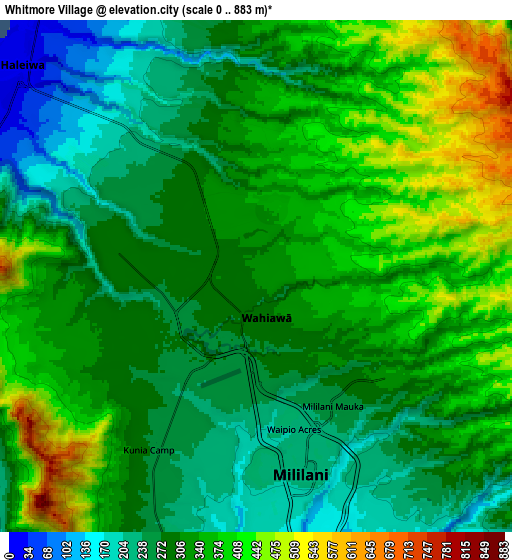
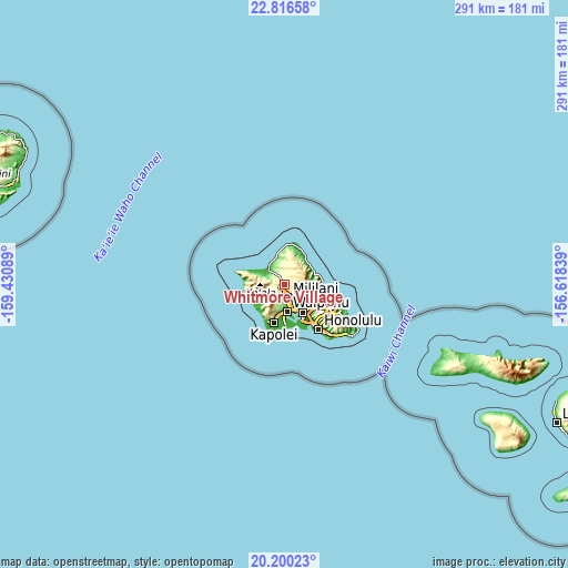
| \ | Map #1 | Map #2 | Topo.Map |
| Scale [m] | 190..507 m | 0..883 m | × |
| Scale [ft] | 623..1663 ft | 0..2897 ft | × |
| Average | 307.6 m = 1009 ft | 320.7 m = 1052 ft | × |
| Width | 9.09 km = 5.6 mi | 18.18 km = 11.3 mi | 290.9 km = 180.8 mi |
| Height | 9.09 km = 5.6 mi | 18.18 km = 11.3 mi | 290.9 km = 180.8 mi |
| ↑Max Latitude | 21.555168° | 21.596034° | 22.81658° |
| Latitude at center | 21.51429° | 21.51429° | 21.51429° |
| ↓Min Latitude | 21.473401° | 21.4325° | 20.20023° |
| ← Min Longitude | -158.068585° | -158.112531° | -159.43089° |
| Longitude center | -158.02464° | -158.02464° | -158.02464° |
| →Max Longitude | -157.980695° | -157.936749° | -156.61839° |
Nearby cities:
Cities around Whitmore Village sort by population:
• Pearl City elevation 31 m
14 km,  158°
158°
• Waipahu 24 m
14.3 km,  173°
173°
• Mililani Town 207 m
7.6 km, 161°
• Wahiawā 290 m
1.3 km,  180°
180°
• Schofield Barracks 283 m
4.5 km,  247°
247°
• Royal Kunia 84 m
13.4 km, 180°
• Waimalu 121 m
14.8 km,  145°
145°
• Waipio 120 m
11 km, 166°
• Village Park 109 m
12.9 km, 182°
• Waipi‘o Acres 210 m
5.6 km, 167°
• Hale‘iwa 8 m
11.9 km,  317°
317°
• Waialua 9 m
13.1 km,  302°
302°
Multilingual:
 En español:
Whitmore Village elevación 308 m.
 En France:
Whitmore Village élévation 308 m.
 Auf Deutsch:
Whitmore Village höhe über dem Meeresspiegel ist 308 m.

Sources and notes:
- [note 1] Map square and city borders are not equal. Map elevation data is calculated only from area inside that square.
- [src 1] Elevation data from geonames database provided with same terms of usage.
- [src 2] The elevation map of Whitmore Village is generated using elevation data from NASA's 3 arcsec (90m) resolution SRTM data.
- [src 3] Base (background) map © OpenStreetMap contributors tiles are generated by Geofabrik and OpenTopoMap.
Copyright & License:
This Whitmore Village Elevation Map is licensed under CC BY-SA. You may reuse any part from this page, if you give a proper credit by linking to this URL:
 More info on terms of use page.