Camas elevation
Camas (Washington, Clark County), United States elevation is 23 meters and Camas elevation in feet is 75 ft above sea level [src 1]. Camas is a populated place (feature code) with elevation that is 256 meters (840 ft) smaller than average city elevation in United States.
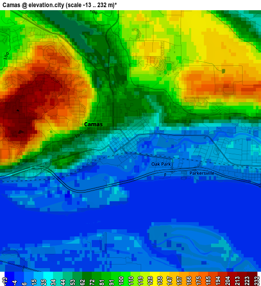
Below is the Elevation map of Camas, which displays elevation range with different colors. Scale of the first map is from -13 to 232 m (-43 to 761 ft) with average elevation of 65.6 meters (=215 ft) [note 1]
These maps also provides idea of topography and contour of this city, they are displayed at different zoom levels. More info about maps, scale and edge coordinates you can find below images.
| \ | Map #1 | Map #2 | Topo.Map |
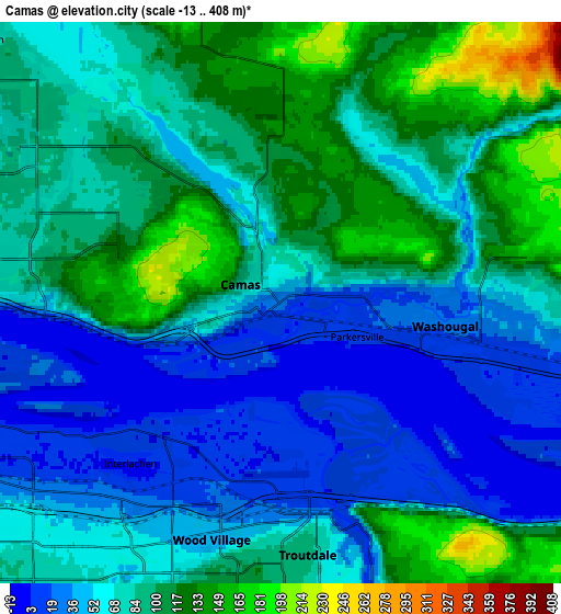
| Scale [m] | -13..232 m | -13..408 m | × |
| Scale [ft] | -43..761 ft | -43..1339 ft | × |
| Average | 65.6 m = 215 ft | 77.8 m = 255 ft | × |
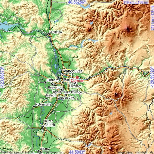
| Width | 6.84 km = 4.3 mi | 13.68 km = 8.5 mi | 218.8 km = 136 mi |
| Height | 6.84 km = 4.3 mi | 13.68 km = 8.5 mi | 218.8 km = 136 mi |
| ↑Max Latitude | 45.617806° | 45.648534° | 46.56256° |
| Latitude at center | 45.58706° | 45.58706° | 45.58706° |
| ↓Min Latitude | 45.556298° | 45.525518° | 44.5943° |
| ← Min Longitude | -122.443485° | -122.487431° | -123.80579° |
| Longitude center | -122.39954° | -122.39954° | -122.39954° |
| →Max Longitude | -122.355595° | -122.311649° | -120.99329° |
Nearby cities:
Cities around Camas sort by population:
• Gresham elevation 96 m
10.2 km,  194°
194°
• Lents 67 m
17.7 km,  227°
227°
• Orchards 71 m
15.3 km,  305°
305°
• Five Corners 65 m
17.4 km, 308°
• Troutdale 39 m
5.4 km,  169°
169°
• Washougal 25 m
3.6 km,  97°
97°
• Walnut Grove 85 m
17.9 km,  300°
300°
• Fairview 42 m
6 km,  206°
206°
• Mill Plain 89 m
9.6 km, 310°
• Hockinson 96 m
18.1 km,  337°
337°
• Wood Village 48 m
6.1 km, 194°
• Fern Prairie 143 m
5.5 km,  0°
0°
Multilingual:
 En español:
Camas elevación 23 m.
 En France:
Camas élévation 23 m.


Sources and notes:
- [note 1] Map square and city borders are not equal. Map elevation data is calculated only from area inside that square.
- [src 1] Elevation data from geonames database provided with same terms of usage.
- [src 2] The elevation map of Camas is generated using elevation data from NASA's 3 arcsec (90m) resolution SRTM data.
- [src 3] Base (background) map © OpenStreetMap contributors tiles are generated by Geofabrik and OpenTopoMap.
Copyright & License:
This Camas Elevation Map is licensed under CC BY-SA. You may reuse any part from this page, if you give a proper credit by linking to this URL:
 More info on terms of use page.