Artondale elevation
Artondale (Washington, Pierce County), United States elevation is 10 meters and Artondale elevation in feet is 33 ft above sea level [src 1]. Artondale is a populated place (feature code) with elevation that is 269 meters (883 ft) smaller than average city elevation in United States.
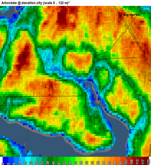
Below is the Elevation map of Artondale, which displays elevation range with different colors. Scale of the first map is from 0 to 122 m (0 to 400 ft) with average elevation of 62.4 meters (=205 ft) [note 1]
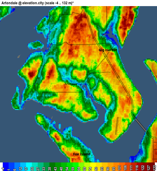
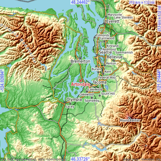
These maps also provides idea of topography and contour of this city, they are displayed at different zoom levels. More info about maps, scale and edge coordinates you can find below images.
| \ | Map #1 | Map #2 | Topo.Map |
| Scale [m] | 0..122 m | -4..132 m | × |
| Scale [ft] | 0..400 ft | -13..433 ft | × |
| Average | 62.4 m = 205 ft | 62.2 m = 204 ft | × |
| Width | 6.63 km = 4.1 mi | 13.25 km = 8.2 mi | 212.1 km = 131.8 mi |
| Height | 6.63 km = 4.1 mi | 13.25 km = 8.2 mi | 212.1 km = 131.8 mi |
| ↑Max Latitude | 47.329334° | 47.359111° | 48.24462° |
| Latitude at center | 47.29954° | 47.29954° | 47.29954° |
| ↓Min Latitude | 47.269729° | 47.239902° | 46.33726° |
| ← Min Longitude | -122.664635° | -122.708581° | -124.02694° |
| Longitude center | -122.62069° | -122.62069° | -122.62069° |
| →Max Longitude | -122.576745° | -122.532799° | -121.21444° |
Nearby cities:
Cities around Artondale sort by population:
• University Place elevation 59 m
8.9 km,  143°
143°
• Gig Harbor 10 m
4.5 km,  42°
42°
• Fircrest 86 m
10.3 km,  130°
130°
• Wollochet 60 m
4.4 km, 141°
• Maplewood 95 m
12.3 km,  22°
22°
• Wauna 7 m
9 km,  349°
349°
• Rosedale 24 m
4.3 km,  326°
326°
• Key Center 55 m
10.5 km,  295°
295°
• Fox Island 63 m
5.4 km,  186°
186°
• Canterwood 109 m
8.7 km, 15°
• Purdy 10 m
10 km,  357°
357°
• Home 27 m
11.1 km,  255°
255°
Multilingual:
 En español:
Artondale elevación 10 m.
 En France:
Artondale élévation 10 m.
 Auf Deutsch:
Artondale höhe über dem Meeresspiegel ist 10 m.

Sources and notes:
- [note 1] Map square and city borders are not equal. Map elevation data is calculated only from area inside that square.
- [src 1] Elevation data from geonames database provided with same terms of usage.
- [src 2] The elevation map of Artondale is generated using elevation data from NASA's 3 arcsec (90m) resolution SRTM data.
- [src 3] Base (background) map © OpenStreetMap contributors tiles are generated by Geofabrik and OpenTopoMap.
Copyright & License:
This Artondale Elevation Map is licensed under CC BY-SA. You may reuse any part from this page, if you give a proper credit by linking to this URL:
 More info on terms of use page.