Tremonton elevation
Tremonton (Utah, Box Elder County), United States elevation is 1318 meters and Tremonton elevation in feet is 4324 ft above sea level [src 1]. Tremonton is a populated place (feature code) with elevation that is 1039 meters (3409 ft) bigger than average city elevation in United States.
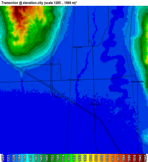
Below is the Elevation map of Tremonton, which displays elevation range with different colors. Scale of the first map is from 1289 to 1513 m (4229 to 4964 ft) with average elevation of 1320.3 meters (=4332 ft) [note 1]
These maps also provides idea of topography and contour of this city, they are displayed at different zoom levels. More info about maps, scale and edge coordinates you can find below images.

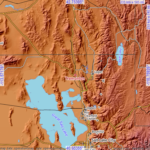
| \ | Map #1 | Map #2 | Topo.Map |
| Scale [m] | 1289..1513 m | 1285..1969 m | × |
| Scale [ft] | 4229..4964 ft | 4216..6460 ft | × |
| Average | 1320.3 m = 4332 ft | 1358.4 m = 4457 ft | × |
| Width | 7.3 km = 4.5 mi | 14.59 km = 9.1 mi | 233.4 km = 145 mi |
| Height | 7.3 km = 4.5 mi | 14.59 km = 9.1 mi | 233.4 km = 145 mi |
| ↑Max Latitude | 41.744667° | 41.777447° | 42.75305° |
| Latitude at center | 41.71187° | 41.71187° | 41.71187° |
| ↓Min Latitude | 41.679056° | 41.646226° | 40.65355° |
| ← Min Longitude | -112.209455° | -112.253401° | -113.57176° |
| Longitude center | -112.16551° | -112.16551° | -112.16551° |
| →Max Longitude | -112.121565° | -112.077619° | -110.75926° |
Nearby cities:
Cities around Tremonton sort by population:
• Logan elevation 1381 m
27.6 km,  84°
84°
• Brigham City 1354 m
25.7 km,  150°
150°
• Hyrum 1434 m
27.4 km,  108°
108°
• Nibley 1390 m
27.9 km,  98°
98°
• Wellsville 1391 m
20.9 km, 112°
• Garland 1322 m
3.3 km,  5°
5°
• Millville 1404 m
28.6 km, 96°
• River Heights 1393 m
28.6 km,  87°
87°
• Benson 1350 m
21.2 km,  66°
66°
• Honeyville 1316 m
10.8 km,  138°
138°
• Mendon 1371 m
15.6 km, 90°
• Elwood 1312 m
3.1 km, 139°
Multilingual:
 En español:
Tremonton elevación 1318 m.
 En France:
Tremonton élévation 1318 m.
 Auf Deutsch:
Tremonton höhe über dem Meeresspiegel ist 1318 m.

Sources and notes:
- [note 1] Map square and city borders are not equal. Map elevation data is calculated only from area inside that square.
- [src 1] Elevation data from geonames database provided with same terms of usage.
- [src 2] The elevation map of Tremonton is generated using elevation data from NASA's 3 arcsec (90m) resolution SRTM data.
- [src 3] Base (background) map © OpenStreetMap contributors tiles are generated by Geofabrik and OpenTopoMap.
Copyright & License:
This Tremonton Elevation Map is licensed under CC BY-SA. You may reuse any part from this page, if you give a proper credit by linking to this URL:
 More info on terms of use page.