Liberty elevation
Liberty (Utah, Weber County), United States elevation is 1563 meters and Liberty elevation in feet is 5128 ft above sea level [src 1]. Liberty is a populated place (feature code) with elevation that is 1284 meters (4213 ft) bigger than average city elevation in United States.
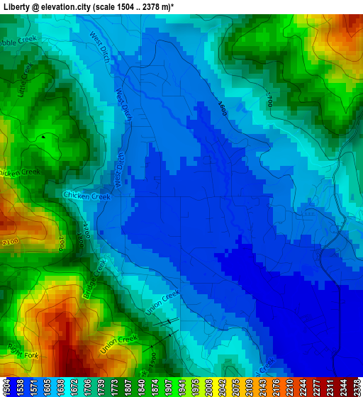
Below is the Elevation map of Liberty, which displays elevation range with different colors. Scale of the first map is from 1504 to 2378 m (4934 to 7802 ft) with average elevation of 1714 meters (=5623 ft) [note 1]
These maps also provides idea of topography and contour of this city, they are displayed at different zoom levels. More info about maps, scale and edge coordinates you can find below images.
| \ | Map #1 | Topo.Map |
| Scale [m] | 1504..2378 m | × |
| Scale [ft] | 4934..7802 ft | × |
| Average | 1714 m = 5623 ft | × |
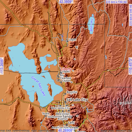
| Width | 7.34 km = 4.6 mi | 234.8 km = 145.9 mi |
| Height | 7.34 km = 4.6 mi | 234.8 km = 145.9 mi |
| ↑Max Latitude | 41.366539° | 42.3809° |
| Latitude at center | 41.33355° | 41.33355° |
| ↓Min Latitude | 41.300544° | 40.26908° |
| ← Min Longitude | -111.907495° | -113.2698° |
| Longitude center | -111.86355° | -111.86355° |
| →Max Longitude | -111.819605° | -110.4573° |
Nearby cities:
Cities around Liberty sort by population:
• Ogden elevation 1315 m
15.4 km,  216°
216°
• North Ogden 1374 m
8.6 km,  250°
250°
• South Ogden 1359 m
18.1 km,  209°
209°
• Pleasant View 1341 m
10.9 km,  261°
261°
• Washington Terrace 1407 m
20.2 km, 207°
• Farr West 1302 m
14.3 km, 253°
• Plain City 1292 m
19 km, 257°
• Harrisville 1310 m
11.9 km,  240°
240°
• Willard 1328 m
16.7 km,  300°
300°
• Marriott-Slaterville 1297 m
16.3 km, 236°
• South Willard 1320 m
14.8 km,  282°
282°
• Wolf Creek 1625 m
3 km,  90°
90°
Multilingual:
 En español:
Liberty elevación 1563 m.
 En France:
Liberty élévation 1563 m.
 Auf Deutsch:
Liberty höhe über dem Meeresspiegel ist 1563 m.

Sources and notes:
- [note 1] Map square and city borders are not equal. Map elevation data is calculated only from area inside that square.
- [src 1] Elevation data from geonames database provided with same terms of usage.
- [src 2] The elevation map of Liberty is generated using elevation data from NASA's 3 arcsec (90m) resolution SRTM data.
- [src 3] Base (background) map © OpenStreetMap contributors tiles are generated by Geofabrik and OpenTopoMap.
Copyright & License:
This Liberty Elevation Map is licensed under CC BY-SA. You may reuse any part from this page, if you give a proper credit by linking to this URL:
 More info on terms of use page.