Belle Fourche elevation
Belle Fourche (South Dakota, Butte County), United States elevation is 921 meters and Belle Fourche elevation in feet is 3022 ft above sea level [src 1]. Belle Fourche is a seat of a second-order administrative division (feature code) with elevation that is 642 meters (2106 ft) bigger than average city elevation in United States.
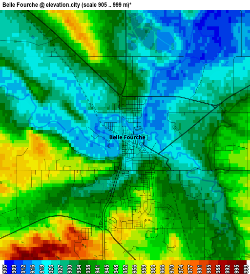
Below is the Elevation map of Belle Fourche, which displays elevation range with different colors. Scale of the first map is from 905 to 999 m (2969 to 3278 ft) with average elevation of 936.8 meters (=3073 ft) [note 1]
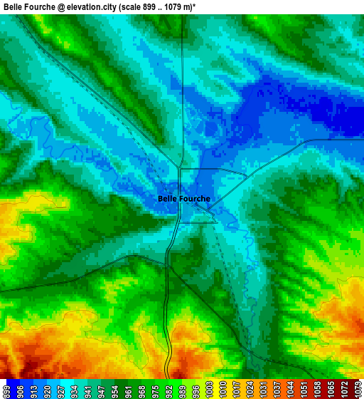
These maps also provides idea of topography and contour of this city, they are displayed at different zoom levels. More info about maps, scale and edge coordinates you can find below images.
| \ | Map #1 | Map #2 | Topo.Map |
| Scale [m] | 905..999 m | 899..1079 m | × |
| Scale [ft] | 2969..3278 ft | 2949..3540 ft | × |
| Average | 936.8 m = 3073 ft | 957.3 m = 3141 ft | × |
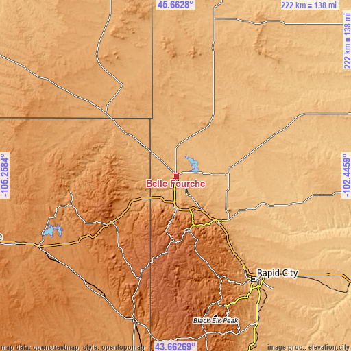
| Width | 6.95 km = 4.3 mi | 13.9 km = 8.6 mi | 222.4 km = 138.2 mi |
| Height | 6.95 km = 4.3 mi | 13.9 km = 8.6 mi | 222.4 km = 138.2 mi |
| ↑Max Latitude | 44.702613° | 44.73384° | 45.6628° |
| Latitude at center | 44.67137° | 44.67137° | 44.67137° |
| ↓Min Latitude | 44.64011° | 44.608833° | 43.66269° |
| ← Min Longitude | -103.896095° | -103.940041° | -105.2584° |
| Longitude center | -103.85215° | -103.85215° | -103.85215° |
| →Max Longitude | -103.808205° | -103.764259° | -102.4459° |
Nearby cities:
Cities around Belle Fourche sort by population:
• Rapid City elevation 990 m
82.2 km,  143°
143°
• Spearfish 1110 m
20.1 km,  181°
181°
• Box Elder 924 m
88 km,  134°
134°
• Rapid Valley 961 m
87.9 km, 140°
• Sturgis 1044 m
39.8 km, 136°
• Lead 1572 m
36.2 km,  169°
169°
• Blackhawk 1064 m
72.2 km, 143°
• Colonial Pine Hills 1246 m
85.2 km,  149°
149°
• North Spearfish 1106 m
18.6 km,  189°
189°
• Summerset 1107 m
67 km, 142°
• Sundance 1450 m
50.9 km,  234°
234°
• Deadwood 1389 m
34.2 km,  163°
163°
Multilingual:
 En español:
Belle Fourche elevación 921 m.
 En France:
Belle Fourche élévation 921 m.
 Auf Deutsch:
Belle Fourche höhe über dem Meeresspiegel ist 921 m.

Sources and notes:
- [note 1] Map square and city borders are not equal. Map elevation data is calculated only from area inside that square.
- [src 1] Elevation data from geonames database provided with same terms of usage.
- [src 2] The elevation map of Belle Fourche is generated using elevation data from NASA's 3 arcsec (90m) resolution SRTM data.
- [src 3] Base (background) map © OpenStreetMap contributors tiles are generated by Geofabrik and OpenTopoMap.
Copyright & License:
This Belle Fourche Elevation Map is licensed under CC BY-SA. You may reuse any part from this page, if you give a proper credit by linking to this URL:
 More info on terms of use page.