Tioga elevation
Tioga (North Dakota, Williams County), United States elevation is 684 meters and Tioga elevation in feet is 2244 ft above sea level [src 1]. Tioga is a populated place (feature code) with elevation that is 405 meters (1329 ft) bigger than average city elevation in United States.
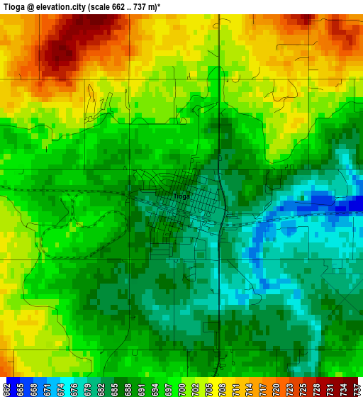
Below is the Elevation map of Tioga, which displays elevation range with different colors. Scale of the first map is from 662 to 737 m (2172 to 2418 ft) with average elevation of 695.2 meters (=2281 ft) [note 1]
These maps also provides idea of topography and contour of this city, they are displayed at different zoom levels. More info about maps, scale and edge coordinates you can find below images.
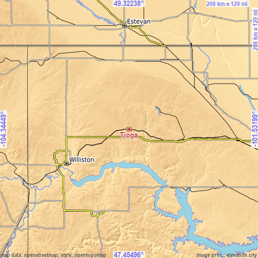
| \ | Map #1 | Topo.Map |
| Scale [m] | 662..737 m | × |
| Scale [ft] | 2172..2418 ft | × |
| Average | 695.2 m = 2281 ft | × |
| Width | 6.49 km = 4 mi | 207.6 km = 129 mi |
| Height | 6.49 km = 4 mi | 207.6 km = 129 mi |
| ↑Max Latitude | 48.42641° | 49.32238° |
| Latitude at center | 48.39724° | 48.39724° |
| ↓Min Latitude | 48.368054° | 47.45496° |
| ← Min Longitude | -102.982185° | -104.34449° |
| Longitude center | -102.93824° | -102.93824° |
| →Max Longitude | -102.894295° | -101.53199° |
Nearby cities:
Cities around Tioga sort by population:
• Williston elevation 573 m
57.5 km,  241°
241°
• Sidney 591 m
118 km,  230°
230°
• Watford City 647 m
70.9 km,  201°
201°
• Stanley 685 m
41.4 km,  102°
102°
• New Town 583 m
57 km,  144°
144°
• Crosby 598 m
63.2 km,  335°
335°
• Parshall 589 m
77.4 km,  129°
129°
• Killdeer 696 m
114.8 km,  173°
173°
• Burlington 489 m
112.4 km, 96°
• Kenmare 577 m
70.1 km,  63°
63°
• Mohall 501 m
112.4 km,  68°
68°
• Bowbells 599 m
68 km,  48°
48°
Multilingual:
 En español:
Tioga elevación 684 m.
 En France:
Tioga élévation 684 m.


Sources and notes:
- [note 1] Map square and city borders are not equal. Map elevation data is calculated only from area inside that square.
- [src 1] Elevation data from geonames database provided with same terms of usage.
- [src 2] The elevation map of Tioga is generated using elevation data from NASA's 3 arcsec (90m) resolution SRTM data.
- [src 3] Base (background) map © OpenStreetMap contributors tiles are generated by Geofabrik and OpenTopoMap.
Copyright & License:
This Tioga Elevation Map is licensed under CC BY-SA. You may reuse any part from this page, if you give a proper credit by linking to this URL:
 More info on terms of use page.