Manning elevation
Manning (North Dakota, Dunn County), United States elevation is 678 meters and Manning elevation in feet is 2224 ft above sea level [src 1]. Manning is a seat of a second-order administrative division (feature code) with elevation that is 399 meters (1309 ft) bigger than average city elevation in United States.
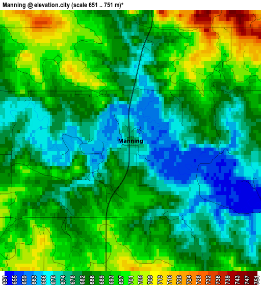
Below is the Elevation map of Manning, which displays elevation range with different colors. Scale of the first map is from 651 to 751 m (2136 to 2464 ft) with average elevation of 686.5 meters (=2252 ft) [note 1]
These maps also provides idea of topography and contour of this city, they are displayed at different zoom levels. More info about maps, scale and edge coordinates you can find below images.
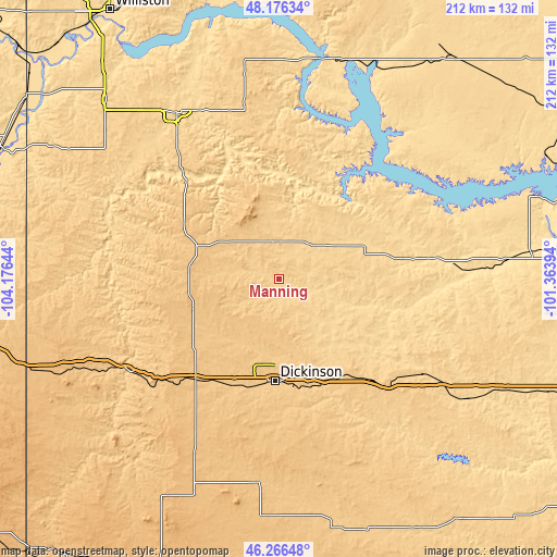
| \ | Map #1 | Topo.Map |
| Scale [m] | 651..751 m | × |
| Scale [ft] | 2136..2464 ft | × |
| Average | 686.5 m = 2252 ft | × |
| Width | 6.64 km = 4.1 mi | 212.4 km = 132 mi |
| Height | 6.64 km = 4.1 mi | 212.3 km = 131.9 mi |
| ↑Max Latitude | 47.259843° | 48.17634° |
| Latitude at center | 47.23001° | 47.23001° |
| ↓Min Latitude | 47.20016° | 46.26648° |
| ← Min Longitude | -102.814135° | -104.17644° |
| Longitude center | -102.77019° | -102.77019° |
| →Max Longitude | -102.726245° | -101.36394° |
Nearby cities:
Cities around Manning sort by population:
• Dickinson elevation 733 m
39 km,  182°
182°
• Watford City 647 m
74.4 km,  328°
328°
• Beulah 542 m
75 km,  87°
87°
• New Town 583 m
86.1 km,  14°
14°
• Hazen 530 m
86.9 km, 85°
• Parshall 589 m
93.5 km,  30°
30°
• Killdeer 696 m
15.8 km,  4°
4°
• Beach 843 m
99.7 km,  249°
249°
• Belfield 787 m
50.3 km,  220°
220°
• Mott 726 m
101.1 km,  160°
160°
• Medora 691 m
67.1 km,  238°
238°
• Amidon 885 m
93.1 km,  206°
206°
Multilingual:
 En español:
Manning elevación 678 m.
 En France:
Manning élévation 678 m.


Sources and notes:
- [note 1] Map square and city borders are not equal. Map elevation data is calculated only from area inside that square.
- [src 1] Elevation data from geonames database provided with same terms of usage.
- [src 2] The elevation map of Manning is generated using elevation data from NASA's 3 arcsec (90m) resolution SRTM data.
- [src 3] Base (background) map © OpenStreetMap contributors tiles are generated by Geofabrik and OpenTopoMap.
Copyright & License:
This Manning Elevation Map is licensed under CC BY-SA. You may reuse any part from this page, if you give a proper credit by linking to this URL:
 More info on terms of use page.