Eagle elevation
Eagle (Idaho, Ada County), United States elevation is 785 meters and Eagle elevation in feet is 2575 ft above sea level [src 1]. Eagle is a populated place (feature code) with elevation that is 506 meters (1660 ft) bigger than average city elevation in United States.
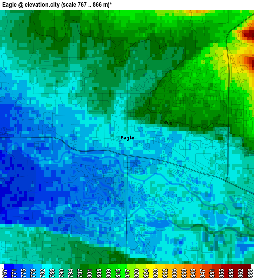
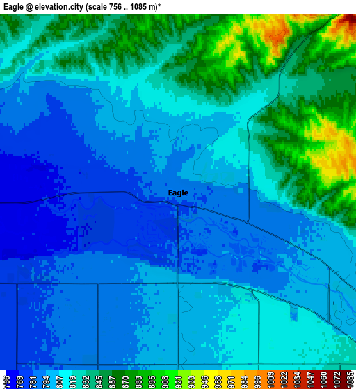
Below is the Elevation map of Eagle, which displays elevation range with different colors. Scale of the first map is from 767 to 866 m (2516 to 2841 ft) with average elevation of 790.6 meters (=2594 ft) [note 1]
These maps also provides idea of topography and contour of this city, they are displayed at different zoom levels. More info about maps, scale and edge coordinates you can find below images.
| \ | Map #1 | Map #2 | Topo.Map |
| Scale [m] | 767..866 m | 756..1085 m | × |
| Scale [ft] | 2516..2841 ft | 2480..3560 ft | × |
| Average | 790.6 m = 2594 ft | 814.8 m = 2673 ft | × |
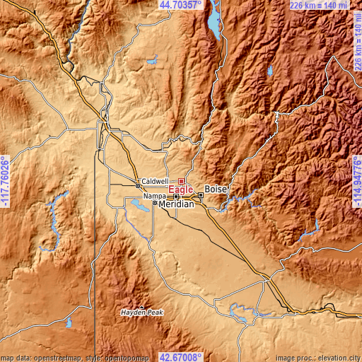
| Width | 7.07 km = 4.4 mi | 14.13 km = 8.8 mi | 226.1 km = 140.5 mi |
| Height | 7.07 km = 4.4 mi | 14.13 km = 8.8 mi | 226.1 km = 140.5 mi |
| ↑Max Latitude | 43.727205° | 43.758953° | 44.70357° |
| Latitude at center | 43.69544° | 43.69544° | 43.69544° |
| ↓Min Latitude | 43.663658° | 43.631859° | 42.67008° |
| ← Min Longitude | -116.397955° | -116.441901° | -117.76026° |
| Longitude center | -116.35401° | -116.35401° | -116.35401° |
| →Max Longitude | -116.310065° | -116.266119° | -114.94776° |
Nearby cities:
Cities around Eagle sort by population:
• Boise elevation 834 m
15.2 km,  126°
126°
• Meridian 796 m
9.7 km,  198°
198°
• Nampa 767 m
24.1 km,  224°
224°
• Caldwell 723 m
27 km,  262°
262°
• Kuna 823 m
23.3 km,  193°
193°
• Garden City 815 m
12.4 km, 131°
• Star 752 m
11.2 km,  268°
268°
• Middleton 732 m
21.4 km, 273°
• Emmett 725 m
23 km,  329°
329°
• Hidden Spring 876 m
8.8 km,  70°
70°
• Marsing 700 m
40.6 km,  245°
245°
• Idaho City 1190 m
44.3 km, 70°
Multilingual:
 En español:
Eagle elevación 785 m.
 En France:
Eagle élévation 785 m.


Sources and notes:
- [note 1] Map square and city borders are not equal. Map elevation data is calculated only from area inside that square.
- [src 1] Elevation data from geonames database provided with same terms of usage.
- [src 2] The elevation map of Eagle is generated using elevation data from NASA's 3 arcsec (90m) resolution SRTM data.
- [src 3] Base (background) map © OpenStreetMap contributors tiles are generated by Geofabrik and OpenTopoMap.
Copyright & License:
This Eagle Elevation Map is licensed under CC BY-SA. You may reuse any part from this page, if you give a proper credit by linking to this URL:
 More info on terms of use page.