Central Valley (historical) elevation
Central Valley (historical) (California, Shasta County), United States elevation is 252 meters and Central Valley (historical) elevation in feet is 827 ft above sea level [src 1]. Central Valley (historical) is a abandoned populated place (feature code) with elevation that is 27 meters (89 ft) smaller than average city elevation in United States.
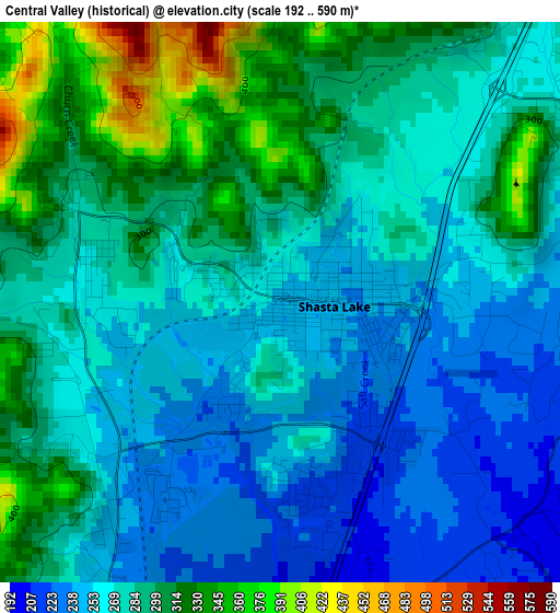
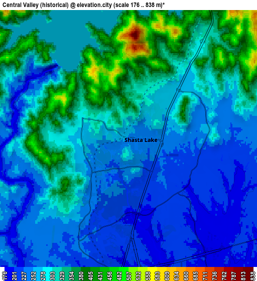
Below is the Elevation map of Central Valley (historical), which displays elevation range with different colors. Scale of the first map is from 192 to 590 m (630 to 1936 ft) with average elevation of 279.4 meters (=917 ft) [note 1]
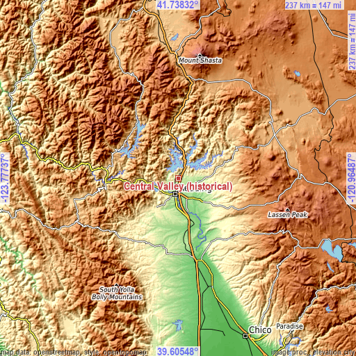
These maps also provides idea of topography and contour of this city, they are displayed at different zoom levels. More info about maps, scale and edge coordinates you can find below images.
| \ | Map #1 | Map #2 | Topo.Map |
| Scale [m] | 192..590 m | 176..838 m | × |
| Scale [ft] | 630..1936 ft | 577..2749 ft | × |
| Average | 279.4 m = 917 ft | 291.2 m = 955 ft | × |
| Width | 7.41 km = 4.6 mi | 14.82 km = 9.2 mi | 237.1 km = 147.3 mi |
| Height | 7.41 km = 4.6 mi | 14.82 km = 9.2 mi | 237.1 km = 147.3 mi |
| ↑Max Latitude | 40.713748° | 40.747049° | 41.73832° |
| Latitude at center | 40.68043° | 40.68043° | 40.68043° |
| ↓Min Latitude | 40.647095° | 40.613744° | 39.60548° |
| ← Min Longitude | -122.415065° | -122.459011° | -123.77737° |
| Longitude center | -122.37112° | -122.37112° | -122.37112° |
| →Max Longitude | -122.327175° | -122.283229° | -120.96487° |
Nearby cities:
Cities around Central Valley (historical) sort by population:
• Redding elevation 172 m
10.6 km,  189°
189°
• Red Bluff 94 m
57 km,  168°
168°
• Anderson 132 m
26.6 km, 166°
• Shasta Lake 252 m
0 km,  90°
90°
• Weaverville 632 m
48.4 km,  276°
276°
• Cottonwood 132 m
33.6 km, 166°
• Bella Vista 176 m
12.5 km,  110°
110°
• Shingletown 1071 m
45.8 km,  117°
117°
• Shasta 322 m
13.6 km,  228°
228°
• Dunsmuir 696 m
59.3 km,  8°
8°
• Palo Cedro 144 m
17.1 km,  139°
139°
• Lewiston 557 m
36.9 km,  274°
274°
Multilingual:
 En español:
Central Valley (historical) elevación 252 m.
 En France:
Central Valley (historical) élévation 252 m.
 Auf Deutsch:
Central Valley (historical) höhe über dem Meeresspiegel ist 252 m.
 На русском:
Central Valley (historical) высота над уровнем моря 252 м
Sources and notes:
- [note 1] Map square and city borders are not equal. Map elevation data is calculated only from area inside that square.
- [src 1] Elevation data from geonames database provided with same terms of usage.
- [src 2] The elevation map of Central Valley (historical) is generated using elevation data from NASA's 3 arcsec (90m) resolution SRTM data.
- [src 3] Base (background) map © OpenStreetMap contributors tiles are generated by Geofabrik and OpenTopoMap.
Copyright & License:
This Central Valley (historical) Elevation Map is licensed under CC BY-SA. You may reuse any part from this page, if you give a proper credit by linking to this URL:
 More info on terms of use page.