Fabens elevation
Fabens (Texas, El Paso County), United States elevation is 1101 meters and Fabens elevation in feet is 3612 ft above sea level [src 1]. Fabens is a populated place (feature code) with elevation that is 822 meters (2697 ft) bigger than average city elevation in United States.
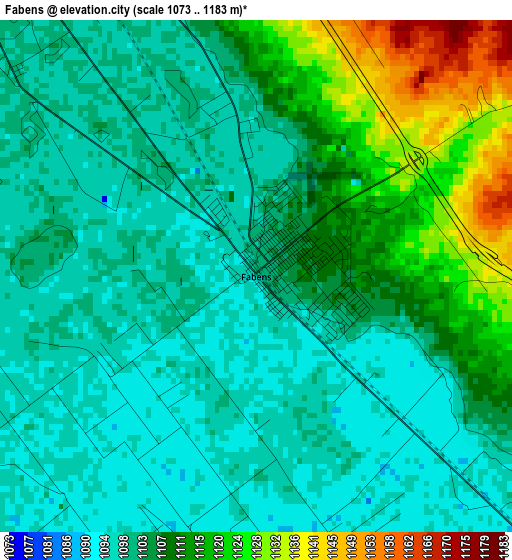
Below is the Elevation map of Fabens, which displays elevation range with different colors. Scale of the first map is from 1073 to 1183 m (3520 to 3881 ft) with average elevation of 1105.7 meters (=3628 ft) [note 1]
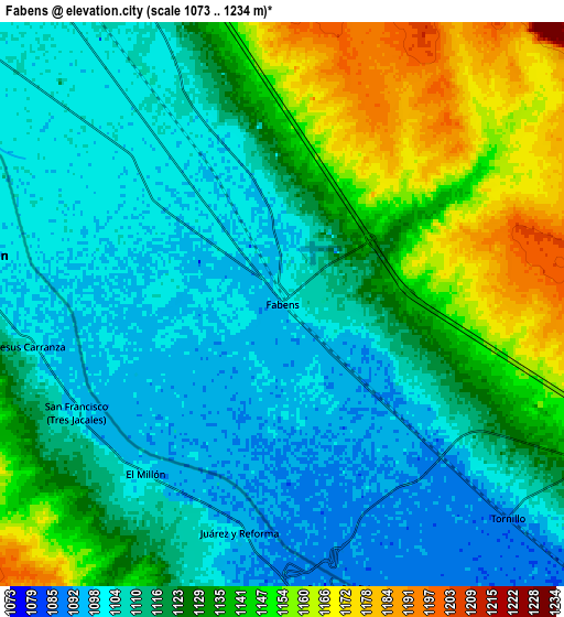
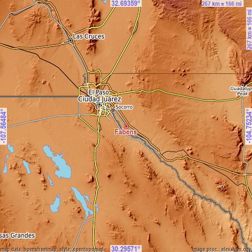
These maps also provides idea of topography and contour of this city, they are displayed at different zoom levels. More info about maps, scale and edge coordinates you can find below images.
| \ | Map #1 | Map #2 | Topo.Map |
| Scale [m] | 1073..1183 m | 1073..1234 m | × |
| Scale [ft] | 3520..3881 ft | 3520..4049 ft | × |
| Average | 1105.7 m = 3628 ft | 1121.8 m = 3680 ft | × |
| Width | 8.33 km = 5.2 mi | 16.66 km = 10.4 mi | 266.6 km = 165.7 mi |
| Height | 8.33 km = 5.2 mi | 16.66 km = 10.4 mi | 266.6 km = 165.7 mi |
| ↑Max Latitude | 31.539801° | 31.577247° | 32.69359° |
| Latitude at center | 31.50234° | 31.50234° | 31.50234° |
| ↓Min Latitude | 31.464864° | 31.427373° | 30.29571° |
| ← Min Longitude | -106.202535° | -106.246481° | -107.56484° |
| Longitude center | -106.15859° | -106.15859° | -106.15859° |
| →Max Longitude | -106.114645° | -106.070699° | -104.75234° |
Nearby cities:
Cities around Fabens sort by population:
• Socorro elevation 1112 m
21.8 km,  320°
320°
• Socorro Mission Number 1 Colonia 1109 m
19.4 km, 319°
• Horizon City 1228 m
21.7 km,  347°
347°
• San Elizario 1107 m
14.2 km,  310°
310°
• Fort Bliss 1184 m
42.1 km,  325°
325°
• Homestead Meadows South 1236 m
34.3 km,  359°
359°
• Homestead Meadows North 1236 m
38.6 km, 357°
• Sparks 1159 m
20.4 km,  337°
337°
• Agua Dulce 1223 m
17.1 km,  6°
6°
• Fort Hancock 1089 m
37.4 km,  127°
127°
• Tornillo 1090 m
9.2 km, 133°
• Clint 1108 m
11.8 km, 328°
Multilingual:
 En español:
Fabens elevación 1101 m.
 En France:
Fabens élévation 1101 m.


Sources and notes:
- [note 1] Map square and city borders are not equal. Map elevation data is calculated only from area inside that square.
- [src 1] Elevation data from geonames database provided with same terms of usage.
- [src 2] The elevation map of Fabens is generated using elevation data from NASA's 3 arcsec (90m) resolution SRTM data.
- [src 3] Base (background) map © OpenStreetMap contributors tiles are generated by Geofabrik and OpenTopoMap.
Copyright & License:
This Fabens Elevation Map is licensed under CC BY-SA. You may reuse any part from this page, if you give a proper credit by linking to this URL:
 More info on terms of use page.