Bovina elevation
Bovina (Texas, Parmer County), United States elevation is 1242 meters and Bovina elevation in feet is 4075 ft above sea level [src 1]. Bovina is a populated place (feature code) with elevation that is 963 meters (3159 ft) bigger than average city elevation in United States.
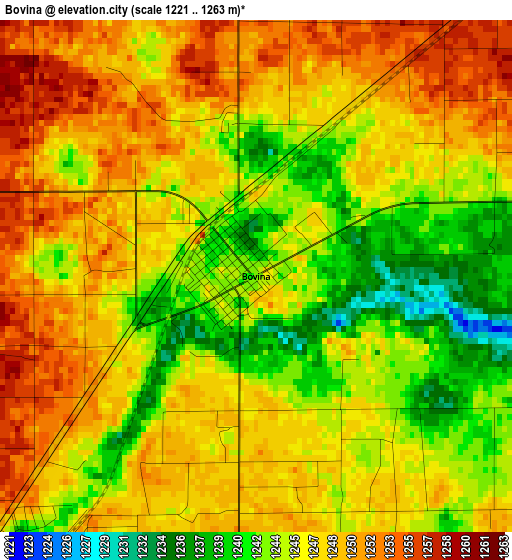
Below is the Elevation map of Bovina, which displays elevation range with different colors. Scale of the first map is from 1221 to 1263 m (4006 to 4144 ft) with average elevation of 1246.5 meters (=4090 ft) [note 1]
These maps also provides idea of topography and contour of this city, they are displayed at different zoom levels. More info about maps, scale and edge coordinates you can find below images.
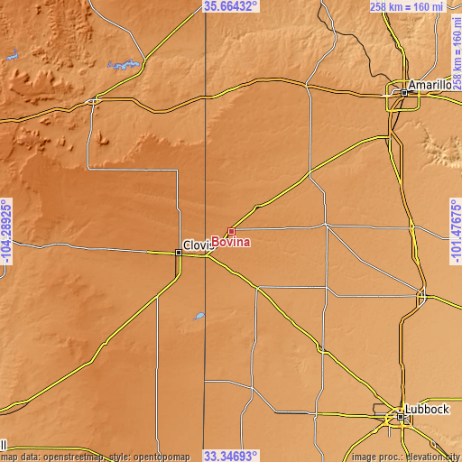
| \ | Map #1 | Topo.Map |
| Scale [m] | 1221..1263 m | × |
| Scale [ft] | 4006..4144 ft | × |
| Average | 1246.5 m = 4090 ft | × |
| Width | 8.05 km = 5 mi | 257.7 km = 160.1 mi |
| Height | 8.05 km = 5 mi | 257.7 km = 160.1 mi |
| ↑Max Latitude | 34.549883° | 35.66432° |
| Latitude at center | 34.51368° | 34.51368° |
| ↓Min Latitude | 34.477462° | 33.34693° |
| ← Min Longitude | -102.926945° | -104.28925° |
| Longitude center | -102.883° | -102.883° |
| →Max Longitude | -102.839055° | -101.47675° |
Nearby cities:
Cities around Bovina sort by population:
• Clovis elevation 1305 m
31.9 km,  247°
247°
• Hereford 1171 m
55.5 km,  52°
52°
• Portales 1227 m
55.2 km,  228°
228°
• Muleshoe 1161 m
35.1 km,  155°
155°
• Dimmitt 1188 m
52.5 km,  85°
85°
• Friona 1232 m
20.4 km, 45°
• Cannon Air Force Base 1315 m
42.5 km, 252°
• Olton 1103 m
77.9 km,  118°
118°
• Farwell 1267 m
20.3 km,  224°
224°
• Texico 1263 m
20.8 km, 227°
• Hart 1117 m
71.8 km,  101°
101°
• Earth 1129 m
53.4 km,  125°
125°
Multilingual:
 En español:
Bovina elevación 1242 m.
 En France:
Bovina élévation 1242 m.


Sources and notes:
- [note 1] Map square and city borders are not equal. Map elevation data is calculated only from area inside that square.
- [src 1] Elevation data from geonames database provided with same terms of usage.
- [src 2] The elevation map of Bovina is generated using elevation data from NASA's 3 arcsec (90m) resolution SRTM data.
- [src 3] Base (background) map © OpenStreetMap contributors tiles are generated by Geofabrik and OpenTopoMap.
Copyright & License:
This Bovina Elevation Map is licensed under CC BY-SA. You may reuse any part from this page, if you give a proper credit by linking to this URL:
 More info on terms of use page.